Blast of heat and humidity to start week
Update #659: The week will start with record-breaking heat and extreme humidity in the Hudson Valley, followed by a return of rain.

It has only reached 100 degrees twice on record during June in Poughkeepsie, which hosts one of the Hudson Valley’s longest-running weather stations. It’s possible that this threshold for extreme heat will be reached this week — on Tuesday — for the first time since July 2011.
The key ingredients will be in place: a hot air mass, full sun and no clouds, and favorable winds. But one thing could get in the way: recent wet weather, including yet more rain falling early Sunday. Moist grounds increase the amount of energy needed to heat the surface compared to dry ground.
100 or not, it’s going to be hot.
An extreme heat warning is in effect for the Hudson Valley from Sunday through Tuesday, with the National Weather Service writing that heat indices may reach 110 degrees and that the potential for heat-related illnesses is significantly increased.
The Hudson Valley is isn’t alone. Extreme heat and humidity will occur across many central and eastern states as well as southern Canada.
Here’s what this week’s forecast maximum humidity levels look like:
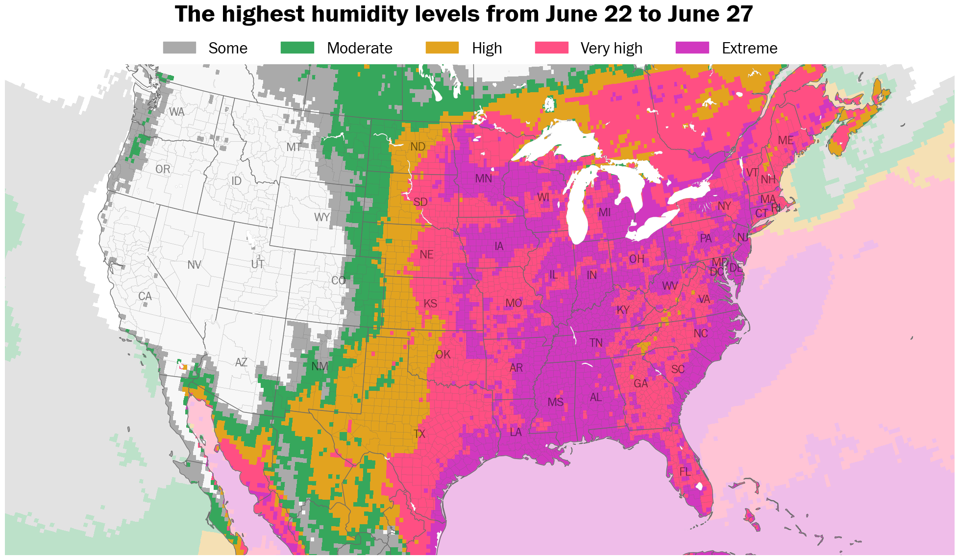
Triple digit heat will broil areas from Boston to Atlanta, with temperature records expected to fall in major East Coast cities — by day, by night, and in terms of the number of consecutive 100 degree days during the month of June.
You can read more about it in my latest story for the Washington Post. Here’s a gift link.

Is this level of humidity normal for the Hudson Valley? In my next post for premium subscribers, I dive deep into statistics of the region’s humidity patterns. To receive this report next weekend, upgrade your subscription by clicking the button below.
The week ahead
The extreme heat won’t last in the Hudson Valley. Late in the week, the region will be along the periphery of the dome of heat — in the zone where showers and thunderstorms often track. This makes graduation forecasts more uncertain, though things should become clearer during the week.
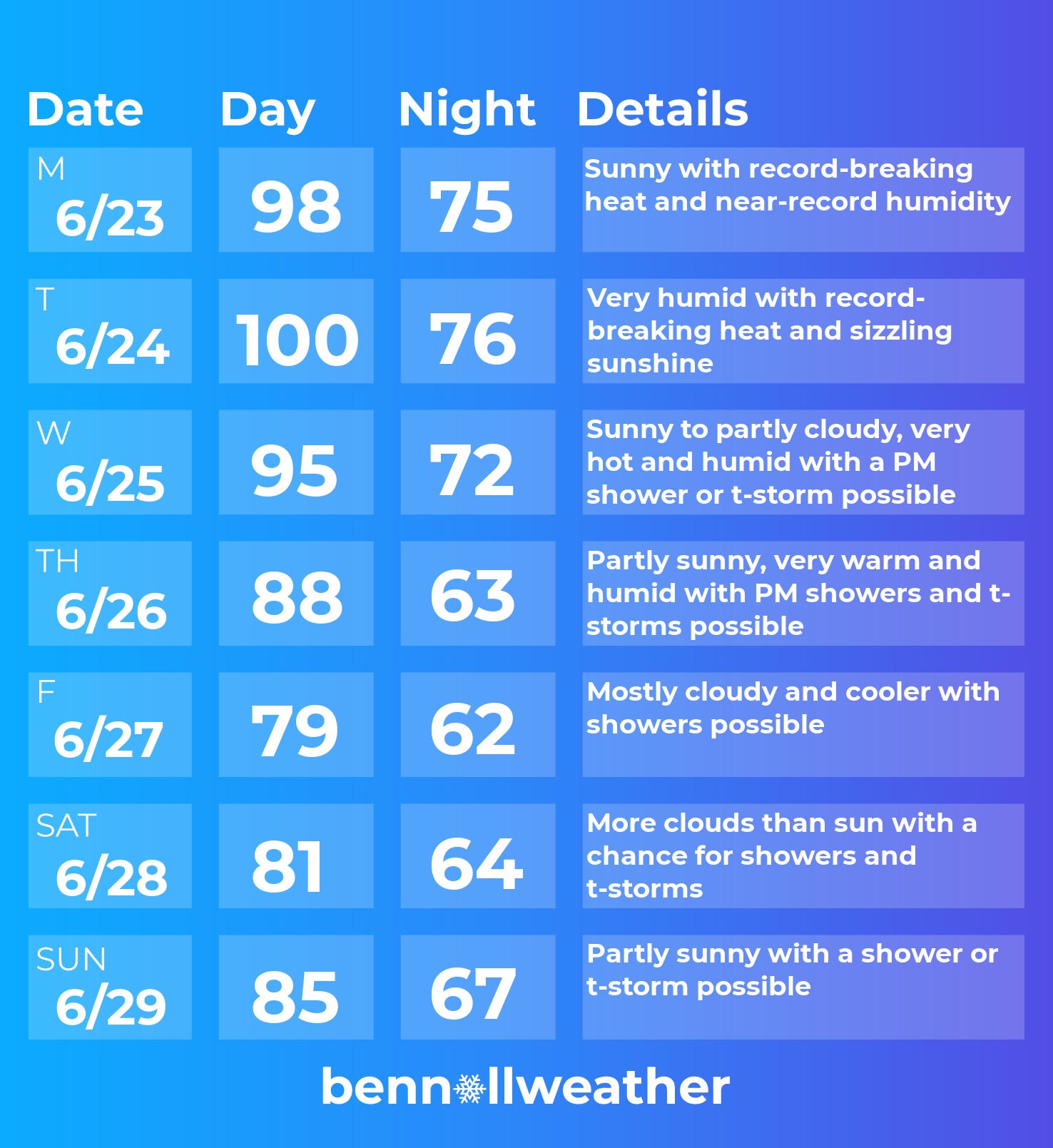
Monday: sunny with record-breaking temperatures and extreme humidity
Tuesday: chance for 100-degree heat with sizzling sunshine and high humidity, an afternoon breeze developing
Wednesday: remaining hot and humid with a PM shower or thunderstorm possible
Thursday: partly sunny, very warm, and humid with widespread PM showers and storms possible
Friday: cooler with clouds and a chance for showers
Saturday-Sunday: humid with a chance for a shower or thunderstorm on both days
For those planning graduations and parties, the forecast from Friday through Sunday will become clearer throughout the week.
Looking ahead to the week of June 30, high humidity, showers, and thunderstorms are expected to continue along with some hot days.
Stay 🆒 this week! ✌️