Thoughts on Thursday-Friday
Premium update #16
🚀 Lift off! The excitable weather pattern that we are entering is ready to produce storm after storm.
After a 2-4 inch “teaser” from late morning Sunday into early Monday, another, bigger storm is possible from late Thursday through Friday.
While the details are not in complete focus just yet, it could come with a medley of wintry precipitation and impact school…
🎳 Like a bowling ball, a disturbance in the upper atmosphere will spin near the Pacific Northwest coast on Saturday before crashing into the Plains and Midwest by mid-week.
Typically, storms that approach the Hudson Valley from the west draw up warm air from the Gulf of Mexico, resulting in rain.
But it’s different this time. Why?
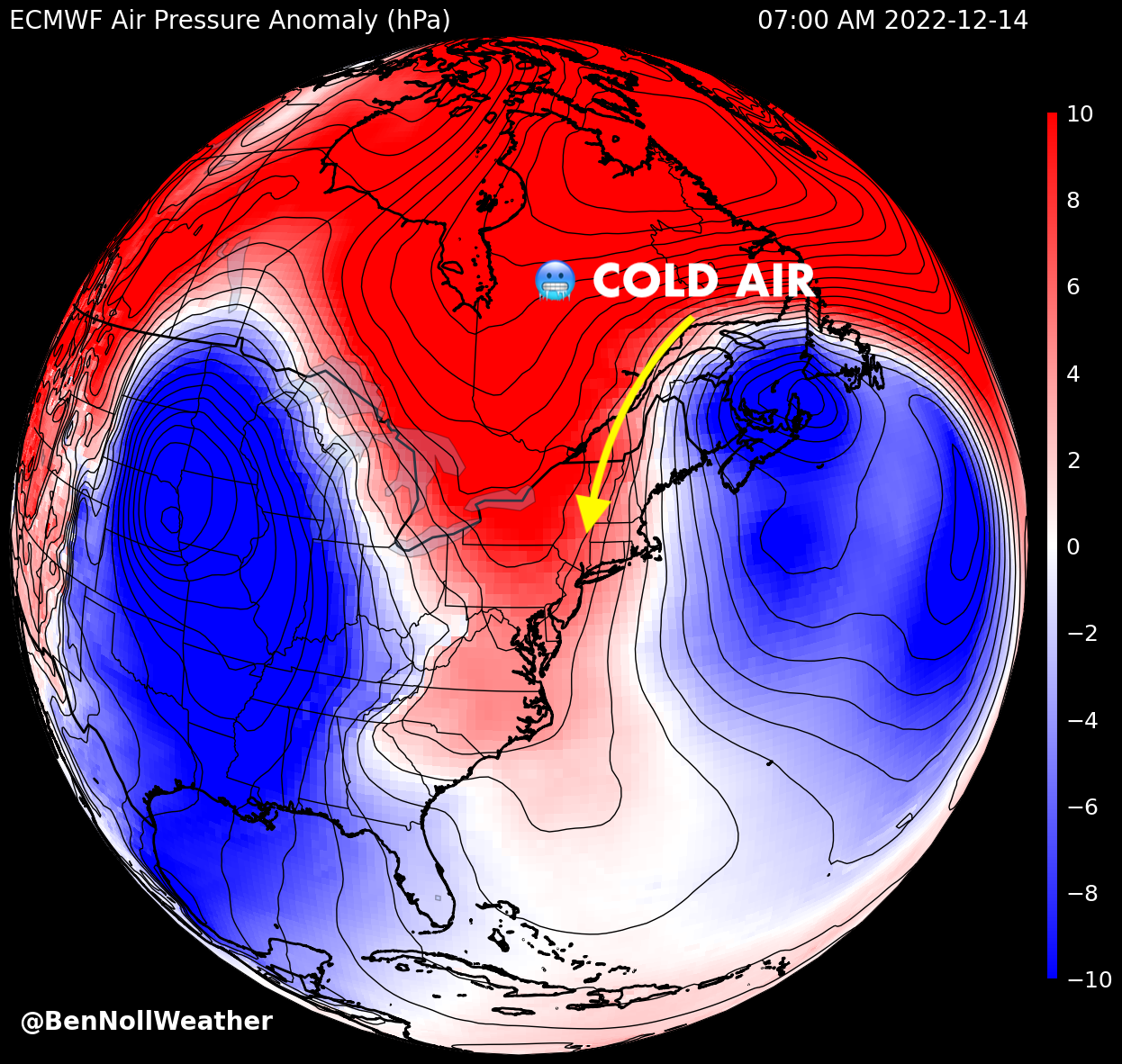
Remember my post from this time last week when I was talking about a monstrous zone of high pressure over northern Canada and Greenland?
That feature has a lot to do with the weather the Hudson Valley experience later in the week.
🔃 Air flows clockwise around high pressure systems — the eastern flank of this big high pressure system (🔴) will act as a conveyor of cold, shipping air from north-to-south. Traveling along this conveyor is an air mass from way up in Labrador, Canada 🥶
Once the air mass reaches the Northeast on Wednesday, the Hudson River Valley will act as a funnel, channeling the chill southward in a very effective manner.
Because cold air is denser than warm air, it’s happy to settle into the nooks and crannies of the valley.
Cold conveyor meet bowling ball 🤝
The low pressure system approaching from the west will jump over the Appalachian Mountains and re-form near the Mid-Atlantic coast. This transition results in a storm called a “Miller B” nor’easter, named after meteorologist and researcher J.E. Miller in 1946. Nor’easters are east-coastal low pressure systems that typically bring snowy conditions, cold temperatures, and prevailing winds from the northeast. The type of nor’easter has to do with where it’s coming from.
As warm, moist air associated with the storm rides up over the cold air that’s in place over the Hudson Valley and the wider Northeast, a shield of precipitation blossoms.
This process, called overrunning, is a result of the storm’s warm air cooling down as it rises up through the atmosphere. This causes the moisture in the air to condense into clouds that can bring snow, sleet, freezing rain, and rain.
While the forecast is not set in stone, an “overrunning” precipitation event may develop in the Hudson Valley starting later in the day on Thursday, lasting through Friday.
With the necessary cold air in place, we could be looking at snow and ice — perhaps quite a bit of it!
The snowiest scenario could result in a half day of school on Thursday and a day off on Friday 😮
There’s plenty of time to watch this one, but this time next week we might just be walking in a winter wonderland 🎵 ❄️


