Stormy Thanksgiving possible, then a polar plunge
Update #629
Hi there! Happy Thanksgiving week 🦃
How much snow fell at your place on Thursday night and Friday?
For parts of the Hudson Valley, it was the biggest November storm since 2018 (remember that one?). Here’s a map that shows storm total accumulation, which reached an impressive 9-12 inches for isolated parts of southeastern Orange County and western Putnam County. Just 50 miles to the north, northeastern Ulster County had little or no snow.
Over the last few days, it was looking like more snow was possible later this week. However, recent forecasts have trended milder and toward rain instead of snow.
While the weather on Thanksgiving might not be the best, at least dry conditions are expected for the big travel day on Wednesday.
Meteorological winter starts next weekend, and right on cue, Mother Nature will unleash several unusually cold air masses 🥶
The week ahead
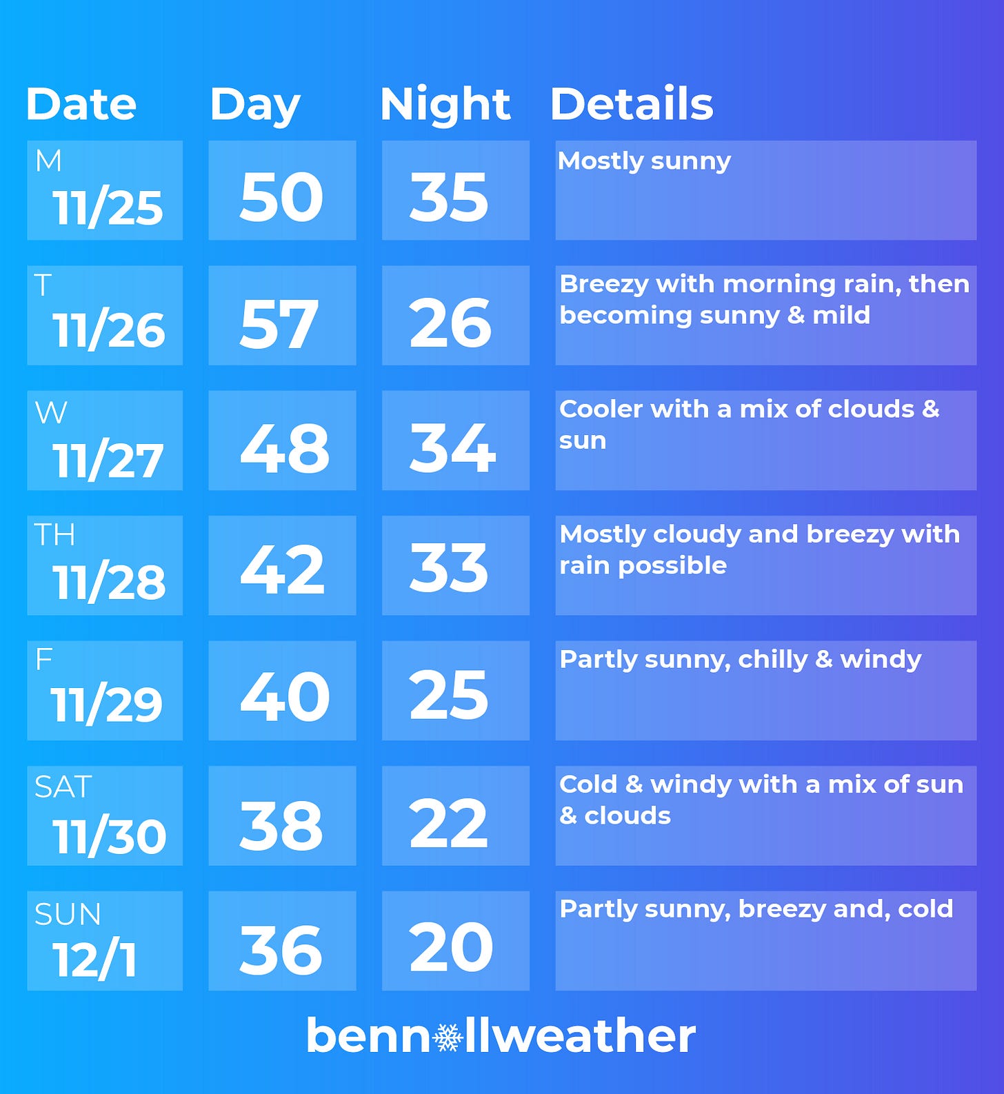
The week ahead will have a relatively mild start and a chilly finish with a rainy interlude.
Monday: mostly sunny
Tuesday: a period of morning rain, then drying out and warming up
Wednesday: cooler with a mix of clouds and sun
Thursday: mostly cloudy and cool with a chance for rain
Friday: breezy and chilly
Saturday-Sunday: windy and cold 🌬️
If you’re going away for the holiday, remember to pack some warm clothes!
Looking ahead to the week of December 2nd, another sharply colder than average air mass looks likely to move into the region, bringing chilly temperatures. It also looks drier than normal.
Meteorological summer
…is almost here in the Southern Hemisphere! Here are a couple of shots from my weekend.
Hope your week is filled with turkey, family, and happiness ✌️


Ben
Have a happy thanksgiving