
Not-so-bad November continues
Update #422

This time last year, the Hudson Valley was on alert for a post-Thanksgiving winter storm. The year before that, it was the memorable November 2018 snow storm that caused rush hour chaos.
This year? Well, it’s looking like we’ll escape November without anything particularly dramatic in terms of winter weather. It’s not the worst thing during a time when being distanced and outdoors is recommended.

This week will have some ups and downs, typical of late fall.
Low pressure to the west will increase the chance for showers in the Hudson Valley starting Sunday afternoon, continuing through the night. A band of rain is expected to track from west to east across the region on Monday morning before drier, cooler, and breezy conditions arrive. Keep the umbrella handy ☔
A cold, dry, Canadian air mass will move overhead for Tuesday. Tranquil conditions will stick around Wednesday before the next disturbance moves in.
Unfortunately, a slow-moving patch of unsettled weather is expected to move in on Wednesday night. Instead of a Thanksgiving Day forecast that’s as smooth as gravy, we’ve got one that’s rough like burnt chocolate chip cookies.
Temperatures in the upper 50s will make it a warmer-than-average turkey day despite the expected damp conditions.
Above average temperatures will hang around on Friday and Saturday. At this point, both days have a chance for a shower, but neither looks like a washout. For daily forecast details as the week goes along, you can follow my Hudson Valley weather bot — it tweets a daily forecast at 6:00 am.
Sunday looks like a transition day. Some dry weather looks likely ahead of yet another storm system that could arrive later Sunday or Monday. It will most likely bring rain followed by colder temperatures around the start of December.

Another disturbance could form along the East Coast around December 5th, with the prospect for wintry weather worth keeping an eye on due to the preceding colder conditions.
Warm wishes 🌺
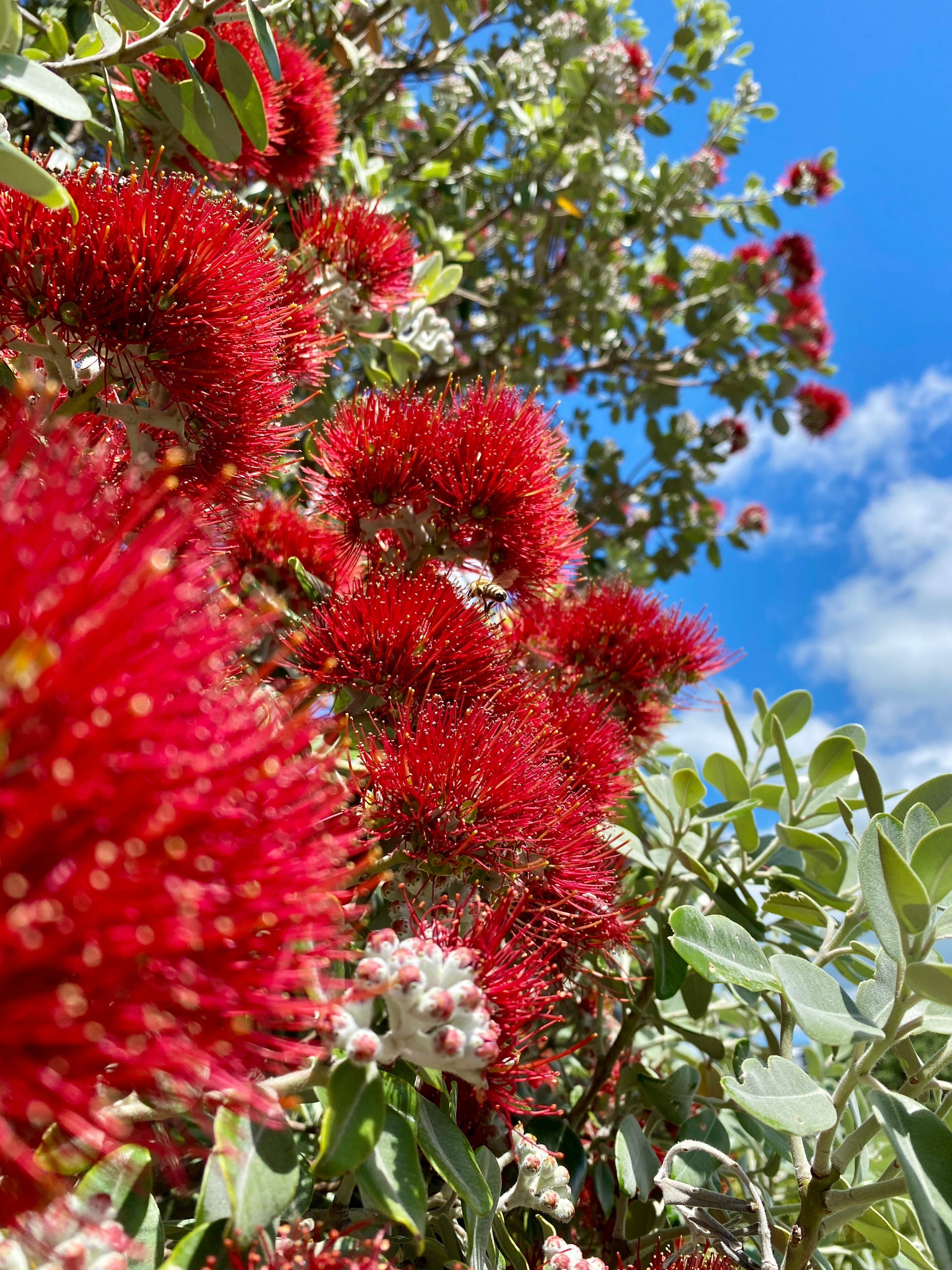
Summer is near in the Southern Hemisphere and New Zealand's "Christmas tree", the Pōhutukawa, is in bloom!
These trees grow only in New Zealand, turning northern coastlines into a carpet of red during November and December.
The vibrant flower is particularly photogenic when set against a blue sky.
The holiday season is not far off! Grab some BenNollWeather merch for the person in your house who is most ready for a snow day. If you find these weekly emails helpful, consider a small donation.