Mild November ends with a rain storm
Update #423
November 2020 will go down as the 6th-equal warmest November on record in the Hudson Valley. The average temperature at the long-term climate site in Poughkeepsie was 46 degrees — about 4 degrees above average. Did it feel mild to you?
Weeds have continued to grow and seasonal allergies may not have fully eased despite a few freezes.
Meteorological winter arrives on Tuesday (December 1st). Learn more about the difference between meteorological and astronomical seasons here. While it looks to turn chillier for a time, I don’t think we’ll be shattering any cold temperature records in December 2020.
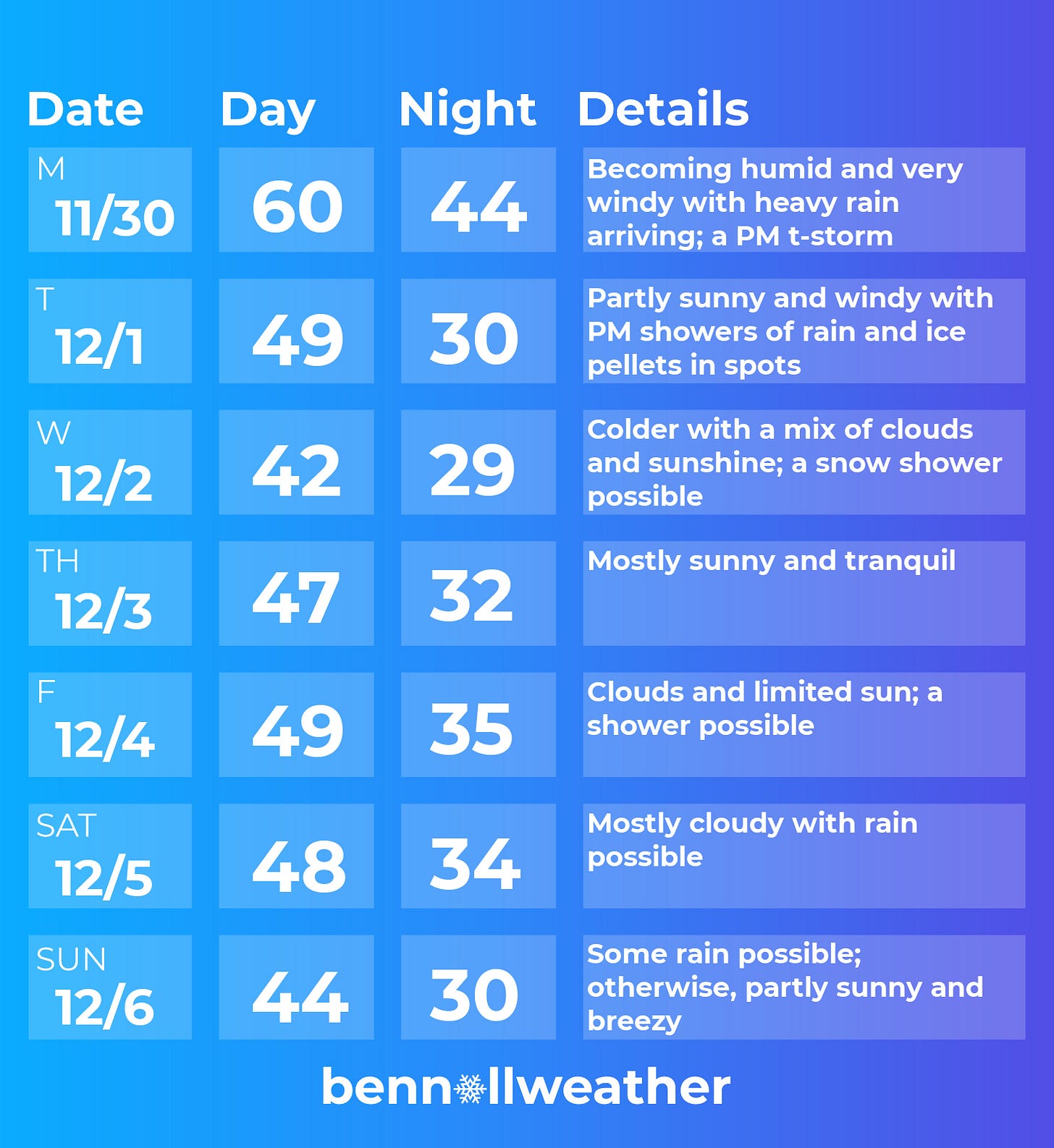
The weather during the upcoming week will be headlined by a rain and wind storm on Monday and possibly a second one over the weekend. In between, it will be seasonably cool.
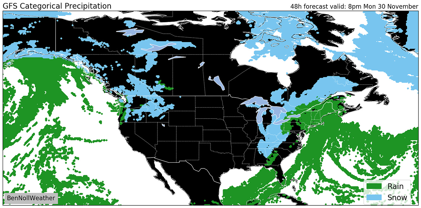
After a stunning day today (Sunday), the working week will start off on a busy note. Rain will arrive around 8am on Monday and intensify during the morning. The heaviest rain is expected during the afternoon when scattered thunderstorms are also possible. Rainfall amounts of 1-2 inches (locally higher) will be common, which could lead to ponding of water on roads or flooding in low-lying areas.
Winds will be particularly strong from lunchtime onward, with gusts of 40-50 mph possible.
On top of all that, it will even be a bit humid during Monday afternoon and evening.

The rain will end on Monday evening but could return in the form of showers on Tuesday, mainly during the afternoon and perhaps mixed with ice pellets. Tuesday will also be windy, but not quite as windy as Monday.
Colder temperatures will become noticeable by Tuesday evening as a brisk northwesterly wind ushers an air mass from northern Quebec.
By Wednesday, the disturbed weather will have mostly pushed to the north, but with some moisture on the backside of the system and cold air in place, I couldn’t rule out a snow shower.
Thursday is the pick day of the week 🌟
Friday sees an increase in clouds and a slight chance for a shower as the next storm system starts to gather over the Deep South. Not too bad, though.
As of this writing, the weekend forecast comes with uncertainty. It looks like a storm system will make its way up the East Coast on Saturday with a shot at some rain reaching the region. Snow looks unlikely at this point.
A transition toward rather chilly and windy conditions looks likely from Sunday into the week of the 7th with some snow possible.
A trend back toward milder conditions is possible during the mid-month.
Merch sale: I’ve launched the “snow day magic” collection in time for the holiday season! Try promo code “snowday” for 25% off. If someone lucky in your house receives a gift, please send me a photo on Twitter 📸, I’d love to retweet you!


