On Mother Nature's nice list — mostly
Update #424
Happy Sunday!
The first Northeast snow storm of the season missed the Hudson Valley by about 125 miles on Saturday. The conditions on I-84 near the CT-MA border were downright nasty. The wet snow led to downed trees, power outages, and accidents. The “jackpot” was Worcester County, Massachusetts, where upwards of a foot of snow accumulated.
Were you happy or sad about the miss?
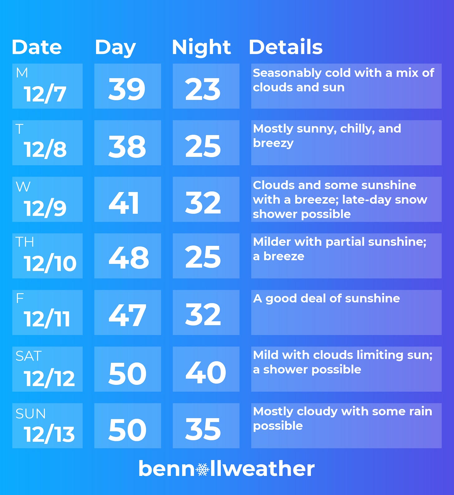
Although it will be a chilly and breezy start, the Hudson Valley will be on Mother Nature’s “nice list” during the upcoming week — mostly.
High pressure nosing into the region from Canada will shield the region from another coastal low pressure system on Monday. The low will cause wet snow across Virginia of all places!
The source region of our air mass (Canada) means that it won’t just be cold, but dry as well. Because of this, it is well and truly lip balm and lotion season 🧴
Tuesday will have a cold start to the day with a stiff northerly breeze during the afternoon.
Temperatures will be a few degrees warmer on Wednesday ahead of a late-day front which could cause scattered snow showers.
Thursday will be a few degrees warmer yet, although breezy conditions are expected to continue.
A strong high pressure system will move overhead on Thursday night, bringing a dry Friday with light winds. I’d say Friday is a pretty clear weather pick of the week 🥇
Stormy conditions will gather over the Great Lakes on Saturday, putting the Hudson Valley on the warm side of a system once again.
Increased cloudiness looks likely for the weekend along with spots of rain mixed in with some dry time. Finer forecast details are fuzzy at the moment, typical of days 6 and 7 within a 7-day forecast.
When will it snow?
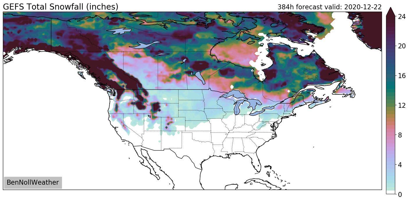
Looking ahead to the week of the 14th, there is a signal for some busier weather but cold air may once again be lacking.
To get a winter weather event, it looks like we’ll need just the right storm track to maximize any cold air that’s around — in other words, it looks like an uphill battle!
It’s a bit like December 2011, the last time we had such a strong La Niña pattern.
Furthermore, there are indications of a warming trend during the week leading up to Christmas.
If you’re digging these weekly weather emails, consider a small donation or check out my newest merch. Every little bit keeps this free forecast service going.


