Snow update II
Update #425b
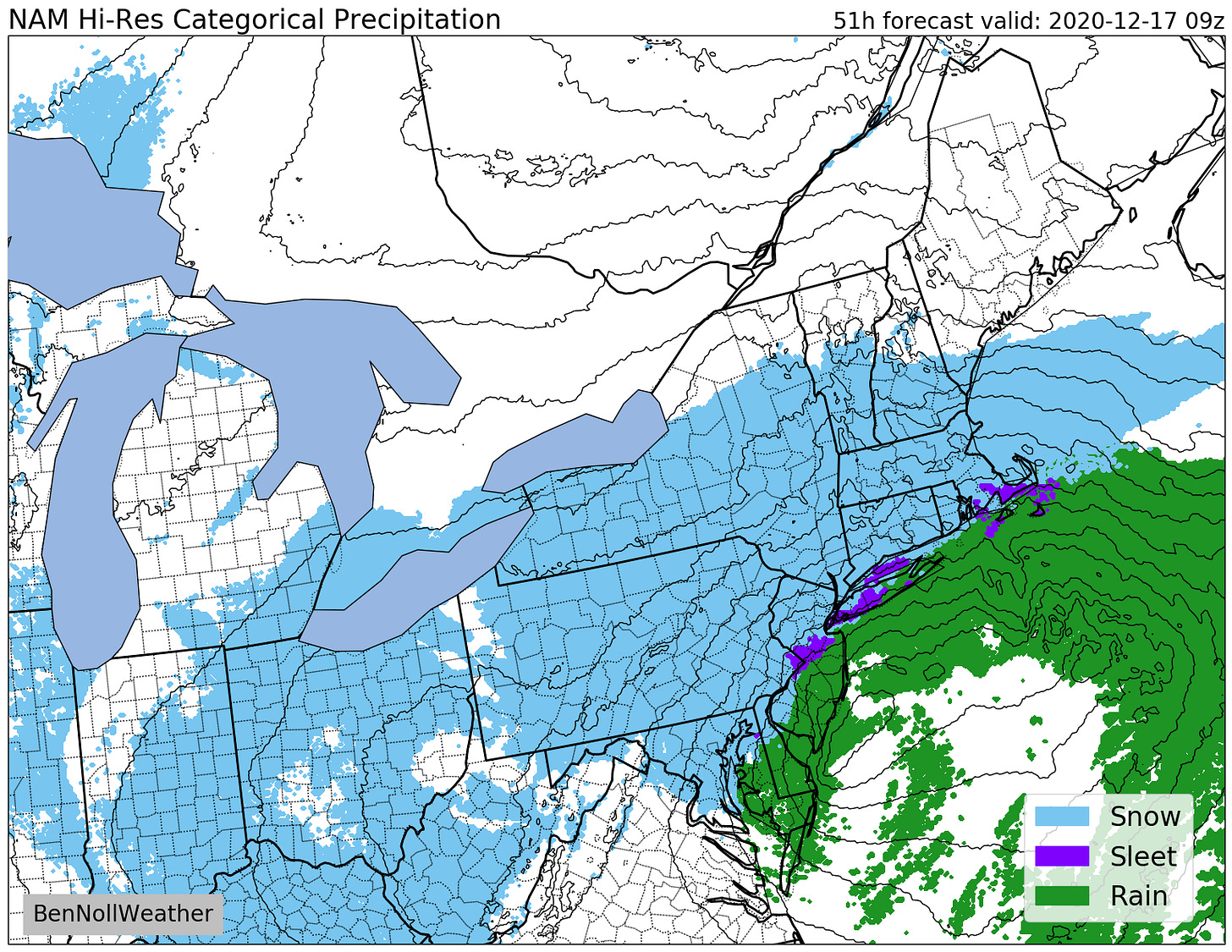
Hi everyone. Because the Wednesday-Thursday storm will almost certainly be discussed on your Zoom meetings today, I’m once again checking in with the very latest 😉
On Monday, the National Weather Service (NWS) issued a Winter Storm Watch for the entire region. The timing of the watch is Wednesday afternoon through Thursday morning, depending on what part of the Hudson Valley you live in. That’s a broad range, so I’ll try to drill down more below.
Cutting to the chase, here’s the forecast snowfall map from the NWS — it shows over a foot, just about regionwide. That would make it the biggest December storm for our region since 2010.
I access weather model outputs from different places on the web to help hone my Hudson Valley forecast. Sometimes this process even involves using computer programming to transform a gridded dataset produced by NOAA’s supercomputer into an easy to understand map or chart.
That’s in addition to applying local knowledge, years of forecasting experience in the Hudson Valley, and putting my meteorology and math degrees from SUNY Oswego to work! And if you didn’t know, I do my Hudson Valley forecasts from 8,500 miles away in New Zealand. Read about it here.
Here’s what I’m expecting:
What? Snow, heavy at times, with wind gusts of 30-40 mph. Whiteout conditions are possible Wednesday night and early Thursday morning.
When? Beginning from south to north from 4:00-8:00 pm on Wednesday. The start time will be earlier to the south (e.g. south of I-84) than it will be to the north. A cold, Canadian high pressure system will keep the lower part of the atmosphere very dry on Wednesday, which is why the start time is expected to be a bit later. The height of the storm is expected between 10:00 pm Wednesday and 4:00 am Thursday. The snow is expected to gradually end on Thursday morning, possibly sticking around until lunchtime.
How much? At this time, the most likely range is 12-18 inches. Bands of very heavy snow are likely on Wednesday night. The placement of these bands will dictate what parts of the region receive the most snow. The intensity and powdery nature of the snow means that it could pile up at a rate of 1-3 inches per hour on Wednesday night!
Impacts? Road conditions will deteriorate late Wednesday afternoon and evening before becoming extremely treacherous or even impassable Wednesday night until Thursday morning. Visibility will also be very poor at times with blowing snow and possible whiteout conditions. In other words, travel is not advised — perhaps road closures will occur around the height of the storm. A significant cleanup will be needed on Thursday.

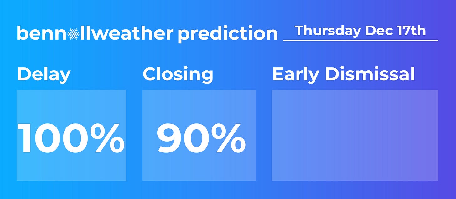
The chance for early dismissals on Wednesday is about 50/50 due to the expected later arrival of the snow. Schools may opt to dismiss an hour or two early just to give everyone a chance to get home safely before the storm.
Closures are highly likely on Thursday since the snow isn’t expected to end until after the morning commute and a large cleanup will be needed.
I expect that our Winter Storm Watch will be converted into a Winter Storm Warning at some point today.
I’ll check in again tomorrow morning by email, but I’ll provide additional updates on Twitter before then.
Have a wonderful Tuesday and remember to check that you’ve got enough bread, milk, and eggs to get you through the storm 🍞 🥛 🍳
If you are finding these updates helpful, consider grabbing some merch for the big weather fan in your house or giving a small donation.


