
Friday night ice & possible Sunday snow
Update #427a

Hi everyone, sorry to interrupt your New Year’s Eve celebrations, but I have a quick update on Mother Nature’s plans 🙃
A Winter Weather Advisory has been posted for the Hudson Valley from Friday evening through early Saturday morning for some mixed precipitation.
Temperatures during the event look borderline. After a day with highs in the upper 30s, it will drop to near 32 (give or take a degree) as precipitation begins.
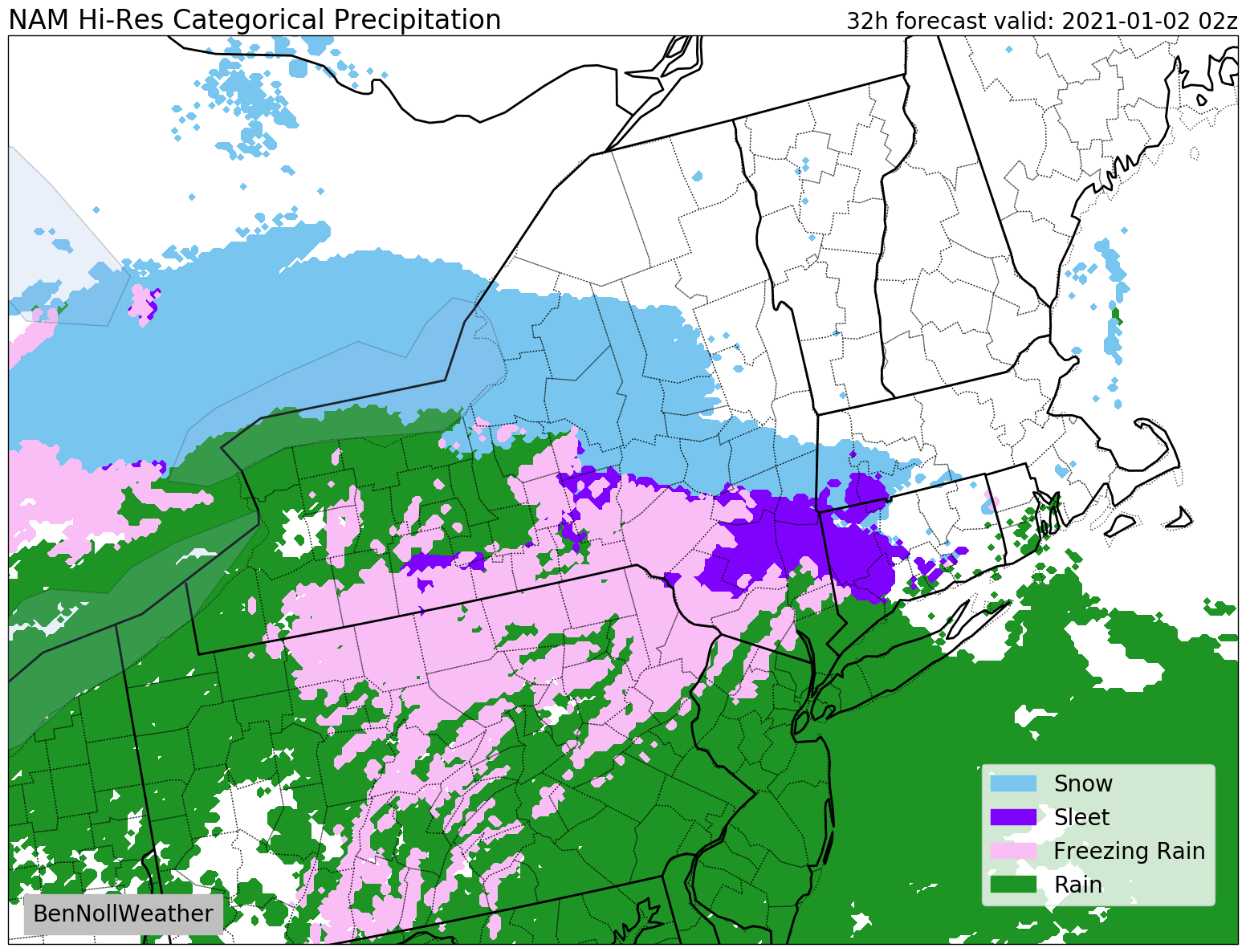
What? A period of freezing rain and sleet, changing to plain rain, except in the Catskills where ice will persist for longer.
When? Starting between 6:00-8:00 pm from southwest to northeast on Friday evening.
Impact? Even a light glaze of ice can cause slippery travel, so some precautionary road and sidewalk treating would be worthwhile. The risk is higher in hilly, mountainous, and elevated areas and on bridges and overpasses.
If you are traveling on Friday night, take extra care. Things should be okay by Saturday morning.
Sunday
A period of wet snow is possible on Sunday, mainly from late morning onward. At this time, the chance for significant snowfall is low, but a few inches do appear possible. I’ll have more information on this tomorrow, if necessary.
Of course, follow along on Twitter for the very latest!
Happy New Year! 🥳

