Here comes the snow!
Update #432
Hello Hudson Valley! I predict today will be extra busy at the grocery stores 🥛 🍞 🥚 — my predictions go beyond just the weather 😉
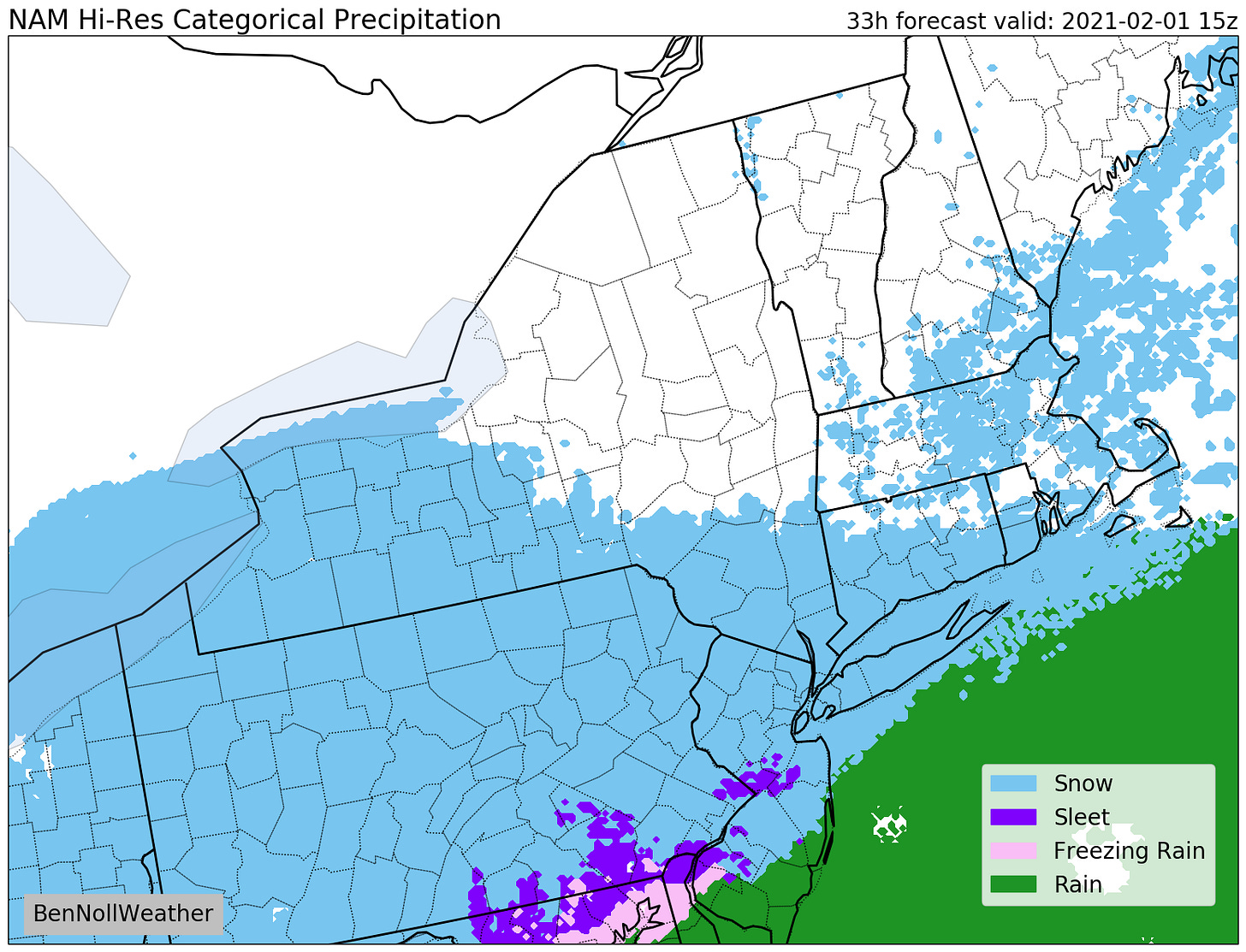
Why? Well, we’ve got our second big snowstorm of the season coming, as the region is now expected to get in on some of the nor’easter’s heavy bands.
❗ The National Weather Service has issued a Winter Storm Warning for Monday to Tuesday morning for significant snow accumulations of 14 to 18 inches.
Here’s my detailed take:
What? Snow, becoming heavy at times, particularly during Monday afternoon and evening. Blowing snow may also create near whiteout conditions at times Monday night.
When? Starting between 1:00 and 7:00 am Monday from southwest to northeast. The worst of the storm is expected during Monday afternoon and evening as the nor’easter intensifies offshore. Heavy snow is expected to end before daybreak Tuesday, although periods of light to moderate wraparound snow are likely throughout the day.
How much? 12-18 inches along and south of I-84, 6-12 inches north. Heavy snow bands will likely affect the region on Monday afternoon and evening. Areas that experience these bands would receive even more snow; however, the exact placement of the bands won’t be known until the features develop on radar (on Monday afternoon). With banding features, snowfall intensity and amounts can vary significantly over relatively short distances (10-20 miles). This was evident during the December storm when Binghamton received around 3 feet (!) of snow but areas outside the band received markedly less.
In other words, find your yardstick! It might come in handy.
Impacts? The Monday afternoon and evening commute will be severely affected with moderate to heavy snow and poor visibility, making for dangerous travel. The Monday morning commute will probably have deteriorating conditions. Areas along and south of I-84 will get into the accumulating snow first, so the farther south, the worse it will likely be to start the day. My advice here would be to avoid travel if possible, particularly if you are headed south. The Tuesday morning commute will be slow, but the heavy snow will have come to an end by then. Road crews will have time to get the main roads into reasonable shape but side roads will probably remain snow-covered for some time.
School closures (or virtual days where applicable) are very likely on Monday. If the forecast holds over the next 12 hours, this number will increase to the magical 💯. I will post this information on Twitter come Sunday evening.
For Tuesday, delays are very likely at this point. A second snow day remains possible as there will be a substantial cleanup along with some additional snow.
Wednesday could continue to have flurries as the slow-moving nor’easter swirls off the coast of New England. We’ll also need to keep an eye on the potential for some light wintry precipitation on Friday morning.
Temperatures won’t be as cold from Thursday onward and the winds will ease.
Cold, Canadian air could spill into the region early during the week of the 8th with the busy weather pattern continuing.
For the very latest on the storm, check Twitter.
❄️ ❄️ ❄️
Here’s a half and half picture of glacial meltwater and mountains that I took this past week in Milford Sound, New Zealand. Can you believe how clear that water is?! Between the strong river flow and frigid temperatures, my hand was about to turn into a glacier after dipping it under water to take the photo!
My forecasts have always been free, but they do take considerable time to produce. If you are finding these updates helpful, please consider grabbing some merch or giving a donation.


