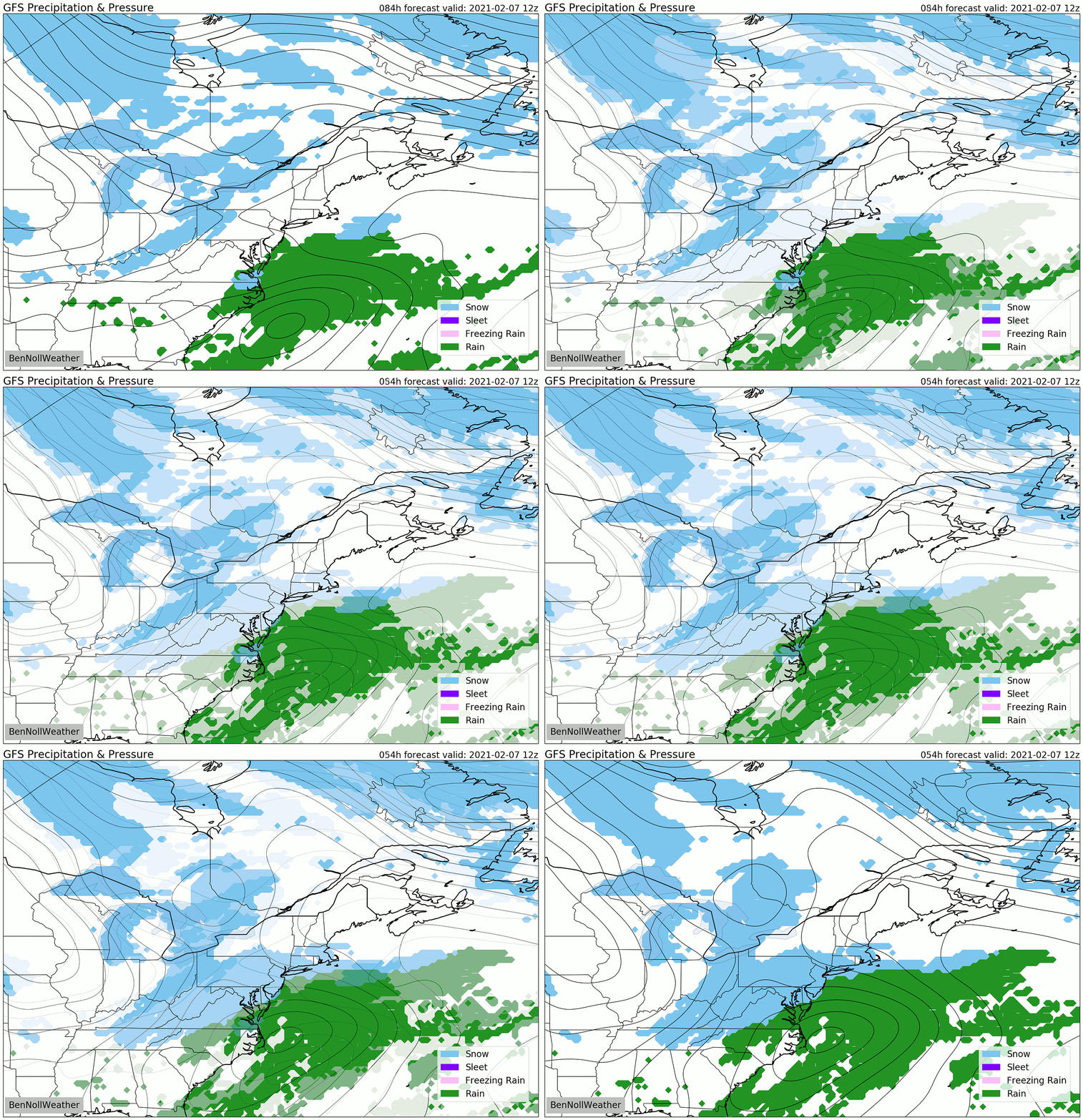
Sunday: to be clipped or nearly missed
Update #432d
Busy weather calls for frequent updates! So here I am, popping into your inbox once again.
The radar this Friday morning does show some weak echoes (indicating precipitation) over the Hudson Valley. Much of this is drying up before reaching the ground, although very light snow was reported in the Catskills.
Some light snow will fall this morning, but amounts are expected to be quite light (less than an inch). Even a little snow with sub-freezing temperatures can cause slippery spots, so drive to the conditions. Nevertheless, widespread school disruptions are not anticipated.
Sunday
It’s looking like the Hudson Valley will be clipped or nearly missed by a coastal storm on Sunday as it glides to our south and east. 48 hours away, but still too close to call!
Here are the key messages:
Not like the storm earlier in the week, it will be a fast mover.
If snow does fall, Sunday morning into the afternoon is favored.
If snow does fall, up to a few inches are possible.

Next week
The next threat for winter weather looks to be on Tuesday, but it’s too early to comment on details.
Next week’s jet stream pattern, or the storm-guiding current of air in the upper atmosphere, will be particularly fast and furious — such setups often lead to changeable forecasts, even in the short-term, so prepare yourself for a topsy-turvy week of weather to come.
In case you need to temporarily remove yourself from New York’s winter, here’s a drone’s eye view of summer in New Zealand. The keen viewer will note the snow-dusted mountain peak in the upper right.
My forecasts have always been free, but they do take considerable time to produce. If you are finding these updates helpful, please consider grabbing some merch or giving a donation.


