Tuesday snow day potential 📈
Update #433a
Good morning everyone! As I mentioned in yesterday’s email, this week is packed with potential when it comes to wintry weather and the next threat is knocking on the door…
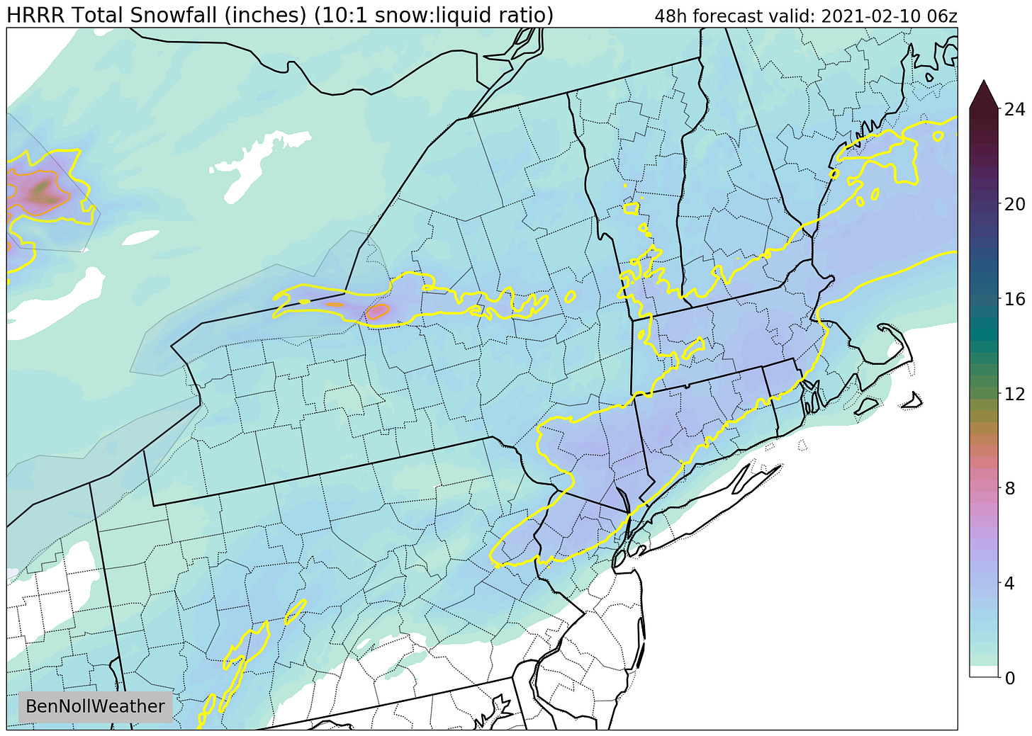
It will come in the form of snow on Tuesday and it’s looking like it could be a bit of a mid-Hudson Valley special — producing more snow over our region than just about anywhere else.
A wave of moisture will dart across the Ohio Valley on Monday, reaching the area during the early hours of Tuesday morning. On Tuesday, weak coastal low pressure will form, extending the chance for snow through much of the day.
What? Accumulating snow of light to moderate intensity.
When? Starting before daybreak Tuesday. Steadiest throughout the morning. Turning lighter and gradually ending Tuesday afternoon.
How much? 2 to 5 inches. Enough to be disruptive!
In the graphic below, the yellow-outlined areas show the potential for more than 3 inches of snow.

Impacts? With temperatures in the teens early Tuesday morning, snow will easily stick to all surfaces. Roads will probably become snow-covered around the time of the morning commute, remaining that way into the afternoon. The chance for school closures or virtual days where applicable is increasing.
There may be some small shifts in the forecast over the next 12-24 hours, but I don’t anticipate large changes.
Should the current forecast hold, I’d expect the chance for a snow day to increase further. I’d also expect the National Weather Service to issue a Winter Weather Advisory.
Follow along on Twitter for more updates, particularly on Monday evening.
Have a great day!


