
Ice storm potential
Update #433e

Greetings! It’s time for a little update on all that weather coming over the next several days.

We’ll start off with…
The good
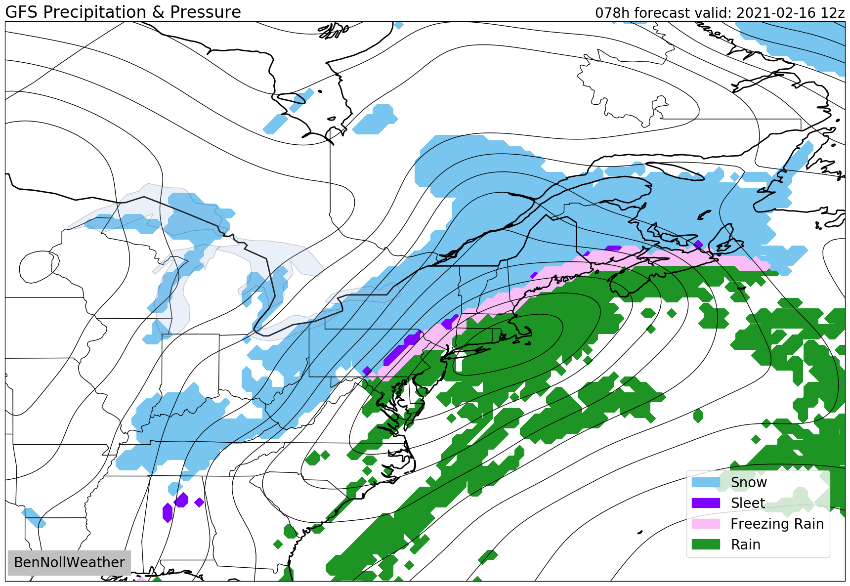
The impact of the wintry mix tonight through early Sunday is expected to be minimal. That said, spotty snow, sleet, and/or freezing rain will affect the region this evening through tonight. And when it comes to ice, don’t think twice! Even a brief period of freezing rain can cause slippery conditions on untreated surfaces. I think roads will be in decent shape by mid-morning Sunday as any lingering precipitation ends.
Monday morning isn’t looking too bad either. I expect some snow over PA during the morning to spread eastward as a wintry mix, probably reaching the region during the afternoon or evening but only falling lightly at first.
That’s where the good news ends. By later Monday, it’s a whole new ballgame…
The bad
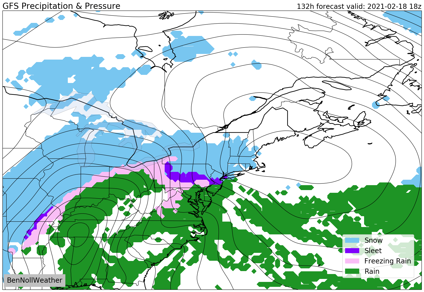
A burly storm will take aim at the Northeast starting on Monday night. Road conditions will deteriorate, especially during the second half of the night. I’m expecting the Hudson Valley to be very close to the all-critical snow and ice line. Makes for a really fun forecast (not).
At this point, I’m leaning toward more ice than snow (I can hear your groans from New Zealand) and accretion has the potential to be significant.
It will depend on the exact track: a more easterly track allows for colder air and snow, a more westerly track allows for warmer air and even the potential for a changeover to plain rain.
Right now, we’re stuck in the middle — the ice zone 🧊
Silver lining: it’s a fast mover, out of here by Tuesday afternoon. Despite that, it’s hard to envision a scenario where there isn’t widespread cancellations for Tuesday at this point.
A hard freeze Tuesday night could bring a risk for black ice on Wednesday morning.
Next up after that: Thursday-Thursday night.
Right now, this one is looking to be a snow to ice threat. Still too early to talk amounts, but the second major winter storm of the week is looking increasingly likely to occur. Schools that are in session could be looking at yet another snow day!
I’ll end on a good note: meteorological spring is on March 1st, 16 days away 🙌

Have these updates become part of your routine this winter? Please consider grabbing some merch or giving a donation to help support this free service.