Details on two winter storms
Update #434
Hello there! The forecast is looking icy ⛸️
In this update, I’ll discuss the week ahead, which includes not one but two winter storm threats: Monday night-early Tuesday and Thursday-Thursday night.
Starting off with right now, today’s weather is looking dry. For those with plans, that’s the good news 👍
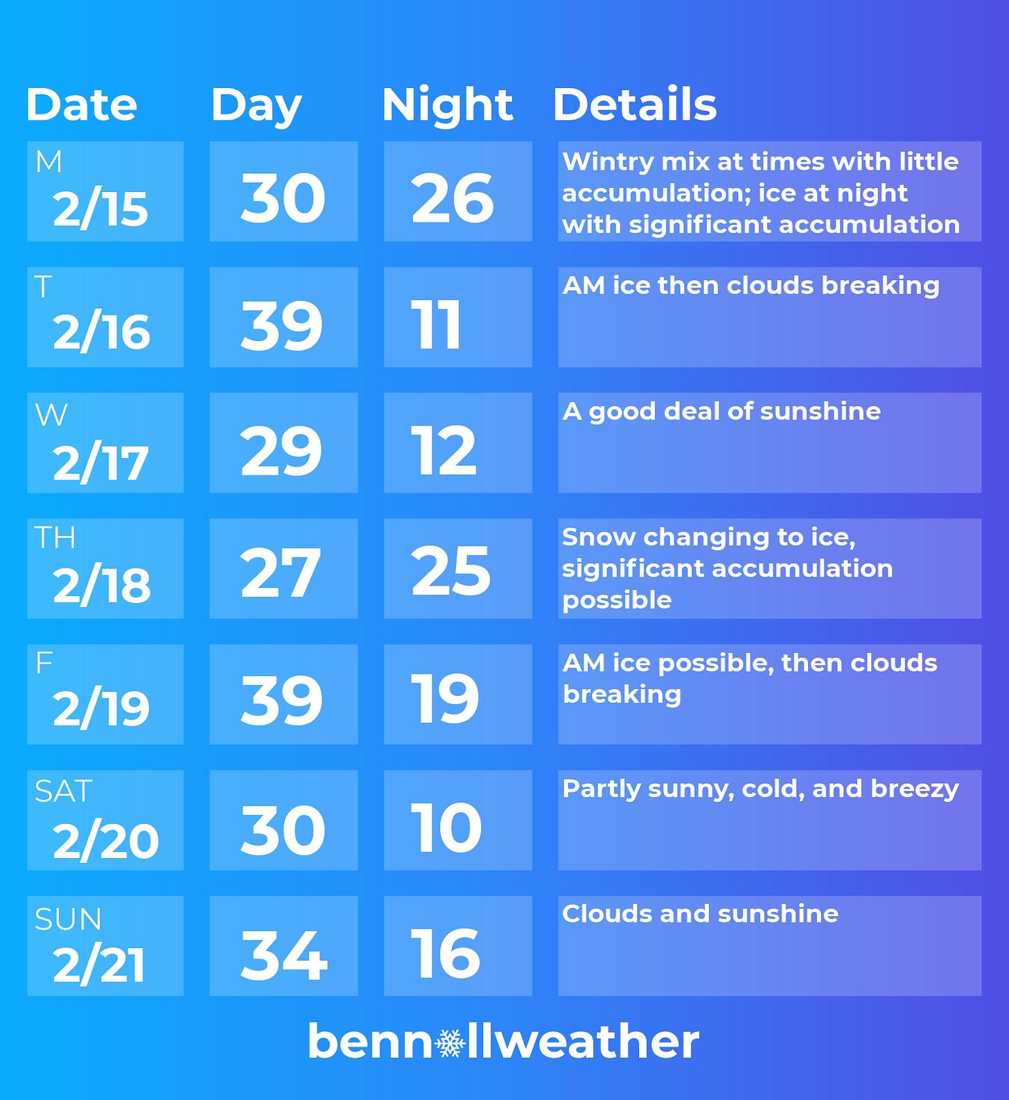
Monday’s forecast includes a light wintry mix, mainly during the afternoon. It’s not looking like a lot, but more of an appetizer for the entrée that Mother Nature will dish out on Monday night.
Monday night-Tuesday morning
Concern is growing for a significant icing event in the Hudson Valley. The snow / ice line looks like it will be positioned well to our north, allowing freezing rain and sleet to be the dominant precipitation types.
It will start on Monday evening, reach a peak overnight, and end on Tuesday morning.
For Rockland and Westchester County, a changeover to plain rain is even possible late Monday night as warmer air surges northward.
For those wondering how a meteorologist deciphers between the most likely precipitation type, here’s a little weather 101:
Snow: occurs when the entire atmosphere is below freezing.
Sleet (ice pellets): occurs when most of the atmosphere is below freezing, but there’s a ‘warm nose’ of above freezing air about a mile above Earth’s surface. This allows the snowflake to melt. Then, the melted snowflake encounters another sub-freezing layer before reaching the ground, re-freezing into an ice pellet.
Freezing rain (rain that freezes on contact): occurs when there’s a shallow layer of sub-freezing air near the ground. Starting as a snowflake, it encounters a pocket of above freezing air about a mile up, melting into a raindrop. It continues to fall as a raindrop until it reaches the ground which is ≤32 degrees, freezing upon contact and creating an icy glaze.
The depth of the cold air near the ground will determine whether this event produces more sleet (preferred) or freezing rain. As it stands now, freezing rain looks dominant.
When it comes to determining how much of the rain will actually turn to ice when it hits the ground, that’s a whole different animal. It depends on the intensity of the freezing rain, the ground temperature, and if it’s falling on top of a layer of snow/sleet or not.
Right now, ice accretion has a medium chance to exceed 0.25” and some chance to exceed 0.50”. That’s a solid casing. It can cause treacherous travel and scattered power outages due to downed trees and power lines. If it starts to look more likely to exceed 0.50”, we could be looking at more widespread outages. I’ll need another 24 hours of forecast watching to fully understand that potential.
The silver lining is that winds look light, which is a key factor in the most damaging of ice storms.
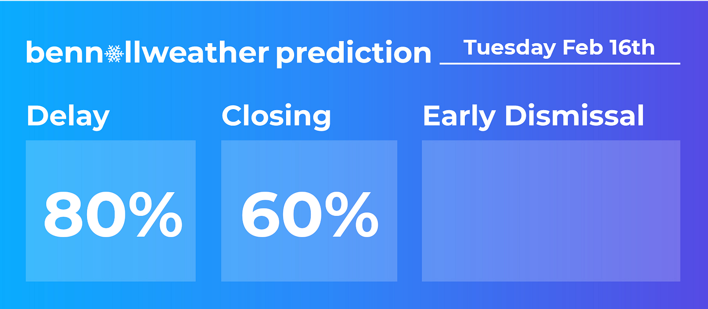
Regardless of exactly what occurs, slippery travel conditions will be possible for the Monday PM commute and likely for the Tuesday AM commute. School closures are favored Tuesday, although delays may be an option for areas closer to NYC that see a changeover to plain rain.
Temperatures on Tuesday afternoon will rise above freezing before a strong cold front blows through the area during the afternoon, setting the stage for a frigid night.
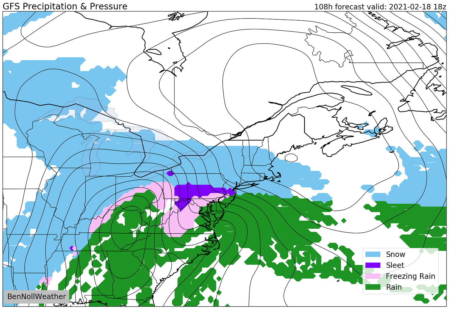
Wednesday’s dry weather offers some reprieve before storm number two, which will have everything but the kitchen sink on Thursday and Thursday night.
At this point, it’s looking like snow will get underway at some point on Thursday morning with several inches of accumulation possible before a changeover to ice later in the day.
Icy conditions will likely continue on Thursday night into early Friday before ending, although the exact timing will become clearer in the coming days.
Regardless, we will again be dealing with widespread travel disruptions and school cancellations for schools that are in session.
Settled weather is currently predicted for next weekend. We’ve got a lot to get through before then.
The week of the 22nd doesn’t look as cold. A long way out, but something to look forward to.
If the forecast has left you furious, here’s a little something to brighten your day…


Highland has no more snow days. From now on, this year, we will switch to all remote days instead of snow days.