April showers...
Update #442
The Hudson Valley has enjoyed a tranquil start to the month of April, but rarely does it stay warm and dry for long in mid-spring.
Unsettled patterns during spring are often the result of slow-moving upper level low pressure systems, or bowling balls of energy in the upper atmosphere fuelled by anomalies in the jet stream (called jet streaks), most common in spring and fall.
The movement of upper level lows is notoriously difficult to predict, leading to lower forecast accuracy.
Sometimes they can produce hail 👀
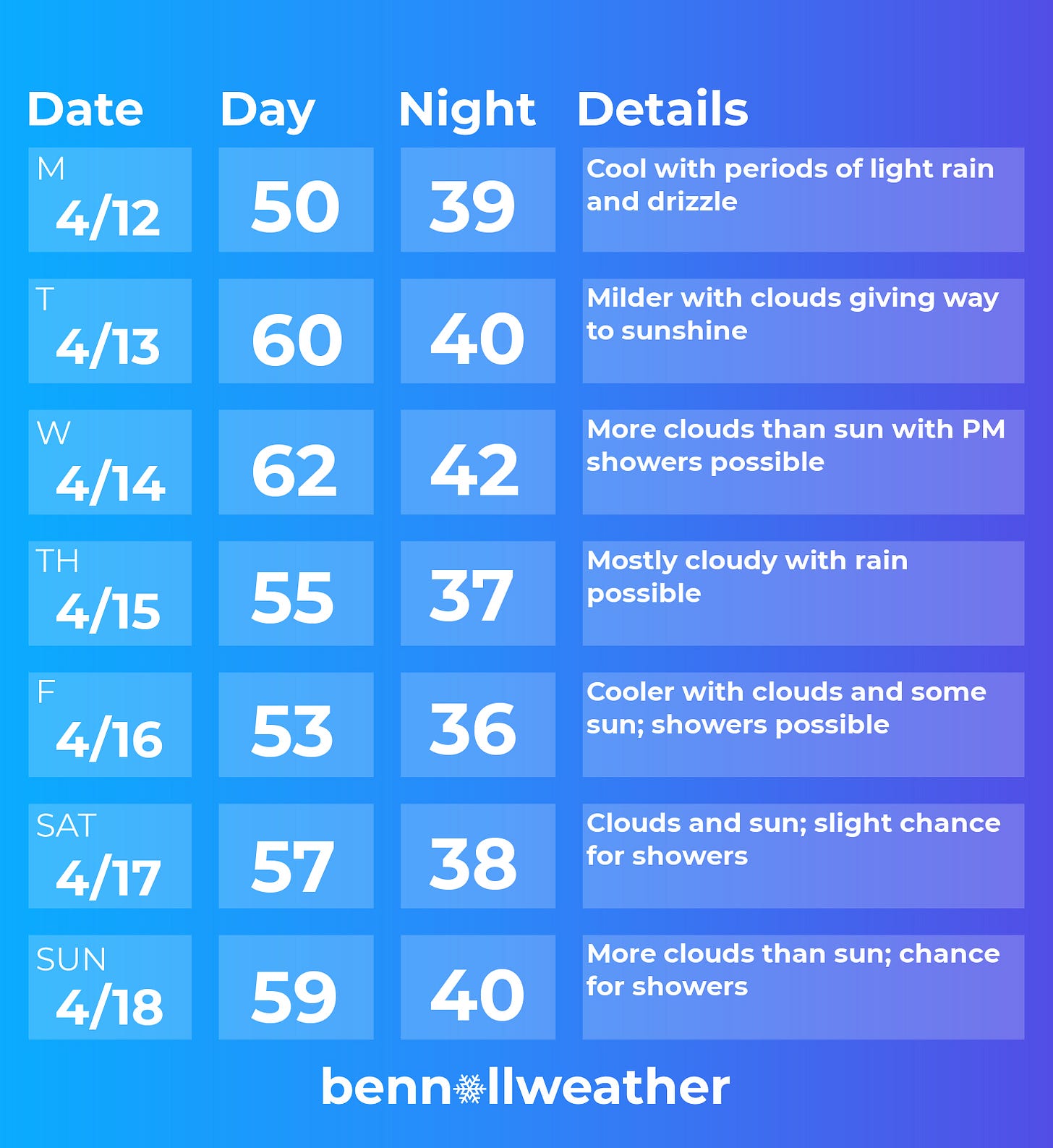
That said, here’s my best stab at the week ahead. Things can and will change, so keep up with the latest forecast if you have plans.
Sunday’s wet weather will linger into Monday with periods of light rain and drizzle.
The gloom will likely dissipate on Tuesday as clouds give way to sunshine, leading to milder afternoon temperatures.
Wednesday looks dry to start. A disturbance —one of those aforementioned upper lows— will approach the region later in the day, possibly sparking showers.
The chance for rain will increase Wednesday night and Thursday. Weather conditions could range from slightly unsettled to downright awful depending on how things play out. Wet snow can’t be ruled out for the higher elevations of the Catskills. Definitely worth keeping an eye on!
Cooler air will likely come in on Friday, behind the storm system. Additional showers are possible next weekend with slightly higher chances on Sunday as of this writing.
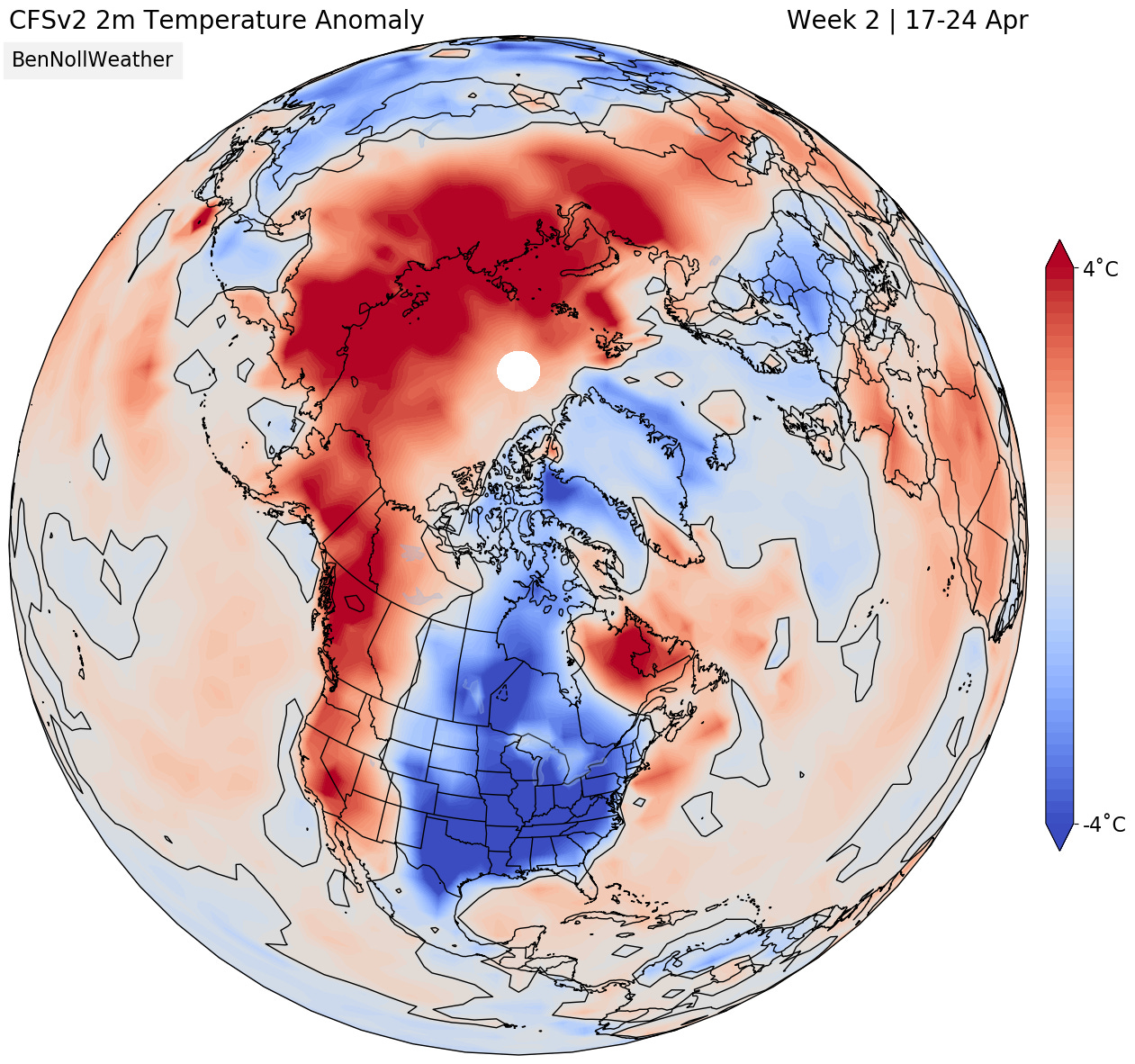
The week of the 19th looks cooler than average but less rainy.
Have a great week!


