
Not so hot for peak summer
Update #457

The Hudson Valley’s warmest days of the year typically occur between the 10th and 30th of July. Last week failed to reach 90 degrees. The upcoming week may only have a single day graze the mark.
After some heat early on, this week will be punctuated by the arrival of a much cooler, Canadian air mass on Friday. It will make it feel more like September for a time! 🍃
For those keeping track, July 2021 is currently in 15th place for the rainiest July in at least the last 90 years in the Hudson Valley.
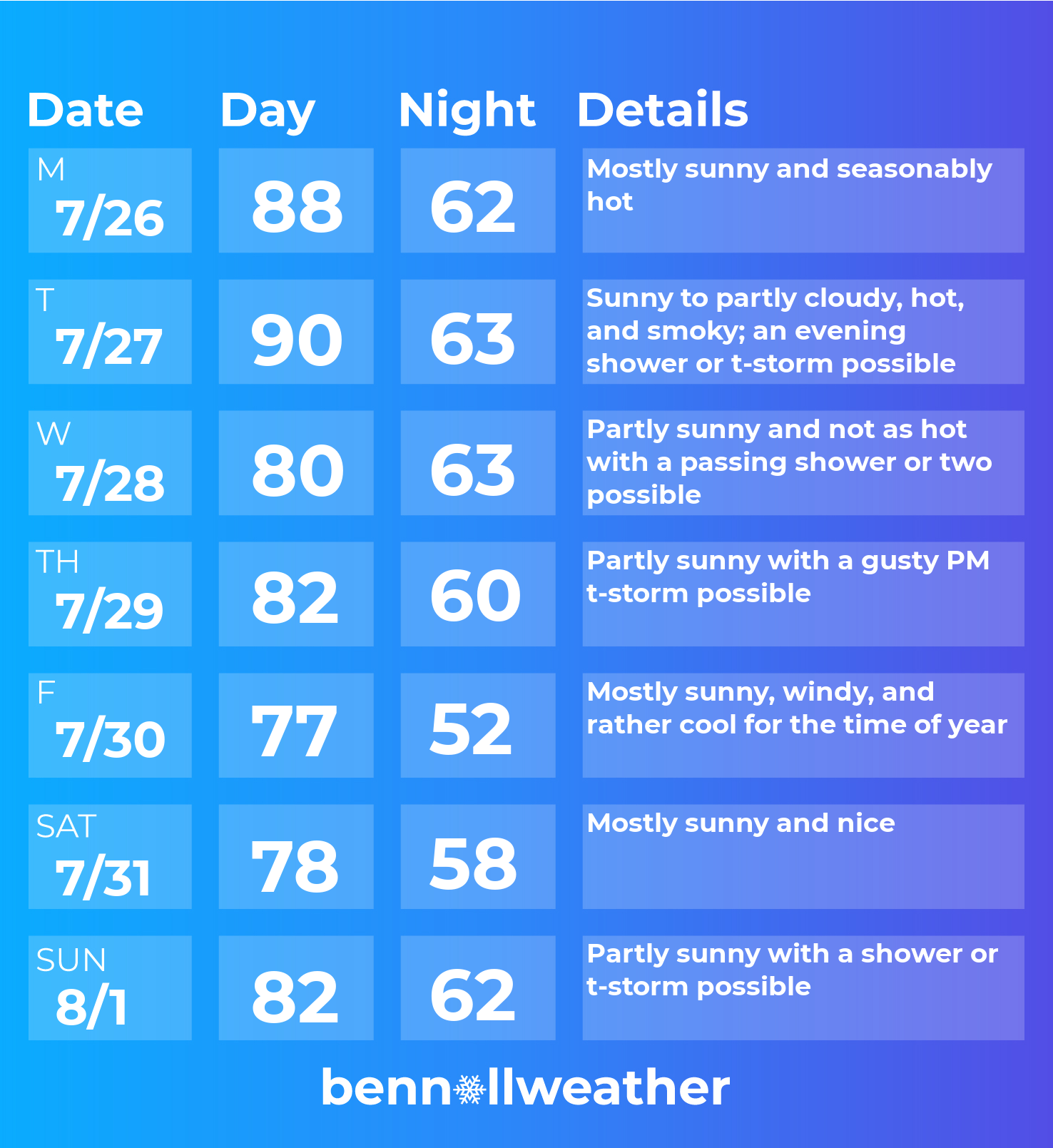
The week will start off with high pressure and dry weather on Monday.
Tuesday looks to be the hottest day of the week. A front will approach late in the day, igniting showers and storms farther upstate that could make their way down toward the mid Hudson Valley by evening. Just ahead of the front, a plume of smoke could again filter the sky with an increasingly familiar haze — more on that later.
Behind the front, a cooler day is in store for Wednesday.
Another, stronger front will approach the region later Thursday. This one will mean business as it tows air down from Canada’s Northwest Territories. The clash of the incoming, sharply cooler air mass with the preexisting warmer one will likely spark some gusty thunderstorms. Keep an eye on it! ⛈️
Friday and Saturday will offer a September-like feel. Friday night looks particularly cool, dipping to near 50 degrees — definitely a time to give the AC a rest and crank open the windows.
Another series of Canadian cold fronts may approach for Sunday-Monday, offering yet more refreshing air early in the week of August 2nd.
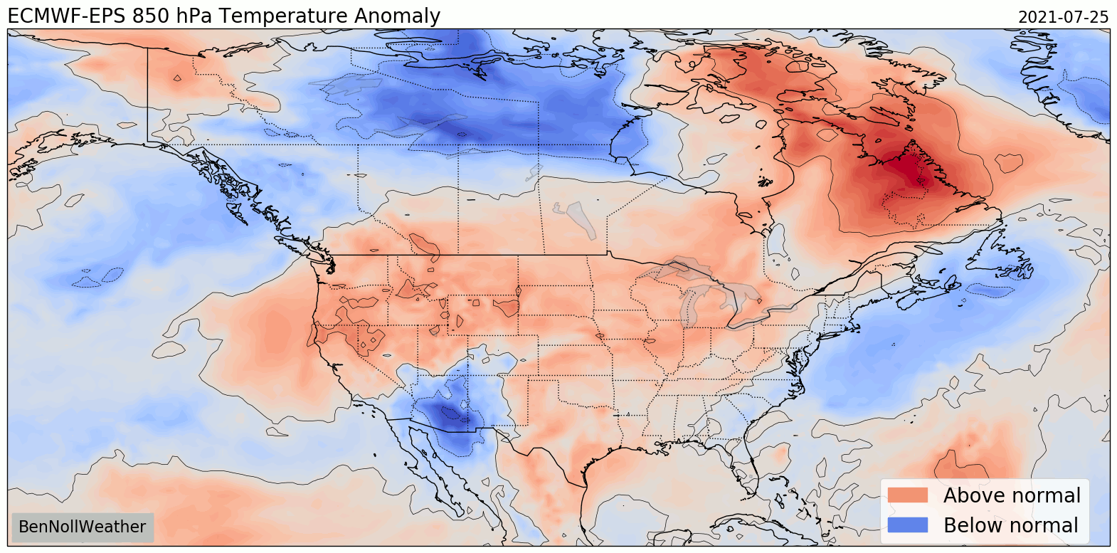
A trend toward warmer conditions is possible by the 2nd week of August.
Smoke spans 3,000 miles
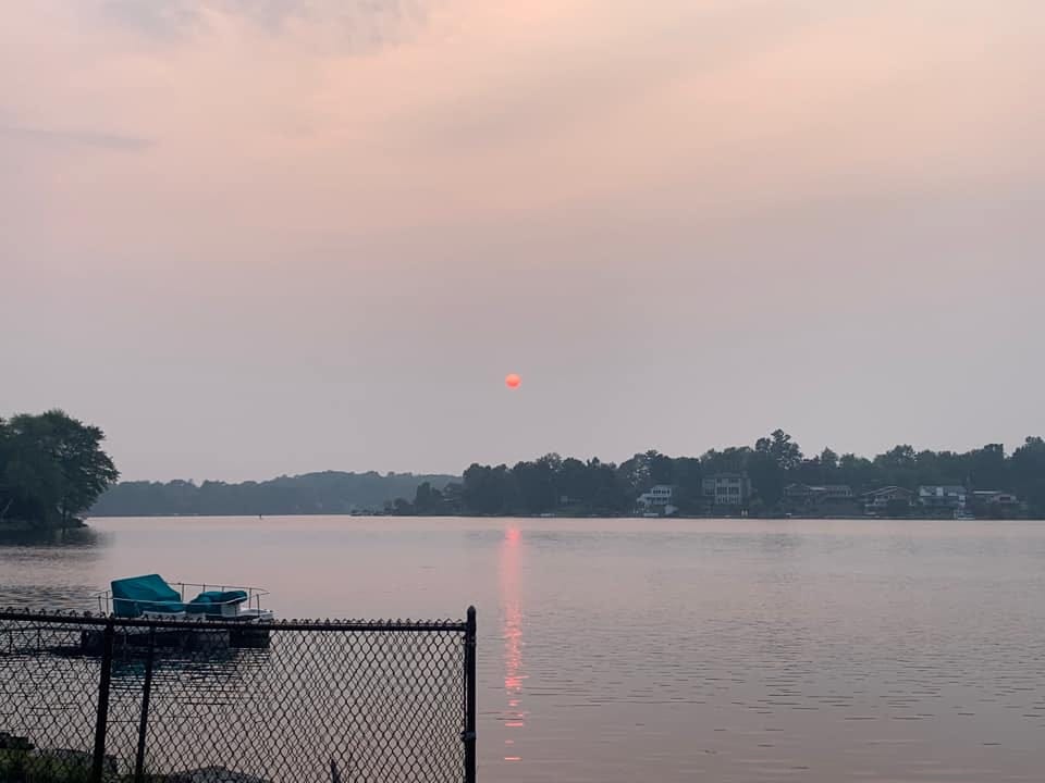
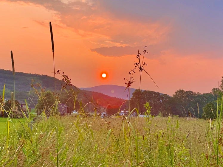
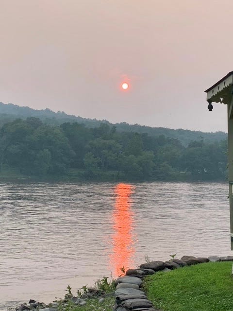
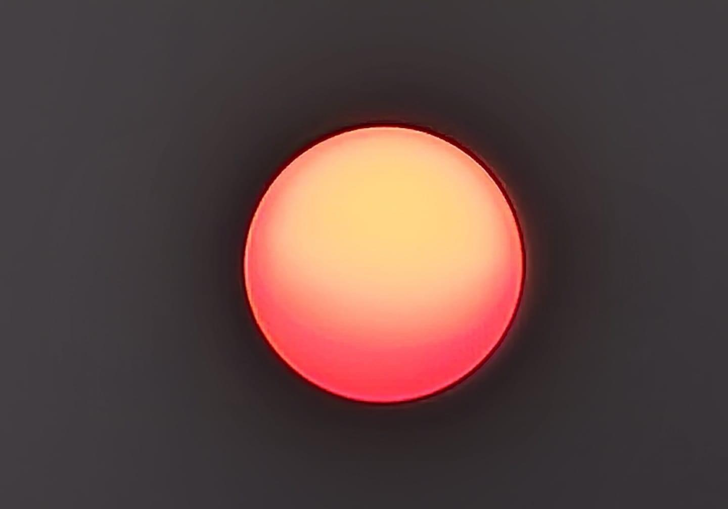
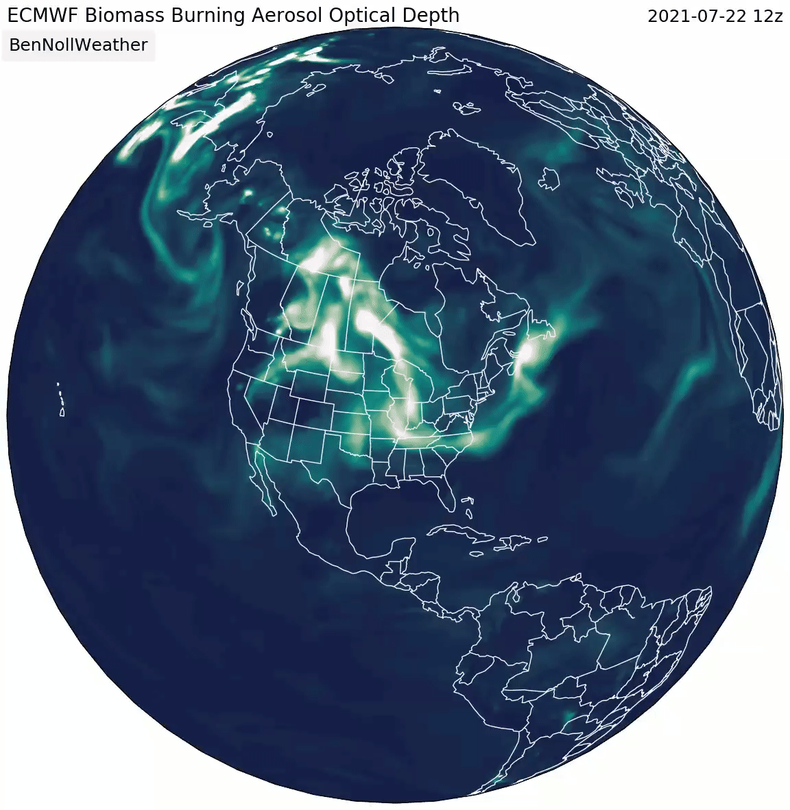
On Tuesday July 20th, smoke from the wildfires across the western U.S. and Canada had traveled nearly 3,000 miles eastward into the Northeast.
Unlike previous occasions of wildfire smoke appearing in our skies, it was more concentrated and infiltrated the lower atmosphere this time. It ended up having an effect on air quality, with some residents reporting being able to smell and even taste the smoke.
The fine particulate matter acted as an Instagram-like filter in the sky, creating some very distinctive scenes at sunrise and sunset. Below are some of the most eye-opening shots shared from across the Hudson Valley. Thanks to everyone who sent in their photos!


The smoke didn’t just stop in the Northeast. It continued to travel across the Atlantic Ocean, lofted high in the sky by the jet stream. Countries as far away as Sweden witnessed a smoky haze.
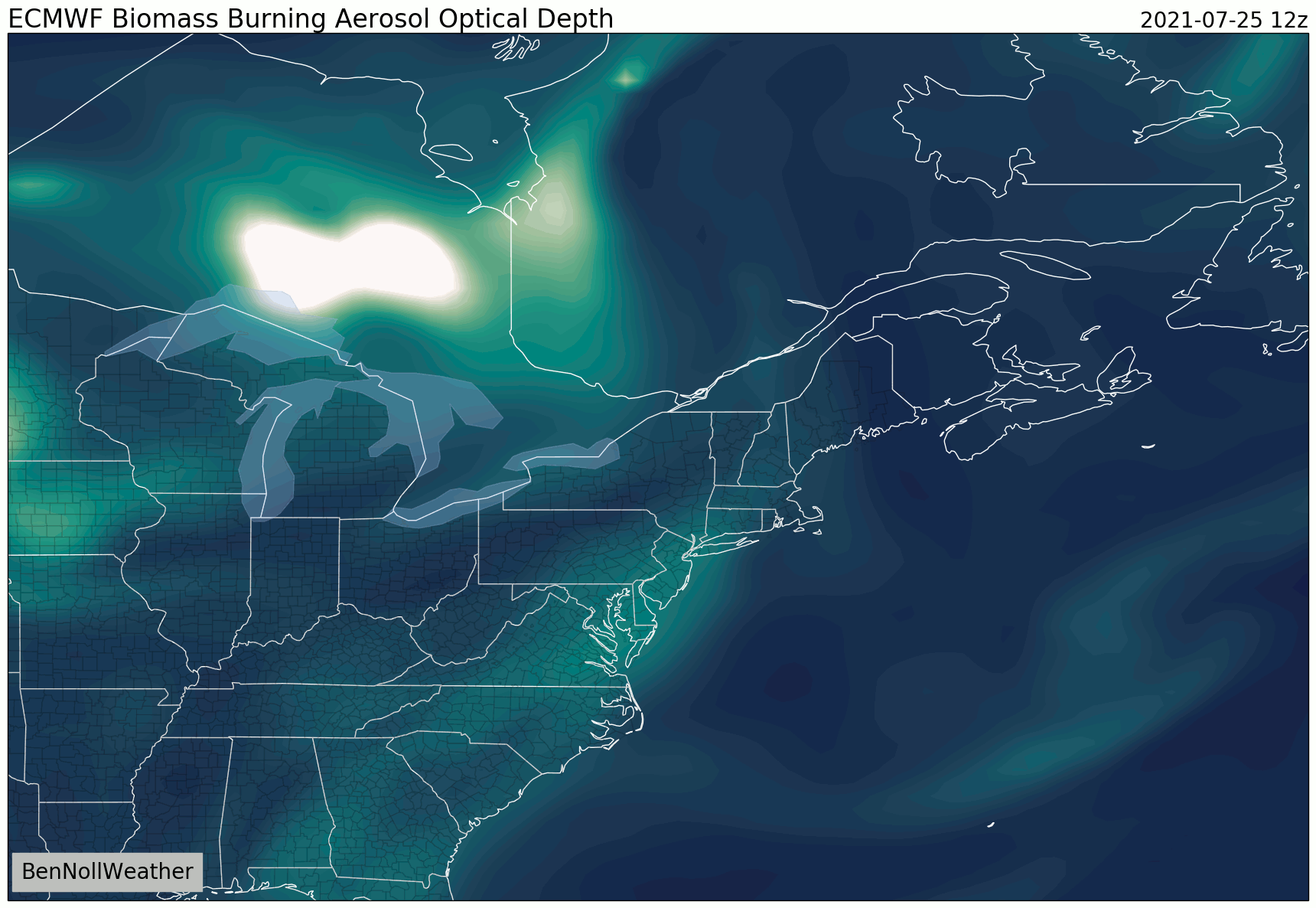
Skies will again be smoky at times over the coming week, with Tuesday afternoon and evening looking to have the highest concentration. It remains to be seen how much smoke infiltrates the lower atmosphere, but there will probably be less than last week. Regardless, it should spell the return of the blood red sun! 🔴
Have a fantastic week!