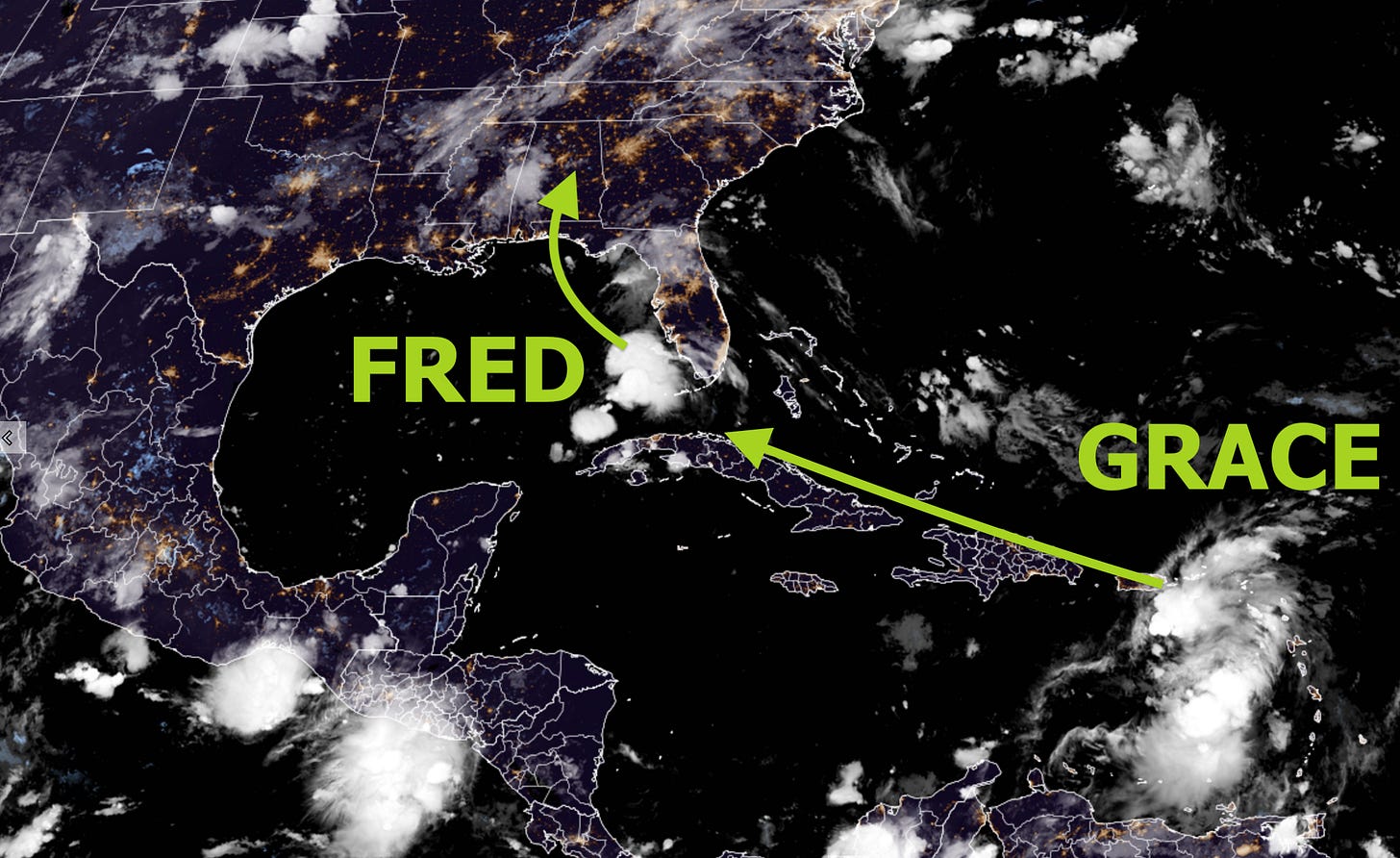
Who’s Fred, you ask?
No, not that guy.
It’s a remnant tropical system swirling in the Gulf of Mexico that’s predicted to make landfall in the Florida Panhandle or Alabama late Monday.
It will dump a lot of rain on Southeastern states, possibly resulting in flooding, before saying yabba-dabba-doo and heading northward.
The Hudson Valley will feel its effects in the form of humidity starting on Tuesday before the potential for some heavy rain on Thursday.
For tropical storm and hurricane tracking, feel free to follow my tracking bot on Twitter.
Monday will have the lowest humidity of any day this week.
The mugginess meter will reach a 7 or 8 on Tuesday as the chance for showers enters the forecast.
The humidity will reach its peak from Wednesday-Friday, with Thursday having the highest chance for widespread showers and thunderstorms — some may be heavy ⛈️
The unsettled conditions caused by Fred look to push offshore by Saturday, but the sticky weather is set to remain. It will probably remain more humid than normal into the week of the 23rd.
While it won’t be all rainbows and butterflies this week in the Hudson Valley, at least it won’t be as hot as this past week! 👍
As we look ahead to the next few weeks and months, the Atlantic Ocean should have its share of tropical storms and hurricanes. Using this upcoming week as an example, these storms can impact our weather in different ways from time to time.


Views 😎
Escape New York's humidity and head to the snowy mountains!
This is the North Island's Central Plateau, a mountainous region known for its volcanoes, following a recent snow storm.
Earlier this week, 3 inches had fallen at an elevation of 3600 feet and by afternoon it was 50 degrees and mostly sunny. Much heavier amounts occurred higher up the mountain, which towers at over 9000 feet.
There was just enough for us to enjoy without having to drive up the mountain, which required chains.
Have a wonderful week!


