Ida's rain to reach Hudson Valley
Update #462
Greetings!
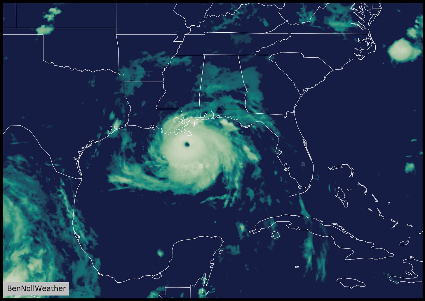
This week’s post will start off with a look at Hurricane Ida, a dangerous category 4 storm that will make landfall in southeastern Louisiana today.
Sustained winds of 145 mph as of 5:00 am Sunday make it a formidable category 4, with a chance it strengthens to category 5 status (≥157 mph) before landfall. Its fuel? The sultry waters that it’s tracking over — nearly 90 degrees in the northern Gulf of Mexico.
The wind, surge, and flooding impacts will be catastrophic in southeastern Louisiana, including New Orleans.
The following animation shows the simulated radar until Tuesday morning to give you an idea as to how slow the storm will move post-landfall. 10-20+ inches of rain will fall in a wide area across the southeastern part of the Louisiana, where New Orleans has already received more rain in 2021 than it averages for an entire year.
After first drenching Mississippi, Alabama, Tennessee, Kentucky, and West Virginia, Ida will reach the Northeastern states from Wednesday into Thursday.
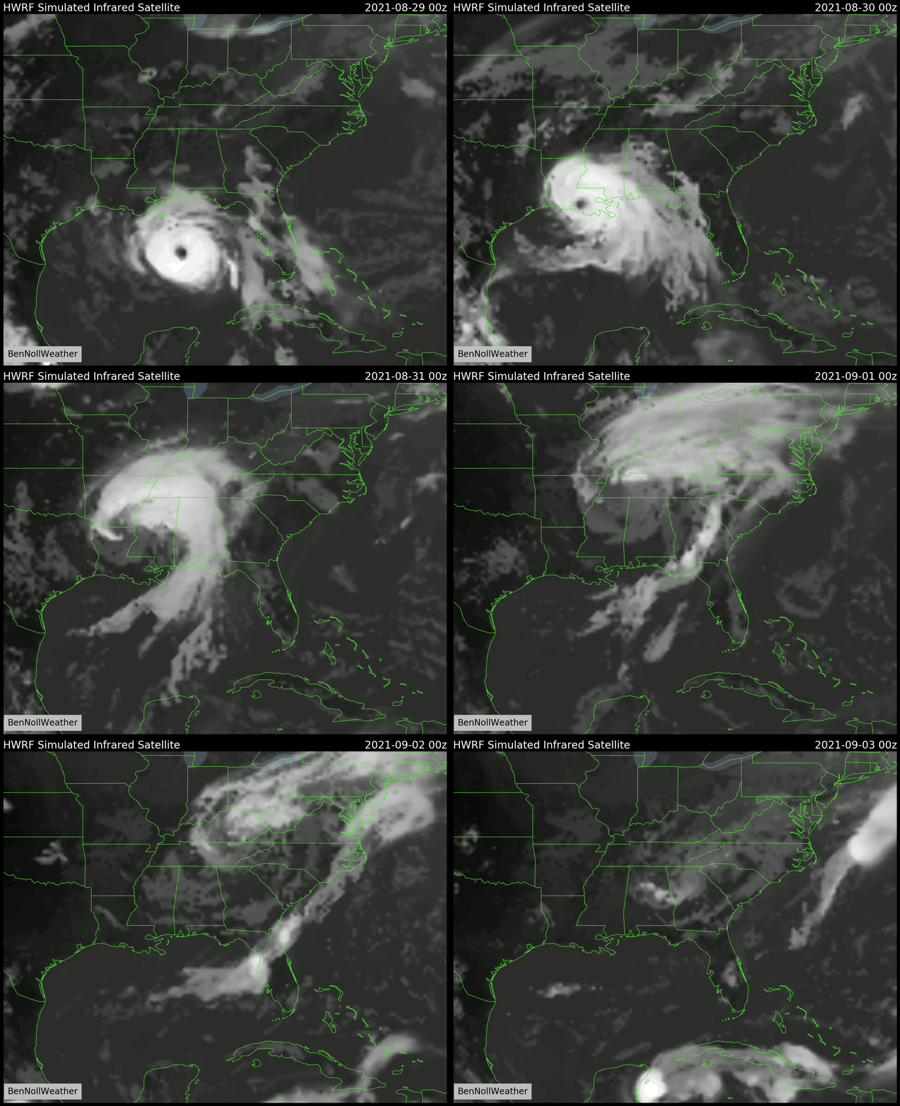
This animation shows the predicted satellite picture as if we were viewing the storm from space. Although Ida will quickly weaken over land as it runs out of fuel, its impacts will be spread across a wide area when it becomes wrapped into a frontal boundary. This includes the Hudson Valley, particularly on Wednesday night and Thursday morning, just as the new school year kicks off…
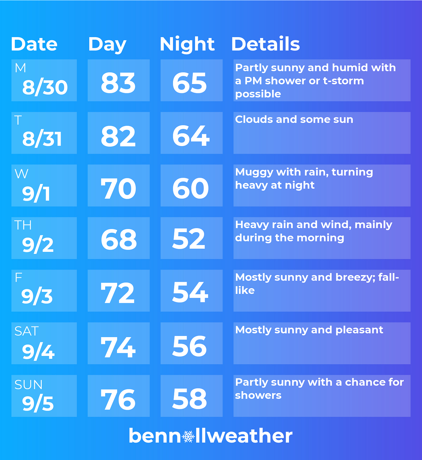
The week will start off with more of the same muggy weather we’ve been dealing with over the last few weeks.
By Friday, the weather will have done a full 180˚!
Following the chance for a shower or thunderstorm on Monday afternoon, Tuesday looks to have dry weather.
Conditions will start to go downhill on Wednesday as moisture from Ida starts to streak toward the region. If you’re headed off to school, don’t forget the umbrella ☔
Ida’s impact will likely peak in the Hudson Valley from Wednesday night into Thursday morning. This is when downpours and gusty winds will be possible.
Early indications are that 2-3 inches of rain could fall and winds could gust in the 30-40 mph range, but details are still coming into focus — stay tuned for more updates on my social media channels like Twitter and Facebook.
Temperatures will struggle to reach 70 degrees both days.
Conditions could improve across the Hudson Valley as early as Thursday afternoon, but confidently by Friday. A brisk northerly wind flow from Quebec on Friday will make things feel more like late September, a fall preview! Something to look forward to 🍃
The nice weather will probably continue on Saturday and maybe into Sunday before the next disturbance approaches. The week of the 6th is actually looking rather cool and perhaps a bit unsettled — hello fall! ☺️
Meteorological fall starts on Wednesday in the Hudson Valley!
I thought it would be interesting to look at some provisional summer seasonal stats, as at Dutchess County Airport.
Average temperature: 73.1˚F (8th highest on record)
Average high: 83.3˚F
Average low: 62.9˚F (2nd highest on record)
Warmest night: 74˚F
Coolest night: 43˚F
Warmest day: 98˚F
Coolest day: 68˚F
Days above 90˚F: 19
2nd most humid summer on record in the Northeast
In case you were wondering, astronomical fall (the more common definition) starts on September 22nd.
Have a fantastic week and best wishes for the new school year. The first you-know-what day is just a few months away 😁


