Mild mid-month 🌡️
Update #468
Greetings! 👋
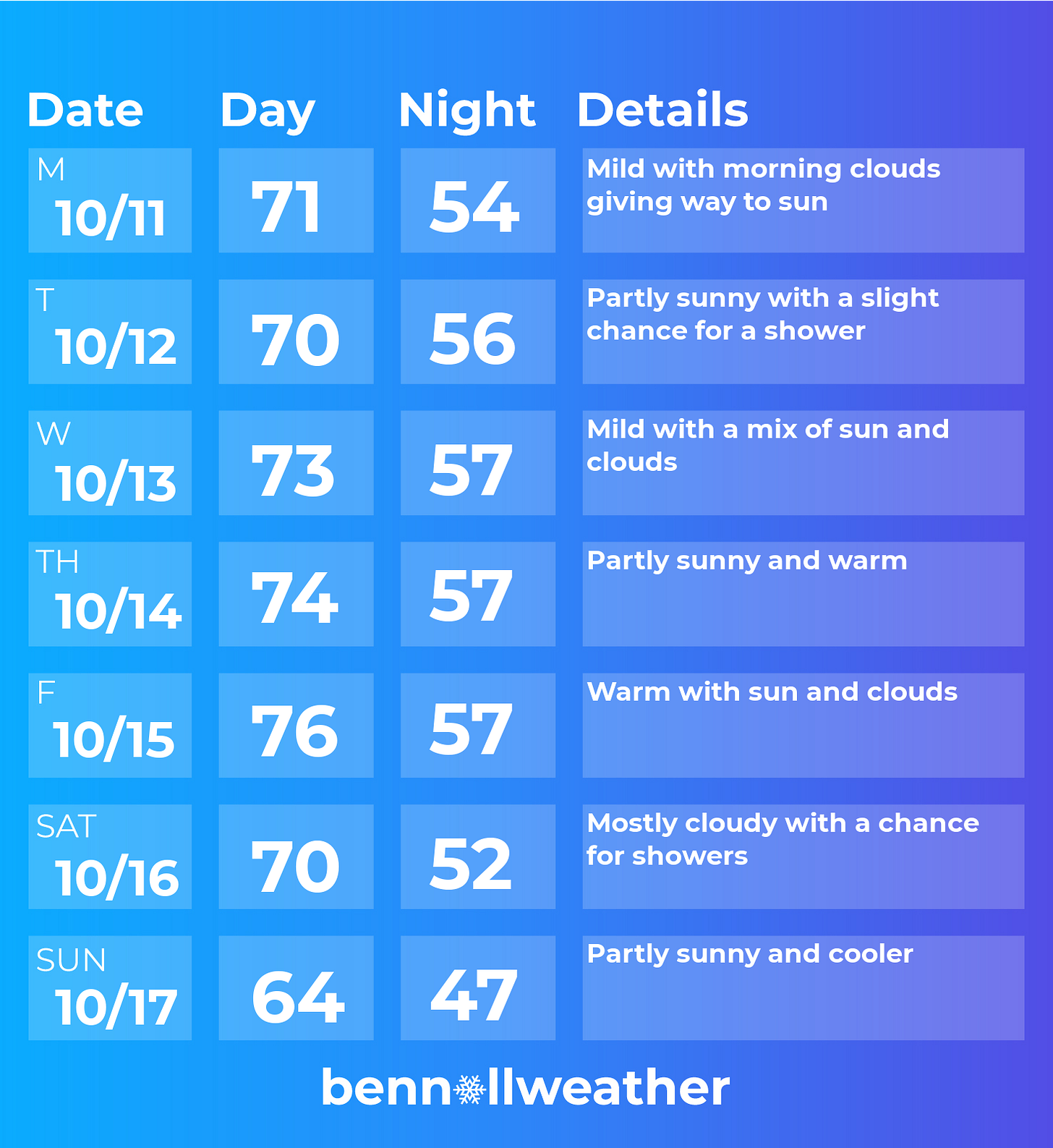
It’s been a warm start to October across the Hudson Valley with temperatures of 3 to 4 degrees above average so far.
More unseasonable warmth is ahead before a cool down arrives in about a week. The end of the month then looks rather mild and dry…
Sunday (today) will have mostly cloudy conditions across the region. A storm swirling near the North Carolina Outer Banks could cause a few showers this afternoon.
A ridge of high pressure on Monday will bring dry and rather warm conditions with clouds and some sun.
❄️ Meanwhile, the Intermountain West will have its first winter storm of the season, with snow across Idaho, Montana, and Wyoming. Typically, when unusually warm conditions are affecting one side of the country during fall, the other experiences the opposite (cold 🥶) — this could *could* flip in a few weeks time…
Back in the Hudson Valley, high pressure should hold overhead on Tuesday and Wednesday, although a disturbance offshore could inch close enough to give us a shower chance.
On Thursday-Friday, we’ll turn the thermostat up a few more notches 🎛️ — forecast highs in the mid-to-upper 70s would be 10-15 degrees above average for the time of year.
On Saturday, a cold front looks to approach the region from the west. It’s too far out to time precisely yet, although some rain will be possible.
A cooler air mass will work into the region starting on Sunday, lasting a few days into the week of the 18th.
A powerful ridge of high pressure could hover over the eastern states for much of late October, bringing mostly dry weather and mild temperatures.
While winter weather isn’t yet on the Hudson Valley’s radar, it’s on my mind. I’ve been working on a winter outlook for the region, which will be released on Saturday, October 23rd along with new merch for the winter season ahead. Stay tuned!
What’s happening down under
This time of the year, the weather in the Hudson Valley is similar to that of northern New Zealand, which is enjoying spring. In Auckland, high temperatures have been in the mid to upper 60s.
This was the view on Saturday, overlooking the Hauraki Gulf (part of the Pacific Ocean) and a dormant volcano named Mt Rangitoto, which last erupted approximately 600 years ago 🌋
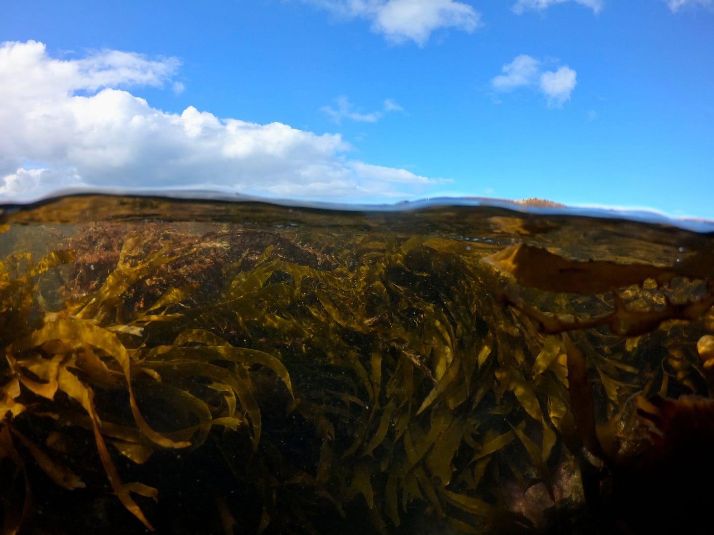
Beneath the ocean surface was quite a different view — a seaweed forest of sorts.
The sea grapes pictured below, also called Neptune’s necklace, are native to Australia and New Zealand.
Sea ya next week! 😉


