Cold but calm, mostly
Update #473
Hi there! It was anything but calm in the Hudson Valley on Saturday afternoon ⚡
Footage from a line of thunderstorms flowed in — for some towns, it was quite a notable event for November standards. The Harriman area took the severe weather crown 👑 as hail blanketed the road, making for treacherous travel and white-knuckle driving along the New York State Thruway. Many thanks to Keith & Karen May of Wappingers for sending this in!
In Mahopac, Chris Ferrante captured rare asperitas clouds, which are associated with an unstable atmosphere and thunderstorm activity.
It was all fueled by an atmospheric disturbance known as a “vort max”, or region of cyclonic spin, that emerged from the Canadian Prairies several days ago. Steep atmospheric lapse rates (decrease of temperature with height) enhanced the instability and likely contributed to hail growth.
The good news is that the week ahead is looking largely settled, albeit chilly.
With the holidays quickly approaching, grab some swag → BenNollWeather store. Don’t forget to add promo code “winter” for some savings 😁
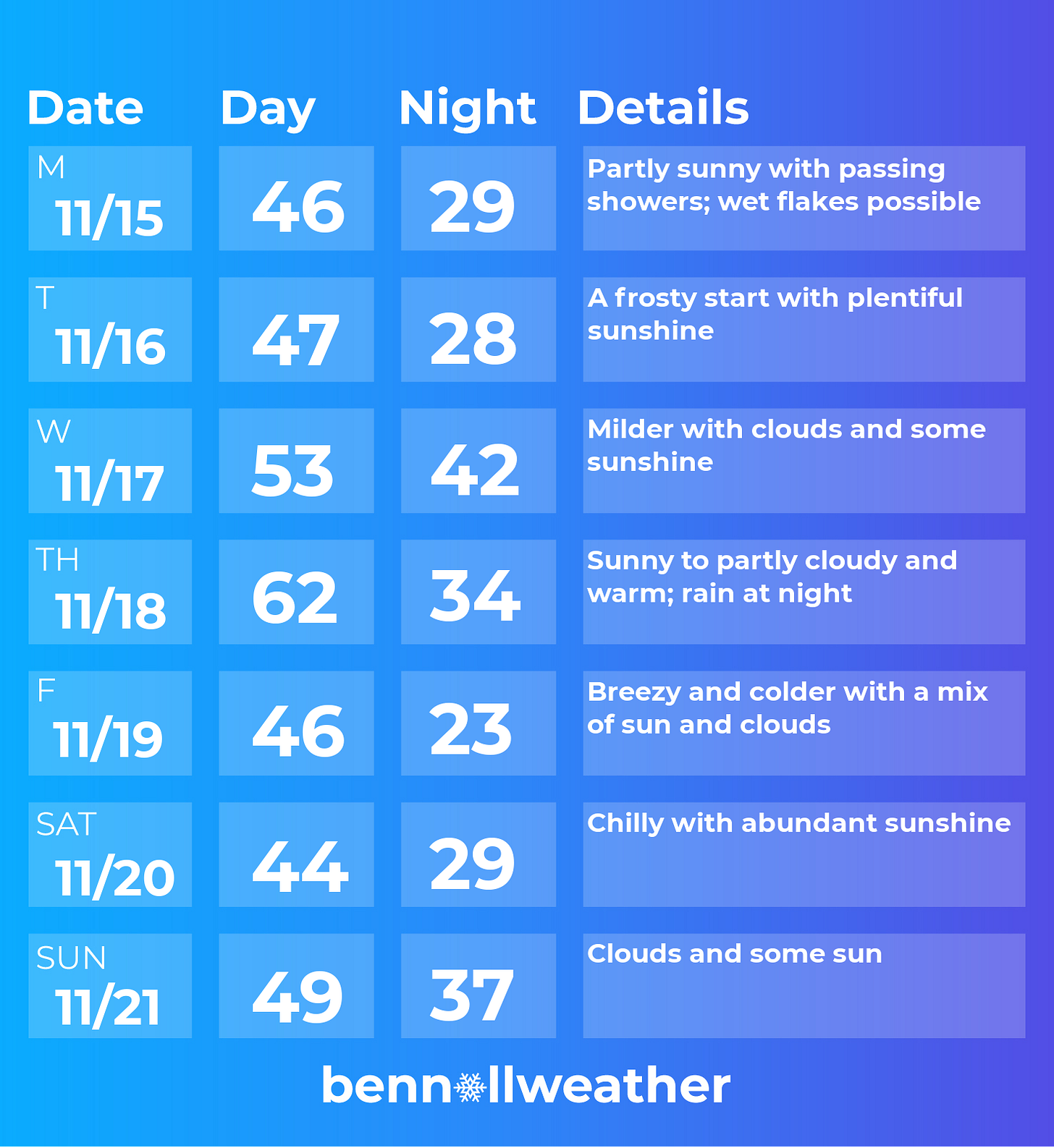
Now for the week ahead. It looks generally uneventful with a few exceptions. Plenty of high pressure, which quickens the pace at which I can forecast!
Monday’s forecast comes with a chance for wet snowflakes! ❄️ It’s not a guarantee, but the air will be cold enough to support snow, particularly over higher elevations. Forecast snowfall across the Northeast reveals several inches of possible accumulation in western PA and NY. As winter closes in, you can follow my SnowMapBot for tweets of 48-hour forecast snowfall maps every 6 hours.
In case you were wondering, I hand craft most of my maps in Python using a geospatial processor called cartopy. The data is extracted from the supercomputer at NOAA 🤖 — writing Python scripts can be time consuming but the output is rewarding.
High pressure will build in on Tuesday, lasting several days. Frosty conditions will be possible on both Tuesday and Wednesday morning.
A southerly air flow on Wednesday and Thursday will give temperatures a boost, with 60+ degree highs possible on Thursday afternoon ahead of a front.
Rain will likely return to the region on Thursday night as a cold front passes through.
High pressure will quickly return on Friday, lasting into the weekend. A particularly chilly morning looks possible on Saturday.
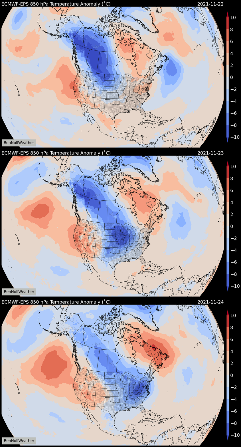
Thanksgiving week weather — a series of fronts will be possible around the start of the week of the 22nd, which is of heightened interest because of Thanksgiving travel. While it’s still early, a strong front looks possible around Tuesday the 23rd. Cold air could rush in behind the front, potentially lasting through much of the rest of the week.
With this type of air mass in place, I’ve certainly got a watchful eye on Mother Nature’s menu around Black Friday and the weekend that follows 👀
For up-to-date information, you can follow along on Twitter.
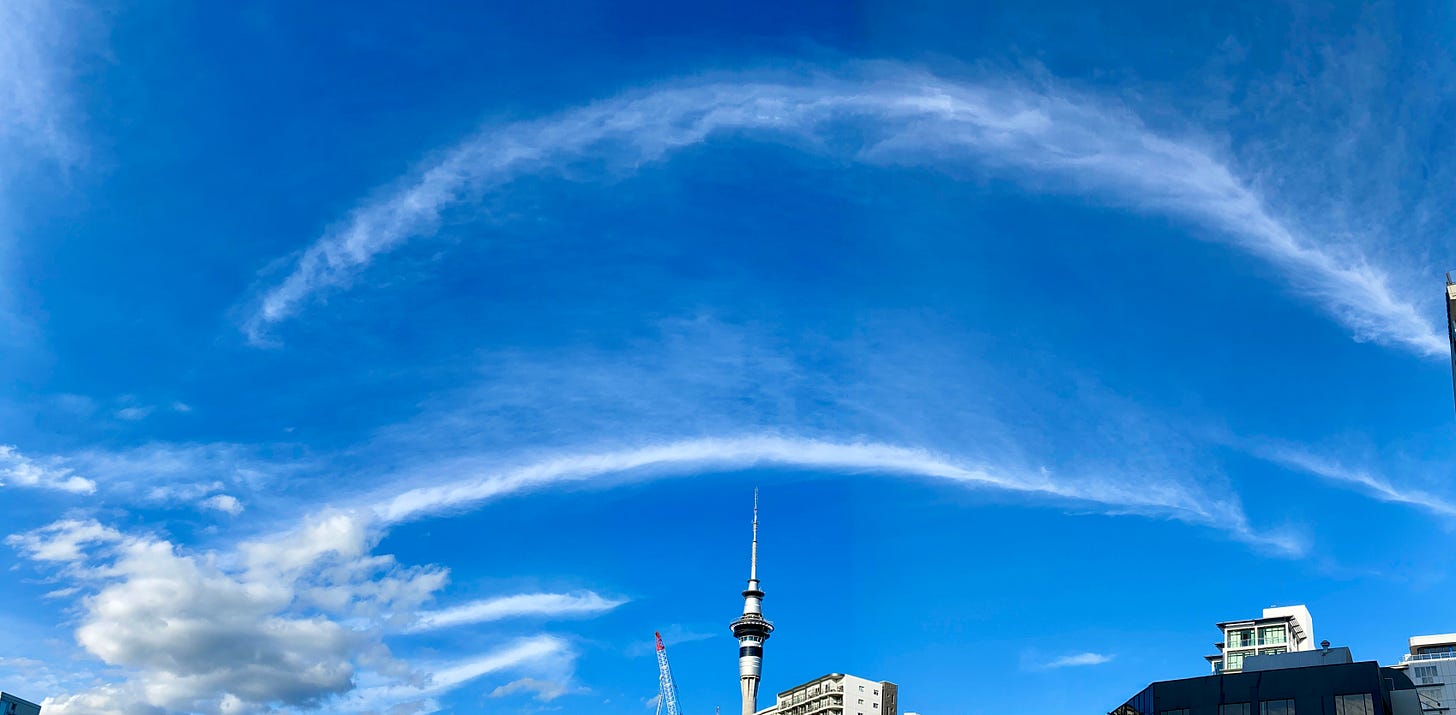
Down under, we had some unique clouds of our own. A tropical air mass descended on Auckland this weekend, with these ice crystal “arcs” on the system’s leading edge Thursday evening.
Make it a winning week!


