
Wintry mix Monday
Update #479a

Hi all! 👋
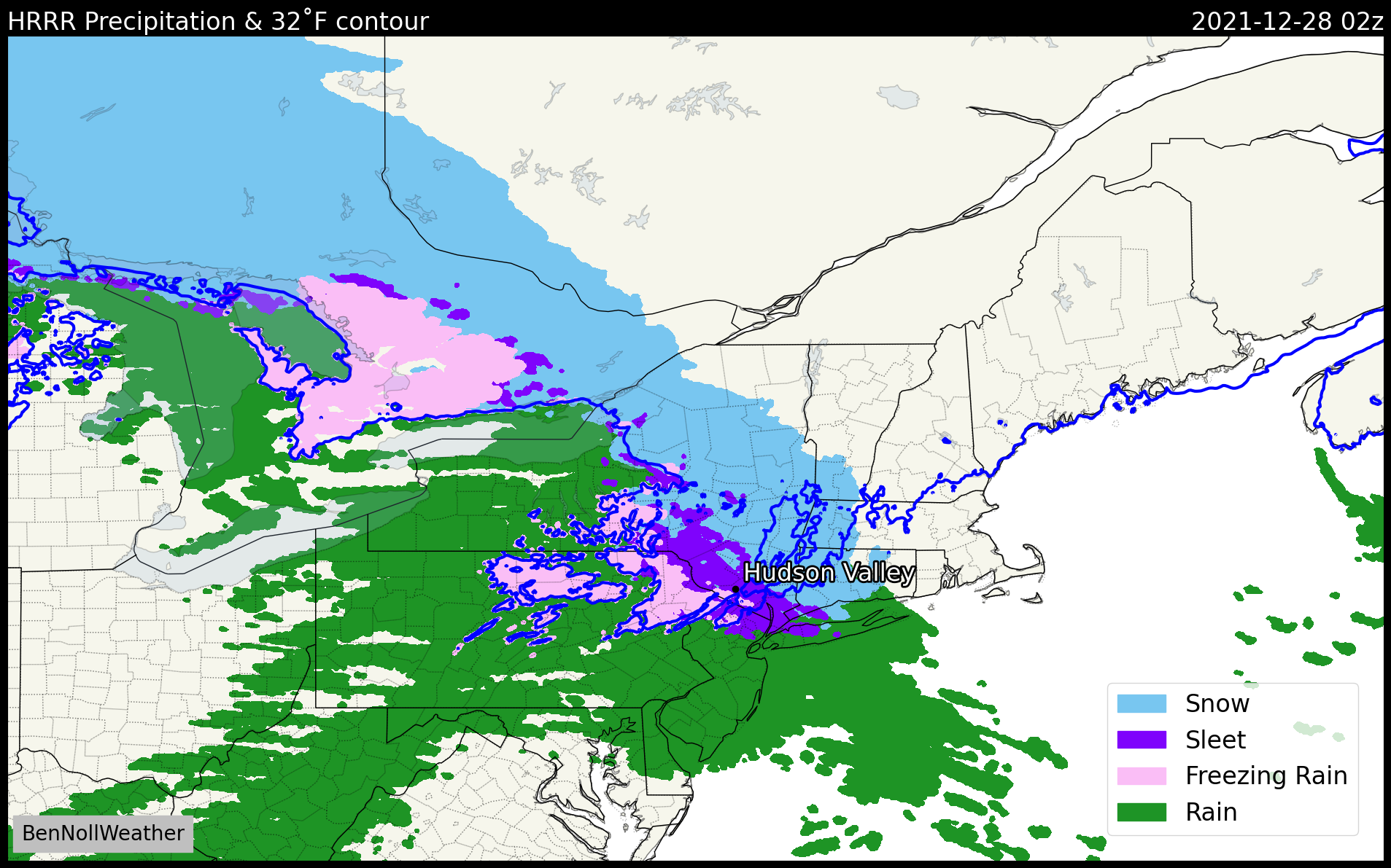
Just dropping by to bring you into the loop on the latest and greatest in the world of Hudson Valley weather. A disturbance is moving eastward from the Ohio Valley and losing steam, but it is expected to produce a bit of wintry weather later today.
A Winter Weather Advisory is in effect from late this afternoon through early Tuesday for a wintry mix.
We’re not talking about a big storm here — but just enough to create slippery conditions on untreated surfaces.
What? Snow changing to ice.
When? Mainly after 2pm. Snow is the most likely precipitation type at first, followed by light sleet and freezing overnight. Ending early Tuesday morning.
How much? A coating to at most an inch of snow, followed by a glaze of ice (sleet / freezing rain).
Temperatures? Lower 30s.
Impact? Untreated road and sidewalk surfaces may become slippery by Monday evening, particularly after dark when sleet and/or freezing rain becomes more likely.
Today’s weather update comes from you from…

The beach where the default Windows 10 background photo was taken. No wintry mix here 😉