Memo on Monday morning 🌨️
Update #481a
Hi there!
By now, you would have almost certainly heard about the winter storm aiming for the East Coast from Sunday into Monday.
From North Dakota to Georgia, a swath of winter weather alerts have been issued by the National Weather Service ahead of this widely disruptive system.
What will it mean for the Hudson Valley?
This moisture-rich storm is expected to carve a path up the eastern seaboard on Sunday night. Unlike classic East Coast snow storms, this one will track inland of the coast. With warmer air riding along its eastern flank, we’ll experience a bit of weather whiplash through the storm, starting out quite cold and finishing up rather mild.
Snow consistency could go from light and fluffy to wet and sticky over just a few hours.
Here’s what you need to know:
What? Heavy snow, changing to rain.
When? Sunday night, mainly after 10pm, into Monday morning; much of the region would have experienced a changeover to rain by 7am Monday.
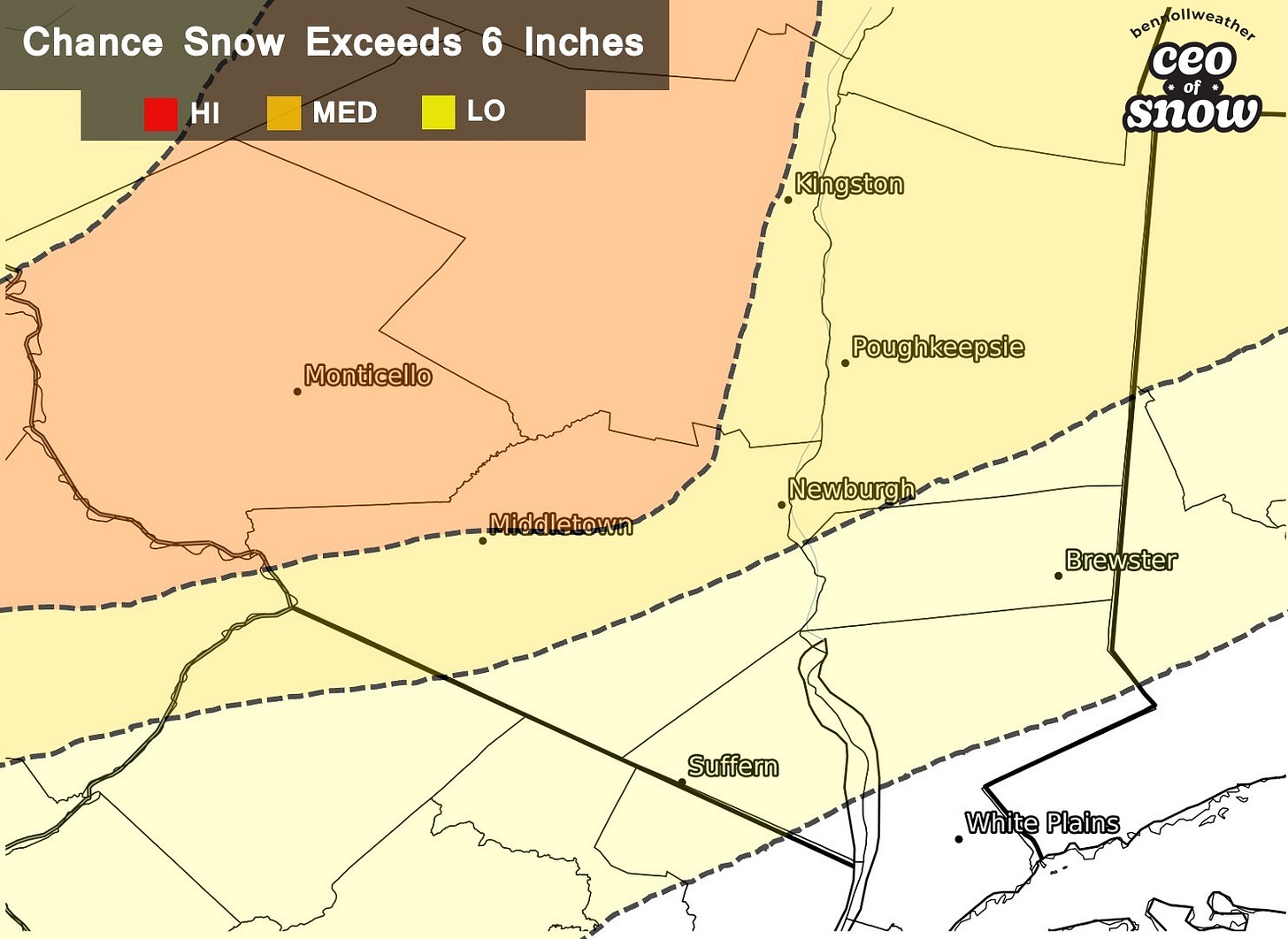
How much? Well, this is a tough one! Accumulation will probably vary greatly across the region, with more snow north & west and less snow south & east. 6-10 inches look most likely over northwestern Orange, Sullivan, and western Ulster — generally along and north of I-84. There’s a medium chance for more than 6 inches across most of Dutchess and central Orange County. Amounts will most likely fall short of 6 inches for southern Orange, Putnam, Rockland, and Westchester — the latter two counties seeing snow change to rain the fastest after a few inches of accumulation.
Impact? Well, there’s already a 💯% chance that schools will be closed Monday. Road conditions will deteriorate rapidly once snow starts Sunday night. Snow rates may reach 1-2 inches per hour during the early hours of Monday morning, particularly along and north of I-84. Gusty winds will also be possible and when combined with the weight of the snow, could result in some power outages. Conditions will improve quickest in Westchester and Rockland County where snow will change to rain the quickest. Much of the rest of the region will see improved conditions by midday Monday with temperatures rising to near 40 degrees.
You may be thinking: why does this have to happen on a day when there’s already no school?! 😭
You’re not alone: https://www.facebook.com/BenNollWeather/videos/1419386455130797/
Have a great day!


