Close shave Saturday
Update #483b
Good day!
It’s a hit, it’s a miss, it’s a hit, it’s a miss. Depending on the Facebook page, app, or website you’re looking at and when you’re looking at it, it may be tough to discern what’s likely to happen.
The pace at which information now flows at us is both a blessing and a curse — when it comes to the weather, a more measured, patient approach is usually required as the forecast for your backyard is highly sensitive to small scale atmospheric changes that are happening 1000s of miles away.
Unpredictable is not the word. I think delicate works better, as modern meteorologists try to strike the right balance between a steady stream of atmospheric advice and communicating the known and unknown.
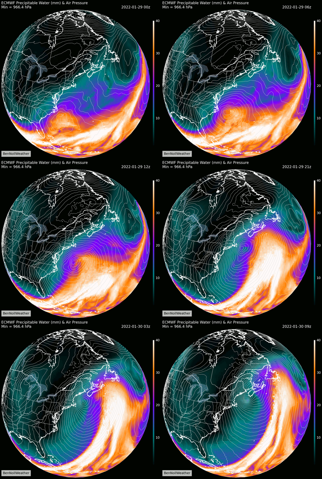
Of the features driving Saturday’s weather along the East Coast, one is swirling high above the Rocky Mountains and the other is crossing the Arctic Circle as of Thursday morning. Only humans know that they’re on a collision course and will “phase” to create a explosive cyclone along the East Coast in a few days. Pretty cool when you think of it like that.

Chances are you’re reading because you want to know about the forecast, so I’ll get to the point! 😅
Friday
Light snow possible, mainly during the morning, with a coating to perhaps a half inch — school impacts now appear unlikely
Saturday
The Hudson Valley will likely end up on the western edge of the storm, meaning that the worst weather will occur to our east, over Connecticut, Long Island, Rhode Island, and Massachusetts
Conditions across the Hudson Valley may differ significantly from west to east — even a small shift east or west can mean the difference between no snow or a heavier accumulation, and while that may sound cliché, it can’t be overstated
Snow is most likely to start during the early morning hours and continue through the day, ending by evening
Snowfall accumulations —taken with a grain of salt: see bullet point #2— are most likely to be 2-4 inches in Orange, Ulster, western Rockland, and western Dutchess, 4-8 inches for eastern Rockland, eastern Dutchess, Putnam, and Westchester, and less than 2 inches in the Catskills « I’ll give these ranges another look tomorrow!
Blustery winds gusting to 30-40 mph are possible on Saturday, and while sporadic power outages could occur, they look unlikely to be widespread with a very powdery snow — winds may cause blowing and drifting snow
An additional email update will be sent tomorrow morning with updates on Twitter in the meantime.
Have a great day! ☃️
Thank you for supporting the hours of meteorological analysis done each week to provide a unique service for the Hudson Valley.

