
Saturday trends snowier ❄️
Update #483c

Greetings all! Onto my 4th email update this week 😬
That’s how you know things are busy!
Fortunately, there’s now a bit more clarity on the Saturday storm.
But first, a quick update on today’s weather…
Light snow will develop during the mid-to-late morning hours across the Hudson Valley, from south to north, continuing during the afternoon. A coating to a half inch may accumulate, primarily on grassy surfaces. There is a risk of distracted students who ask if there will be an early dismissal, but I expect that road conditions during the PM commute will be OK despite the flakes 😄 If you’d like to track the snow, you can use my handy-dandy radar. For clarity, this snow is not from the nor’easter.
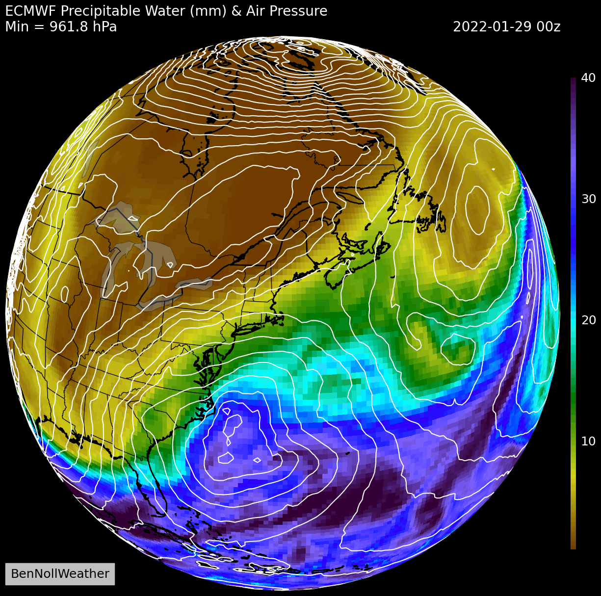
The main event will get underway on Friday night 🌨️
Depending on your county, a Winter Storm Warning or Winter Weather Advisory may be in effect.
What? Snow of a moderate intensity
When? Starting between 10 pm Friday and 1 am Saturday from south to north, ending between 4 pm and 7 pm Saturday from west to east
How much? 4-8 inches in Orange, eastern Ulster, western Rockland, and western Dutchess. 8-12 inches in eastern Rockland, eastern Dutchess, Putnam, and Westchester. 2-4 inches in the Catskills. It will be super fluffy and easy to shovel, but you won’t be able to make a snowman because of the lack of moisture ☃️
Temperatures/wind? Temperatures in the teens. Wind gusts of 30-40 mph on Saturday will cause blowing and drifting of the snow 🌬️
Impact? Snow-covered and slippery roads on Saturday. Canceled events. Roads and sidewalks will remain slick on Sunday with temperatures only reaching around 20 degrees. The temperature likely won’t rise above freezing until Tuesday.
📏 To the east of the Hudson Valley, the snow will be measured in feet. 1 to 2 feet is expected across much of New England with amounts in excess of 2 feet in Rhode Island, eastern Massachusetts, New Hampshire, and Maine. In these places, a Blizzard Warning is in effect. A Blizzard Warning is also in effect for the Jersey Shore and Ocean City, Maryland.
Localized storm maximum snowfall may reach 3 feet 😵 — this will be a crippling storm for eastern New England. If you know someone who lives in the dark purple (🟣) area of the map below, let them know they’re in for a doozy (they probably already know)!

Stay safe and thank you for supporting the hours of meteorological analysis done each week to provide a unique service for the Hudson Valley.
Thank you for all that you do to keep us informed!!!
Can you clarify the colors used on your maps