🌡️ 60s then snow, maybe! ❄️
Update #486
Hello everyone! My weekly updates are back in action just in time for an interesting weather week.
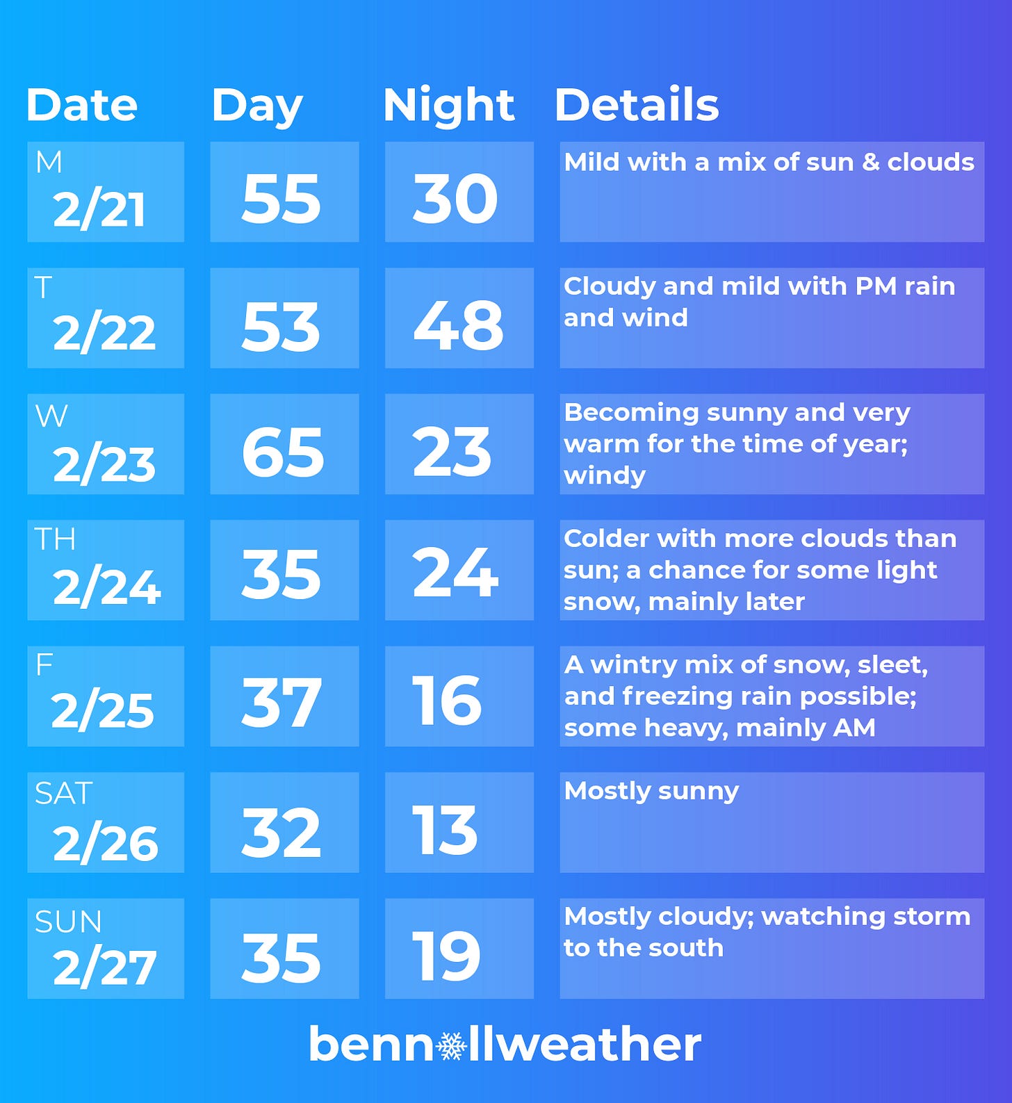
An earlier-than-normal spring-like swing will be in full effect with mild temperatures and the potential for a winter storm over the next 7 days.
In terms of wintry weather, the period to watch is Thursday night and Friday morning. As has typically been the case this winter, it will fall when many, but not all, schools are already off.
Monday (and Wednesday if you don’t mind the wind) will have the pick weather of the week. A high in the low-to-mid 50s would register as about 15 degrees above average for the time of year.
The pleasant conditions will be short-lived, however, as clouds roll in on Monday night and rain begins to fall by Tuesday afternoon. It will turn windy on Tuesday night with gusts possibly reaching 30-40 mph.
The weather will clear on Wednesday morning. Warm air aloft, gusty westerly winds, and an increasing sun angle will be the recipe for an unseasonably warm day. Should the temperature reach 65 degrees, it would equal the average high for April 25th.
A strong cold front will sweep through the region by late afternoon, seeing the temperature plummet into the 30s.
Things will then get even more interesting!
With an Arctic ridge of high pressure splayed out over the northern tier of states, a dip in the jet stream over the Rockies will spawn two waves of low pressure in the Midwest.
The first, a weaker wave, could spell some light snow for the region on Thursday afternoon, but there will probably be too much dry air for it to turn into anything major. There’s also a chance that it remains dry.
The second, stronger wave, will move in on Thursday night and last through Friday morning. There is still much to be determined (extent of cold air, track, timing), but the puzzle pieces for a winter storm are coming together. The early indication is for snow changing to ice with enough to possibly cause significant disruptions.
For schools that are in session, this could be a snow/ice day ~ stay tuned!
High pressure looks to build back in on Saturday, but another system could approach from the south on Sunday/Monday, which bears watching.
The week of February 28th looks sharply colder than normal 🥶
Additional cold snaps look likely in March and April.
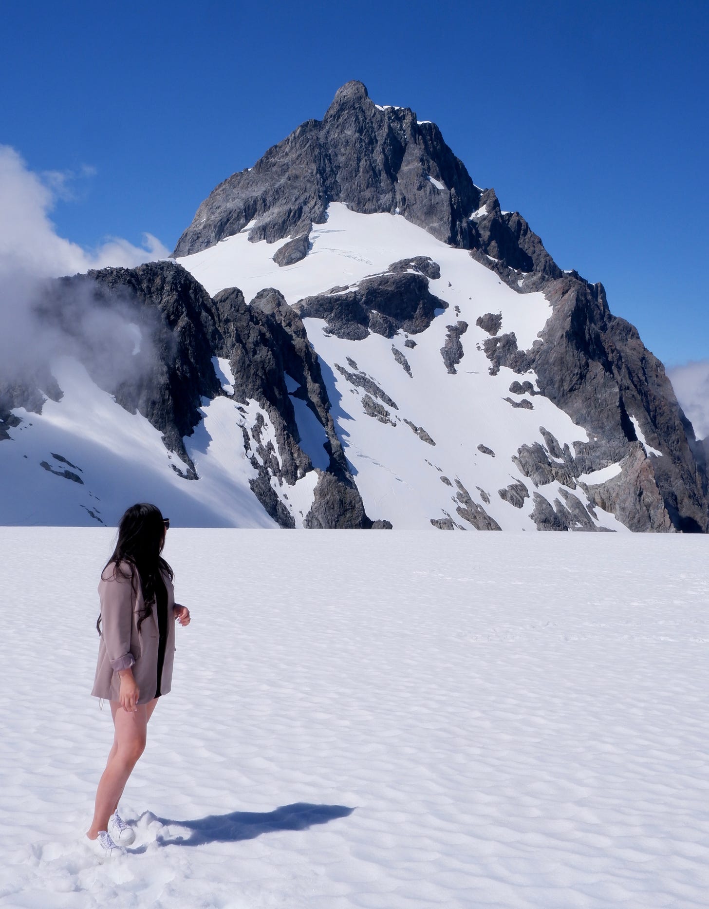
For your enjoyment, here are a few photos from my travels over the last week. Although it’s summer here in New Zealand, snow sits year-round in the Southern Alps glaciers. The mountain pictured below stands at nearly 9,000 feet tall!
Temperatures were in the 40s but with full sunshine it was mild enough to not need full winter gear during a short helicopter trip.
Deep crevasses make New Zealand’s alpine environment a particularly dangerous place, even for the most experienced mountaineers.
In the picture below, older snow is toward the bottom with the newest snow at the top. The snow with reddish tinge —in the middle layer— is from 2019-2020, amid the Australian bushfires, when smoke and dust blew across the Tasman Sea and fell out onto New Zealand.
Stay tuned for some more photos next week!
I’ll be in touch about the weather for Friday ✌️


I think Fallsburg CSD is one of the few locally that DOESN'T have this next entire week off so a Friday snow day would be sweet 😁
I didn't realize how much I looked forward to your weekly forecast until last week when there wasn't one. Congratulations on your marriage, and the photos are beautiful! Thanks for keeping us all informed.