
Friday: avoid AM travel 🛑
Update #486c

Greetings!
The height of the impending storm will coincide with the Friday morning commute, making non-essential travel inadvisable.
Schools are expected to close and announcements may be made today or tonight given the high confidence for bad weather.
Warnings and advisories have now been issued for the region.

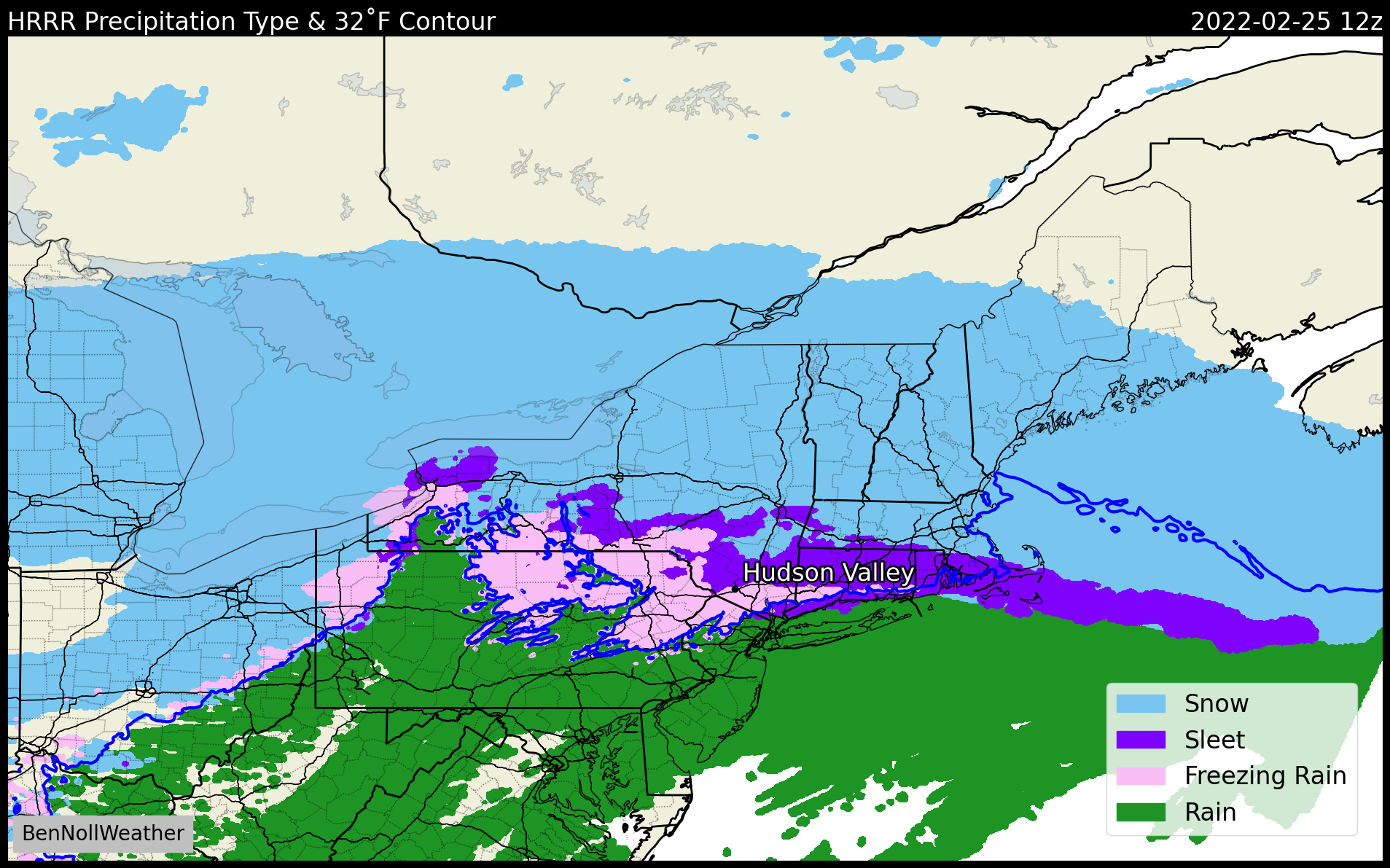
❄️ What? Snow, heavy at times, changing to sleet, which will also be heavy for a time. A small amount of freezing rain may also fall. Snow rates will reach up to 1 to 2 inches per hour between 3:00 - 9:00 am Friday.
🕰️ When? Snow starting between 12:00 - 3:00 am Friday, from west to east. A changeover to sleet and freezing rain is likely from south-to-north on Friday morning, reaching the I-84 corridor by 9:00 am. Steady, accumulating precipitation will end by around midday. A dry slot will reach the region by mid-afternoon.
📏 How much? 9-12 inches in northern Ulster and northern Dutchess, 6-9 inches near and north of I-84 (northern Orange, Sullivan, southern Ulster, and southern Dutchess), and 3-6 inches south of I-84 (southern Orange, Rockland, Putnam, and Westchester). The snow will be light and fluffy at first before a crusty covering of sleet and ice compresses it and makes it more difficult to shovel.
🏫 Impact? School closures expected. Non-essential travel is not recommended during the worst of the storm, approximately between 3:00 - 9:00 am Friday. An easing of precipitation rates will allow road crews to get on top of things by Friday afternoon, with an improvement in conditions by the PM commute. The temperature is now expected to rise into the mid 30s on Friday afternoon before falling into the single digits and teens on Friday night, leading to a refreeze. Be mindful of slippery conditions on Saturday morning.
Take care and enjoy your weekend! My weekly weather outlook will arrive on Sunday morning.
PS: a bit of light snow may fall across the region from late morning into the afternoon today (Thursday) - this is separate to the storm that will arrive overnight