Saturday snow update 🌨️
Update #488d
Hello again! I’ll keep this update short and sweet. Be safe out there today.
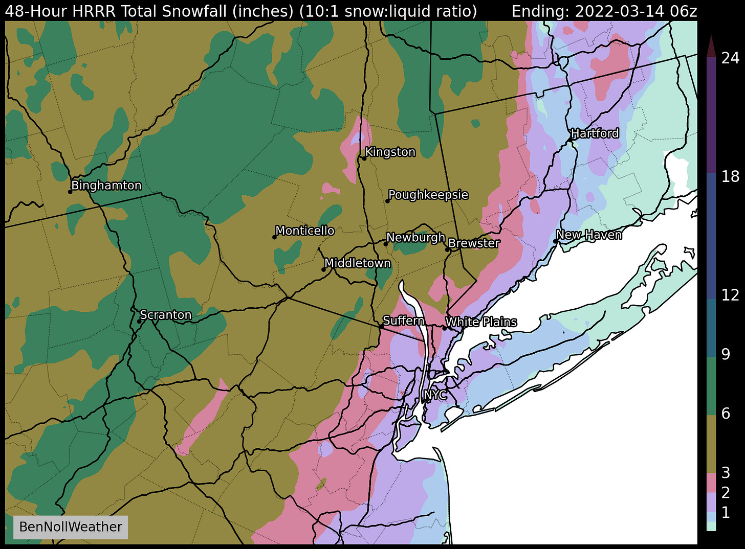
The snow today will get underway a little earlier (8:00 - 10:00 am) and accumulation will be a little higher (3-6 inches) compared to yesterday’s forecast. I wouldn’t be surprised to see some isolated 6-8 inch amounts.
I expect that road conditions will deteriorate quickly after the snow starts, becoming quite slippery by 10:00 am.
The worst of the storm will occur between 10:00 am - 2:00 pm — avoid traveling during this time! Snow rates will reach or exceed an inch per hour and temperatures will fall into the 20s.
Snow rates will ease after 2:00 pm, but the snow probably won’t stop entirely until 6:00 or 7:00 pm.
Conditions on main roads will gradually improve after 2:00 pm, although secondary roads will remain snow-covered for a while longer.
Gusty winds during the afternoon and evening will cause blowing and drifting with whiteout conditions possible at times.
Low temperatures tonight will be in the teens with gusty winds. Sunday will have highs near freezing before it warms up significantly on Monday.


Although we live outside of Albany, I look forward to you forecasts.thank you!!!