Hi everyone and happy Mother’s Day! 👋
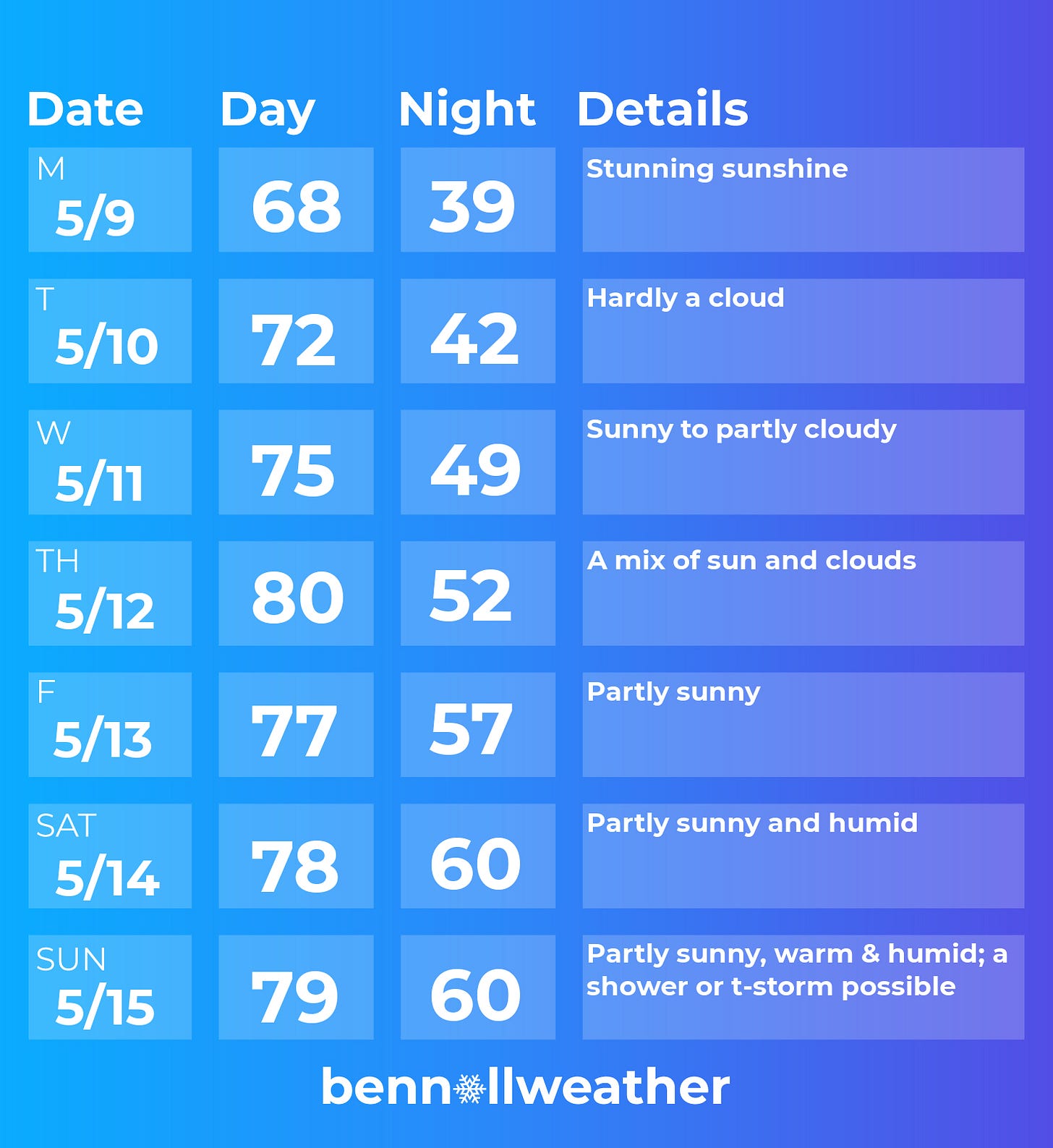
It’s been a bumpy road, weather-wise, over the last few weeks, but Mother Nature is about to turn over a new leaf. Although the dry spell will start today (Sunday), we’ll really start to hit our stride on Monday as sunshine becomes abundant.
The high pressure shield 🛡️ could show a few dents by next weekend as disturbed weather approaches from the south and west.
☝️ The Monday-Wednesday period speaks for itself. Plentiful sunshine (you’ll be hard-pressed to spot a cloud), low humidity, and comfortably cool nights.
🌡️ 80 degrees will be within reach for Thursday — nearly a month since the last 80 degree day.
This particular weather setup will favor northeasterly winds, meaning that northern parts of the Hudson Valley -toward Albany- will experience warmer temperatures than areas closer to NYC.
On Friday, the wind direction across the Hudson Valley will likely switch from northeasterly to southerly, giving moister, more humid air the chance to move in. Meanwhile, a disturbance will be swirling near the Southeast coast — more on that in a moment.
As we head into the weekend, morning low temperatures will be around 60 (!) degrees, a sign that humidity will be out in full force. That’s right, it’s time to locate your fans, because it might get a little uncomfortable 🥵
The forecast will be affected by the aforementioned disturbance, with clouds and the chance for scattered showers and storms growing through the weekend. This makes the high temperature forecast a bit challenging, with the amount of cloud cover and any rain modulating the warmth.
I wish I could say that the generally pleasant conditions will continue into the week of the 16th, but Mother Nature has different plans. A relatively cooler week is possible with some unsettled weather at the start.
The animation below shows the jet stream pattern, or storm track, over the next 10 days. Watch how core of the jet winds (reds, purples) are well to the north over Canada at first (this week), before pushing back into the Northeast at the end of the animation (next week).
If you’ve been enjoying the newsletters even though winter is over, please consider:
Sunshine down under, too 🌞
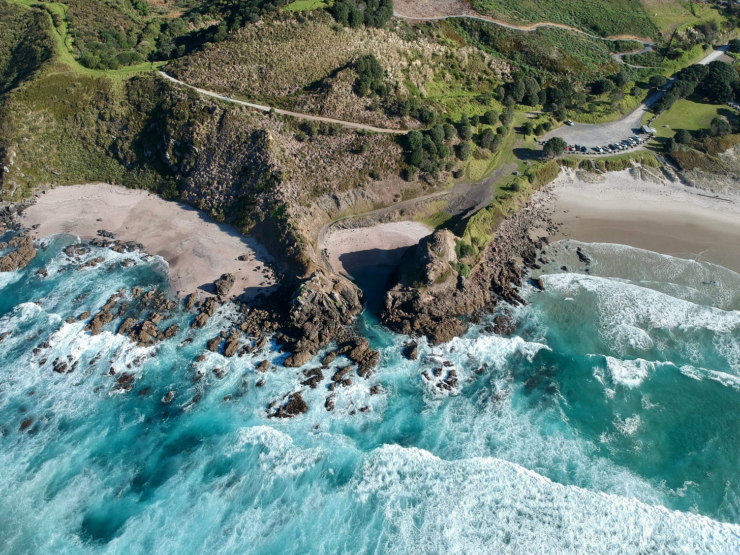
In the spirit of sunshine and warmth, here are a few photos taken this weekend of Auckland’s best beach — called Te Arai 🏖️
May is not known for it’s warmth in New Zealand, being the month before winter, although a climate phenomenon known as a marine heatwave has surrounded our shores since November.


Seas the order of 3 to 4˚F above average have insulated the country from outbreaks of cooler air from the Southern Ocean and Antarctica.
While it is pleasing to be able to step into a reasonably warm sea this time of the year, it’s yet another concerning reminder that Earth isn’t letting off the accelerator on its pace of warming.

For more New Zealand photography, you can follow me on Instagram @bennollofficial.
Don’t forget your sun glasses this week! 😎


Beautiful pictures! You are not only the best meteorologist, but also an awesome photographer. Hats off to you.