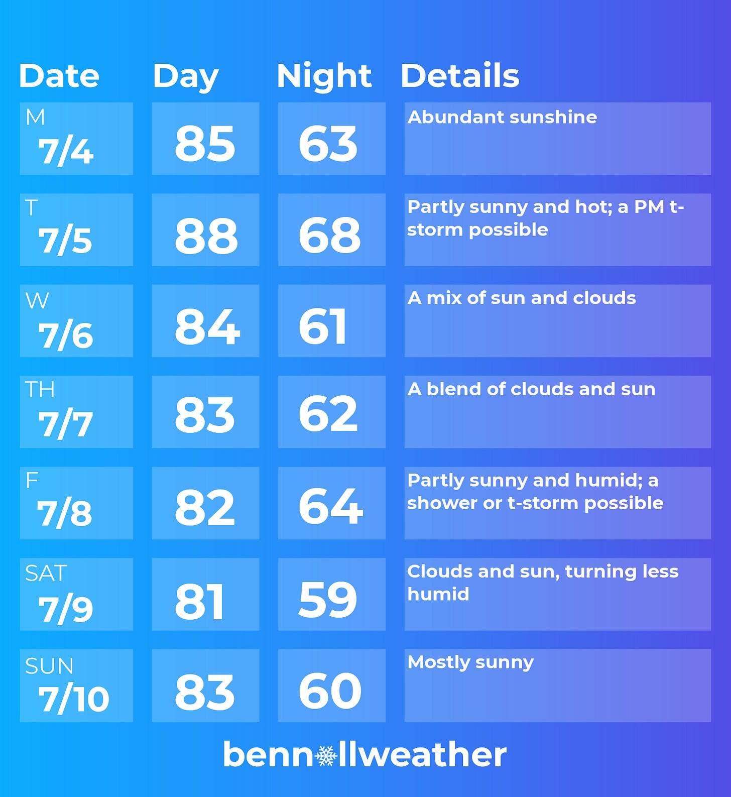
Mother Nature is cooking up some fantastic weather for the 4th of July. Hopefully that means you’ll be cooking up some burgers, hot dogs, corn on the cob, and whatever else suits your fancy on Monday 🌭
And check out the rest of the week: no 90s!
Tuesday looks to be the hottest day of the week with building humidity. A disturbance may approach the region from the west during the afternoon, leading to a chance for thunderstorms.
Wednesday looks to start humid, but it will gradually ease with a mix of sun and clouds. The weather on Thursday looks good.
The next chance for rain looks to be Friday as a disturbance approaches from the west. It will also turn more humid.
The humidity looks to ease on Saturday as an area of high pressure moves down from Canada. Chances are, Sunday will have pleasant conditions.
Looking ahead to the week of the 11th, hot temperatures are possible in the midweek time frame, but 90s continue to look like the exception and not the rule.
Thinking of heading to the Jersey Shore? The sea temperature map below shows that the extent of the coast is between 70-72˚F. A trip down to the Outer Banks gets you into the upper 70s 🌊
NZ - home of the lenticular cloud
Now here’s a cloud type that doesn’t typically grace the Hudson Valley’s skies - a lenticular. Sometimes mistaken for UFOs or taken as a sign of alien activity, this pancake-like stack of clouds form as strong, moist winds blow over a mountain barrier, creating a series of oscillating waves.
They are more common on New Zealand’s South Island, where this one was photographed a few weeks ago.
Have you ever seen one?
Make the most of the week ahead ✌️


