
Drought develops 🏜️
Update #510

This past week, the U.S. Drought Monitor classified a “moderate drought” across most of the mid-Hudson Valley, following two months of rainfall deficits and the 7th hottest July on record.
August has picked up where July left off, with Poughkeepsie reaching a stifling 99 degrees on Thursday, the region’s hottest temperature since July 2011 or in more than 11 years.

My curiosity got the best of me and I ended up ranking historical June and July aridity through a derived metric that combines air temperature, precipitation, cloud cover, and evaporation.
Turns out, June-July 2022 ranked as the 10th most arid compared to all June-July periods over the last six decades in the Hudson Valley. The graphic below is (hopefully) pretty self explanatory, but green blocks indicate wetter years and brown indicates dryness or drought.
The 1960s drought is well documented and researched, particularly as it pertains to low rainfall in the Catskills and impact on the New York City water supply system, which draws on the Delaware River. The Delaware provides approximately half of New York City’s water supply and another 1960s-style drought sequence would put some serious strain on the system given population growth.
Currently, NYC’s water storage is at 81% compared to a historical norm of 89%.

By now, you’re definitely wondering when things will get wetter and cooler. Good news, there will be *a little* relief this week…
A slow-moving front will generate some scattered rain and thunderstorm activity later Tuesday and again on Wednesday, but not enough to be a drought-breaker. After a very hot and humid start to the week, it will turn much more comfortable toward the end.
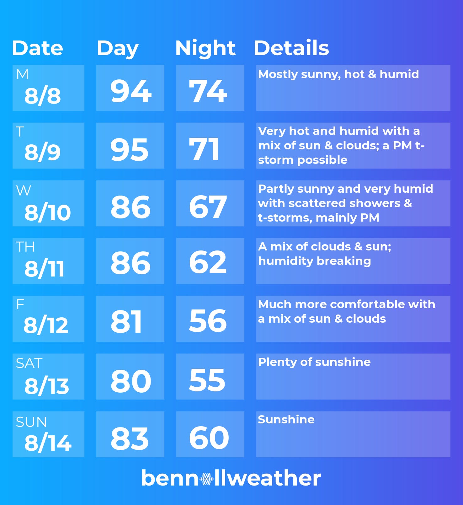
The humidity will tail off on Thursday before a more appreciable drop off on Friday. It’s definitely looking like an opportunity to give the AC a break and open up the windows!
Right now, the weekend weather is looking pretty fantastic and the nice stuff could linger into the week of the 15th.
The map below shows where 10-day temperatures are forecast to exceed 90 degrees (white outline), 100 degrees (yellow outline), and 105 degrees (black outline). The Hudson Valley falls into the 90+ degree category, thanks to the hot start to the week. The Southern Plains, Oklahoma and Texas specifically, remains the epicenter of extreme heat.

Further afield, we’ll need to watch the tropics, which look to heat up as the climatological peak of hurricane season approaches over the next month. There’s a sign for more activity than normal near the U.S. East Coast.
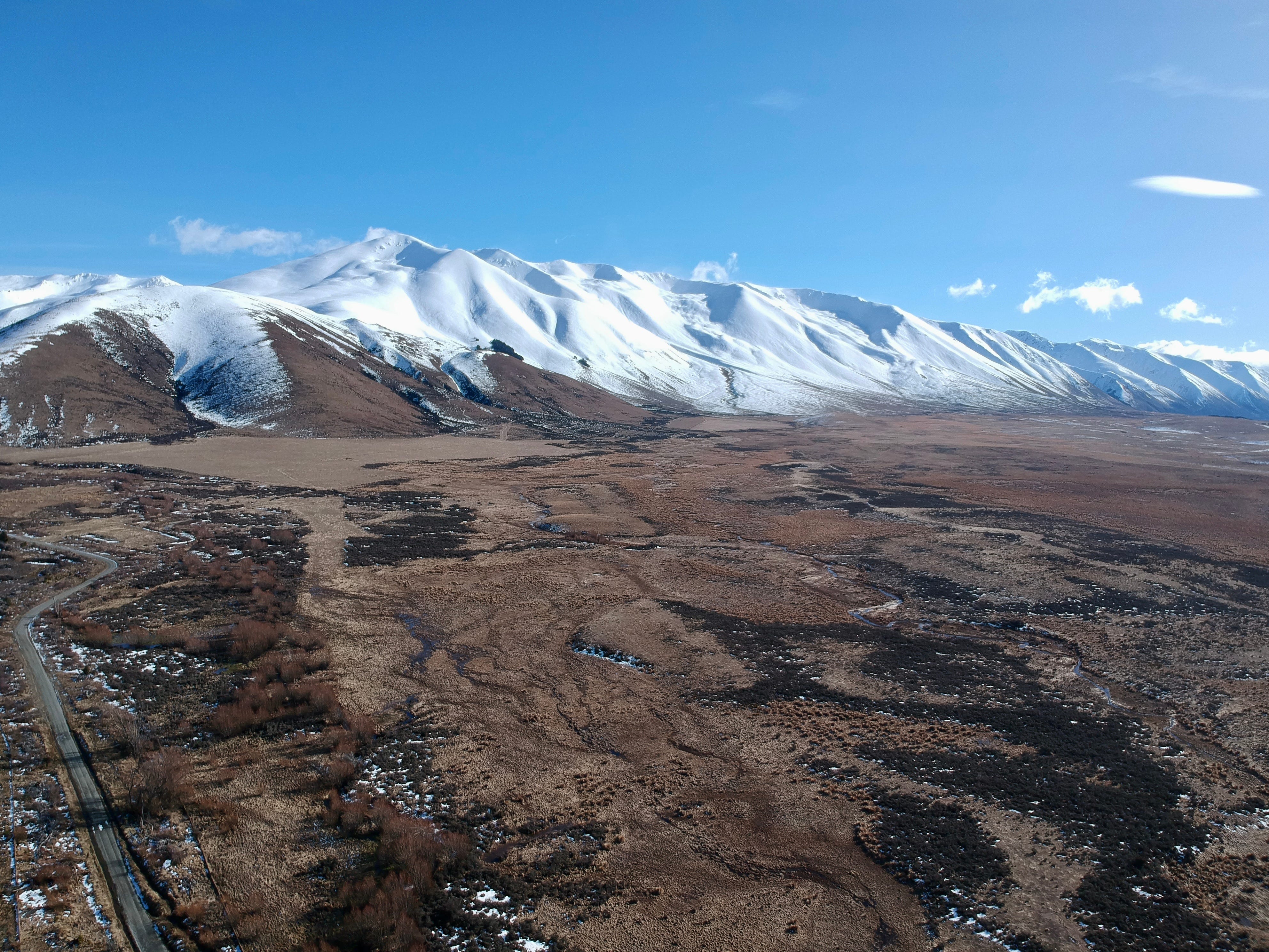
South Island showing off
Last weekend, I shared some spectacularly snowy photos from New Zealand’s South Island. They’re well worth a look if you missed them and there’s a few more on my Instagram. Frankly, it’s tough to take a bad picture in this place!
Exhibit A - amazing rainbow over snow-covered mountain and lake 🌈
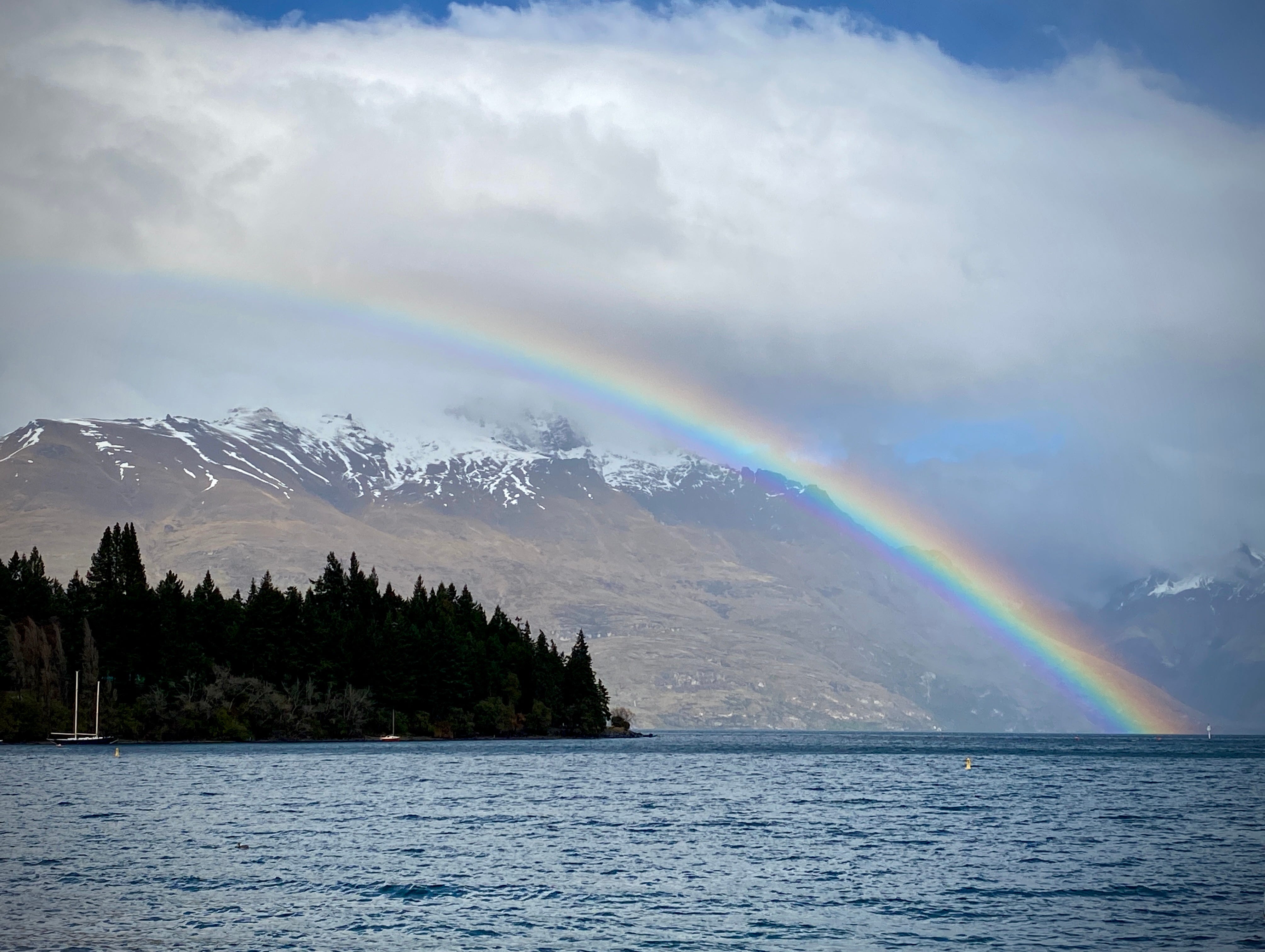
Exhibit B - brilliant window seat views ✈️

Exhibit C - crazy amount of snow in those hills (~9 feet) 🏔️
On that note, it’s hard to believe that meteorological autumn will arrive in the Hudson Valley in just over three weeks…
✌️