The new season, meteorologically speaking, will arrive on Thursday, September 1st.
After a hot, muggy start to the week, it seems Mother Nature has set a reminder on her phone “make the Hudson Valley less humid” 😃
Many of us are probably wondering what to expect in the months to come: when will it rain? Will it be warmer or cooler? How about winter?
I’ll be tackling the latter in my Hudson Valley 2022-23 winter outlook, to be released during the third week of October, along with other announcements about the winter season to come (like a new merch line 👀).
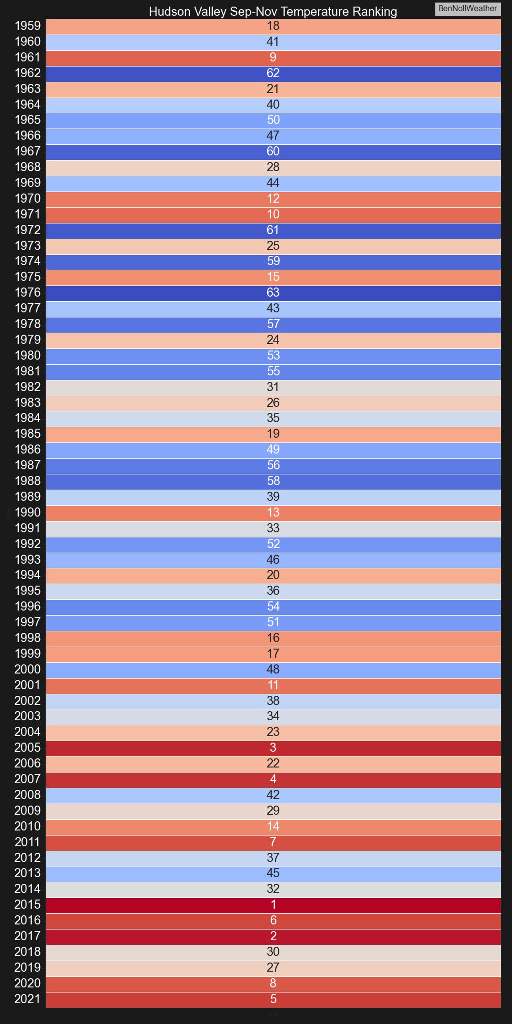
But first, fall. It’s been getting warmer. In the chart below, I rank Hudson Valley fall temperatures from 1959 to 2021. Of the top-8 warmest falls, 5 have occurred since 2015.
The average fall temperature, including daytime highs and overnight lows, over the last 5 years is 54.4˚F. For comparison, the fall average from 1996-2000 was 52.1˚F. The maximum 5-year average is 54.6˚F for the 5 falls ending in 2019 and the minimum is 51.1˚F for the 5 falls ending in 1980.
So yup, it’s getting warmer, and it’s impacting things from how hot your classroom is in September, to how early you have to heat your house, to when the first winter weather event strikes.
As for the start of meteorological fall 2022? It’s more of the same: warm and dry.
Moderate to severe drought continues to encompass the Hudson Valley. A line of showers and thunderstorms along a cold front on Tuesday evening will help a bit, but it won’t be a drought breaker. We’ll be right back to the big dry thereafter.
The humidity will ease on Wednesday behind the front with some very pleasant conditions due in late in the week thanks to an air mass dropping down from southern Nunavut, Canada.
Overnight low temperatures could dip to around 50 by Thursday and Friday 😍 — enjoy it, because…
Another warming trend is expected to start next weekend, potentially peaking as a heatwave during the week of September 5th 😬
It’s looking increasingly likely that any potential for drought relief in September will be mainly dictated by the track of tropical storms and hurricanes. There are several areas of disturbed weather in the tropical Atlantic Ocean, one of which is forecast to track north of the Lesser Antilles later this week and bears watching.
🍂 The drought may mean that fall foliage is colorful for a shorter period of time than normal as the dry conditions can cause faster leaf decay. However, the stress due to the dryness may have caused the leaves to retain more sugar, eventually causing them to turn bright red for a short time.
Meteorological spring
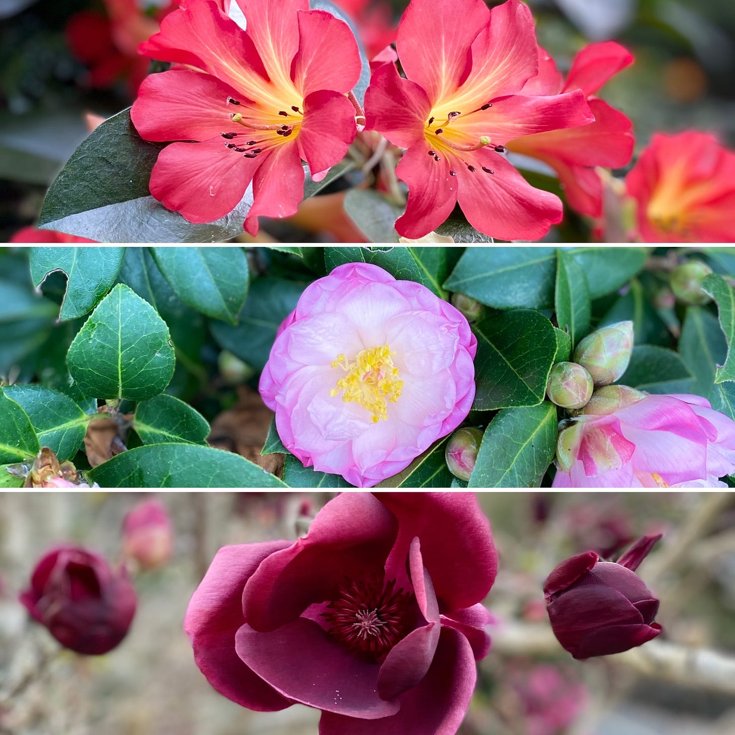
Thursday marks the start of meteorological spring in the Southern Hemisphere! A warm winter down under meant that flowers bloomed early in Auckland.
Spring is in full swing for the avifauna (birdlife) too! 🐦
Hello from the Kererū! Chances are you haven’t seen this type of bird before - New Zealand’s pigeon and bird of the year in 2018. It’s large and loud when in-flight, has iridescent feathers, lives 15-25 years and enjoys getting drunk on fermented berries!
Here’s another one that you won’t find in the Hudson Valley: the spur-winged plover. These guys have a striking appearance with a mask-like yellow face and beak, originating in Australia but finding their way across to New Zealand over the last century.
OK one more: the Australian magpie. An impressive, if not intimidating, creature and one of the most accomplished songbirds. Don’t get too close! During nesting season, these guys will aggressively swoop down in an attempt to scare you away…
Fly high this week and best wishes to those starting the new school year!


Thank you Ben! I enjoyed your beautiful Spring photos. Stay safe.
You too!