🌧️ Rain says hi & bye 🌤️
Update #514
Will it break the drought? Nope.
Will it help? Yup.
We’ll say sayonara to the sun for a few days with a slow-moving frontal boundary draped across the region.
You don’t need a meteorologist to tell you that we need the rain. Meteorological summer (June-August) was the 3rd driest on record at Poughkeepsie, which has a climate record that extends back to 1931. Only 1993 and 1966 were drier.
Just 4.8 inches of rain fell, nearly 7 inches less than the June-August normal of 11.7 inches. The region remains in moderate-to-severe drought.

Further exacerbating the dryness was the heat. The average temperature, considering daytime highs and nighttime lows, was 73.5˚F, making it the 5th warmest summer on record. In the last 10 years, there’s only been one cooler than average summer.
In the chart above, the relative coolness from around 1950-1990 is probably representative of the typical Hudson Valley climate prior to the influence of strong El Niños in 1997-98 and 2015-16 which resulted in upward global temperature step-changes, which has been further accelerated by climate change. The heat in the 1930s and 1940s is linked at some level to the dust bowl and very different land use practices in the Plains.
The week ahead
🌧️ After the early week rain, sunny weather will return later in the week ☀️
For the first time in a long time, the right mixture of ingredients are coming together in the atmospheric mixing bowl for rain on Monday and Tuesday 🧑🍳
The highest chance for rain looks to be from Monday afternoon through Tuesday morning.
In terms of forecast rain amounts, I’d call less than half an inch “disappointing”, an inch or two “in line with expectations”, and more than two and a half inches “exceeding expectations”.
So yeah, useful! But we’ll need more.
This forecast water vapor animation tells the story.

A drier, less humid air mass will push in from the north on Wednesday. It should set us up for a pleasant run of weather lasting into the weekend.
Another surge of humid air may build from Sunday into the week of September 12th, which appears to be the next chance for some rain. Warmer than average temperatures continue to be favored overall.
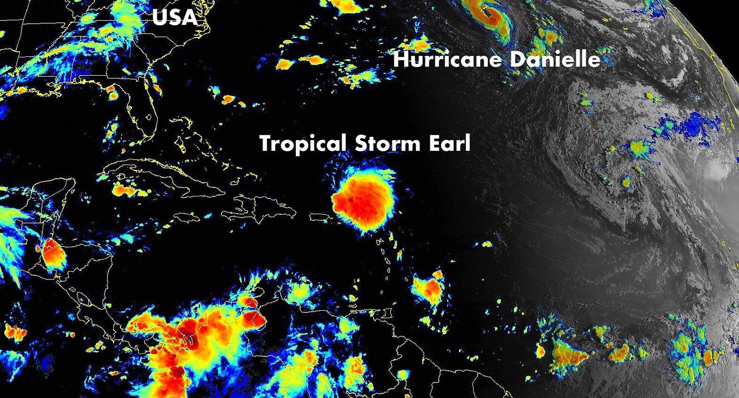
The long range weather pattern looks to be complicated by the track of Tropical Storm Earl, which is passing north of Puerto Rico as of Sunday morning. The storm will most likely pass well offshore of the East Coast, but its track could get a bit “funny” next week depending on its pace of strengthening and forward speed.
At any rate, it’s not something to be worried about, but something to keep an eye on.
By clicking on the tweet below, you can follow my hurricane tracking bot for twice-daily forecast track updates.
See ya soon, winter!
Meteorological winter came to a close in New Zealand this past week as it inches ever closer to the Hudson Valley. Too soon, you say?
Soon enough, my snow day forecasting efforts will ramp up. Remember that October 2011 Halloween snow storm? That was also during a La Niña year. Extremely unusual, but it can happen — and we have La Niña again this year!
Anyway, here’s a collage of a few of my favorite photos from the snowy season down under ❄️
For the weather nerds in the room, I’ve started having a look at some of the climatic indicators for winter. Click on the tweet below for some additional context.
In the meantime, think rainy thoughts ☺️


Thanks Ben! Have a great week.