Summer's last licks 🍦
Update #516
👋 Hello there! Are you ready for things to turn cooler? We had a fall teaser on Friday when it dipped into the low 40s and there’s more to come.
But first, we’ll find ourselves in the 80s again this week, before summer releases its grip — both literally and figuratively.
Scripted masterfully by Mother Nature, a Canadian cold front will advance through the region on Thursday, which happens to be the first day of astronomical fall 🍂
Living in New Zealand, it’s those crisp, fall mornings (and of course snow!) that I miss the most about New York’s climate.
If you want to skip another season ahead, I just published a piece on winter’s weather whispers, providing some very early insights on the snowy season. My full Hudson Valley winter outlook will be released during the 3rd week of October.
As for the week ahead, there will be a little bit of everything: warmth, coolness, the autumnal equinox, wind, some rain here and there, and a decent amount of sun.
Like today (Sunday), Monday will be warm. An afternoon front will cause scattered shower and thunderstorm activity, which will turn things modestly cooler for Tuesday.
Tuesday will come with a chance for scattered afternoon showers.
Things will warm up again on Wednesday, ahead of the first real Canadian cold front of the season. Come Thursday morning, the front will be blowing across the Hudson Valley, ushering notably cooler air and breezy conditions. Some rain may accompany the front early in the day before things clear up.
In the animation below, the blue colors (🔵) indicate the cool air dropping down from Canada ~ get ready to refresh your wardrobe for fall! 🧣
On Friday, high temperatures may fail to reach 65 degrees for the first time since May 19th. On Friday night, temperatures could dip into the 30s! 🥶
It will warm up over the weekend, with very comfortable highs in the upper 60s to lower 70s.
Looking ahead to the week of the 26th, a bit of disturbed weather at the start might be followed by another push of cooler air and a late-week warmup.
Tracking Fiona
No, not that Fiona! This one:
Tropical Storm Fiona will bring flooding rainfall to Puerto Rico today and tonight. After that, it will track into the open waters of the Atlantic and strengthen into a hurricane.
Twice a day, my hurricane tracking bot roars to life, parsing 51 different tracks that Fiona could take. This type of graphic is colloquially know as a spaghetti plot 🍝
When the “spaghetti lines” or tracks overlap, forecast confidence is higher.
🌀 This looks like one for Bermuda, Nova Scotia, and Newfoundland to watch later this week, as Thursday’s front —like a broom— will very likely sweep the storm well to the east of our neck of the woods.
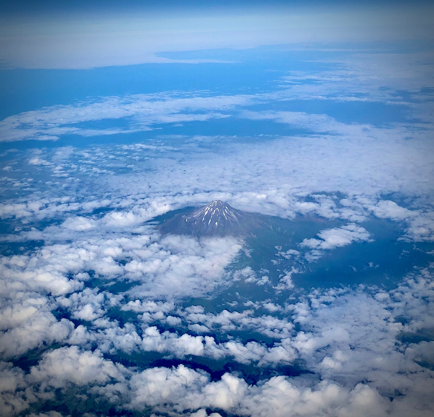
September snow at one of New Zealand’s most iconic mountains 🗻
Mt Taranaki often draws comparisons to Mt Fuji in Japan and was even filmed as Mt Fuji in the movie The Last Samurai (2003).
One my work colleagues, Stu, snapped this shot on Friday as he was finishing up a photo shoot — he had been there for a few days, and naturally, the mountain didn’t emerge from the clouds until he was packing up 🙃
Here’s another photo I took a few years back of the majestic mount. You can see how much less snow there is in January (below) compared to September (above)!
Hope fall starts fantastically for you ✌️


Thanks Ben. Stay well.