
Fantastic fall forecast 👌
Update #519

🍂 Whether the week ahead has you foliage frolicking or relaxing with your favorite warm drink, you’ll flourish with a forecast like this.
Aside from a front on Thursday, there’s little to complain about. Sure, it’ll be a bit chilly at times, but some may find it to be a refreshing change of pace from recent warm Octobers.
Speaking of chilly:

☀️ Sunday-Wednesday don’t need much explaining: cool mornings, pleasant afternoons. A bit of scattered cloud on Monday, abundant sunshine Tuesday, then increasing clouds on Wednesday.

A cold front will approach the region on Thursday, with rain chances increasing as the day carries on. The rain could turn heavy for a time later in the day or at night.
The wet weather will likely give way to sunshine on Friday, although there’s a smidge of uncertainty as to how quickly the front will move away to the east. A slower front means a slower return to sun on Friday.
Saturday looks good. Sunday will probably be alright too, although it’s a little less certain with another Arctic cold front looming off to the west…
This will set the stage for a chilly week of October 17th 🐻❄️

Twice a week, a model provides a glimpse at weather patterns 46 days into the future. For early-to-mid November, it shows a similarly chilly weather pattern to what is being shown for the week of October 17th. Check it out…

Come one, come all, a winter outlook live stream! ❄️
Next Saturday, October 15th at 6pm, I’ll be hosting a Hudson Valley winter outlook live stream on Facebook.
🎟️ Tickets are $5 and you’ll get to enjoy a 30 minute presentation from me followed by an opportunity to ask questions.
If you can’t make it, don’t worry — my winter outlook will be released right here on Saturday, October 22nd. But if you can’t wait, the live stream is definitely for you!
Meteorological marvels
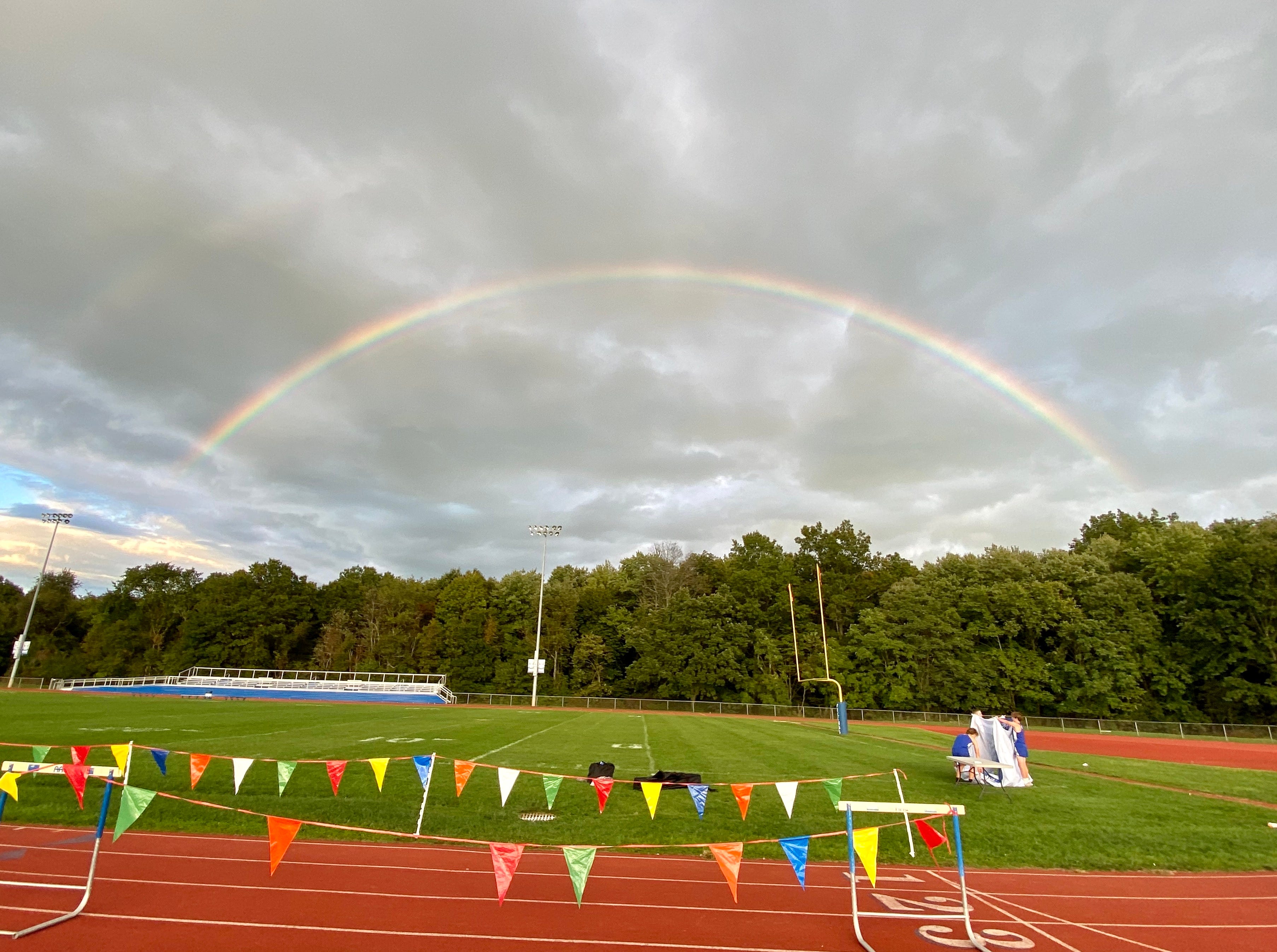
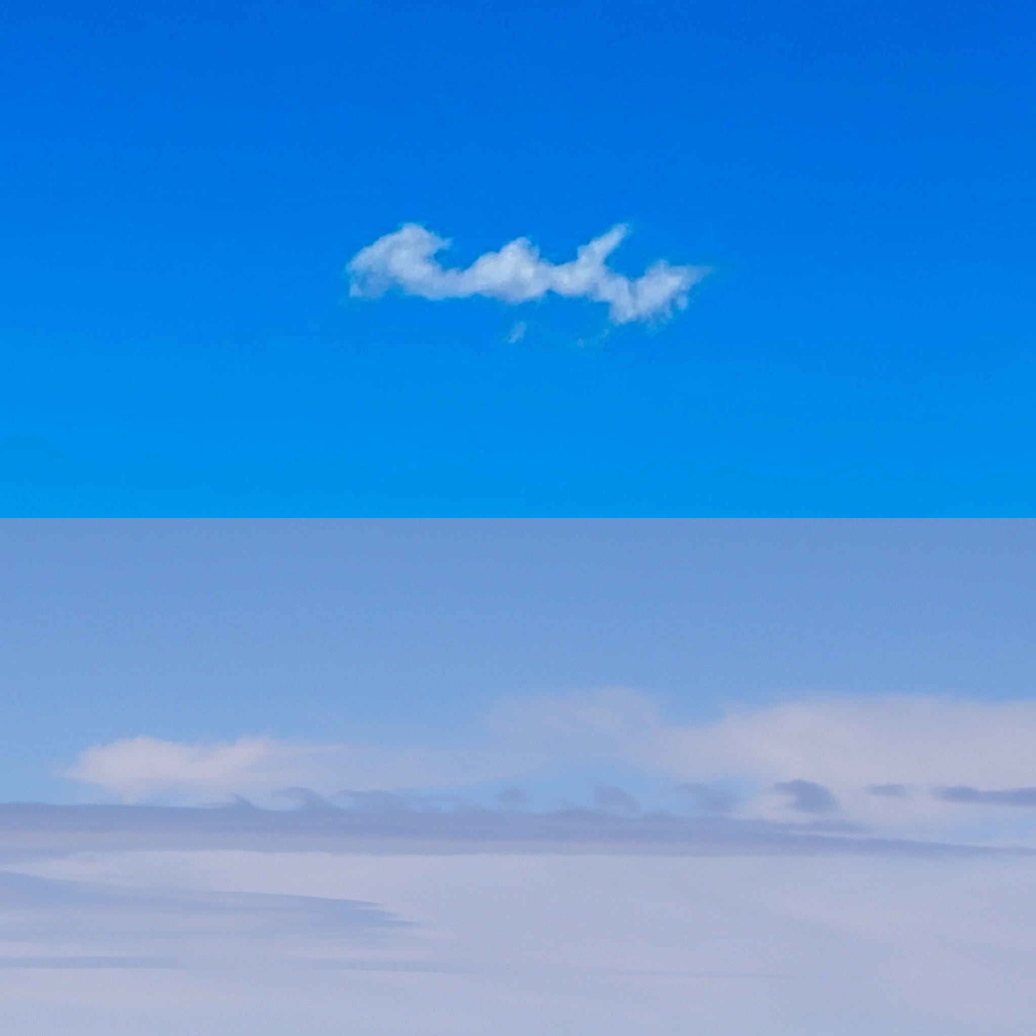
Sometimes, life is all about being in the right place at the right time! Carolyn Baker sent me these photos from Valley Central’s senior night cross country meet vs Warwick.
First, a double rainbow 🌈🌈
Next, and the much rarer of the two, a trio of Kelvin-Helmholtz wave clouds! 🌊

Like ocean waves, but in the sea that is the sky…
They form when the wind in the upper part of the atmosphere is blowing faster than the lower part (called wind shear). This allows the cloud to be “scooped” into a wave-like rolling shape.
I’ve never seen them before in the Hudson Valley but I have seen weakly-formed versions of them in New Zealand.
Enjoy the fabulous fall feels this week ✌️
Thank you Ben. I am really enjoying this beautiful Fall weather👍
Stay well.