You might just call me GrinchNollWeather after reading this one!
A late week storm that once looked promising for snow has shifted west and the odds for a white Christmas in the Hudson Valley are melting before our eyes.
Nevertheless, it will be a rather wild week of weather, so read on!
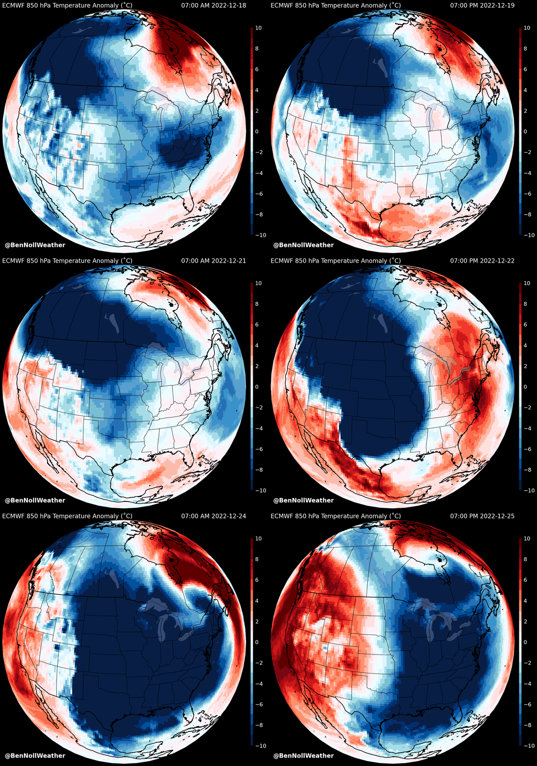
A (mostly) rain-bearing storm from Thursday into Friday will usher the region’s coldest Christmas since at least 2013 when the high was 25˚F, but potentially the coldest since 1983 when the high was a bone-chilling 11˚F, a record.
The average Christmas Day high is 38˚F, but it’ll be in the low to mid 20s this year.
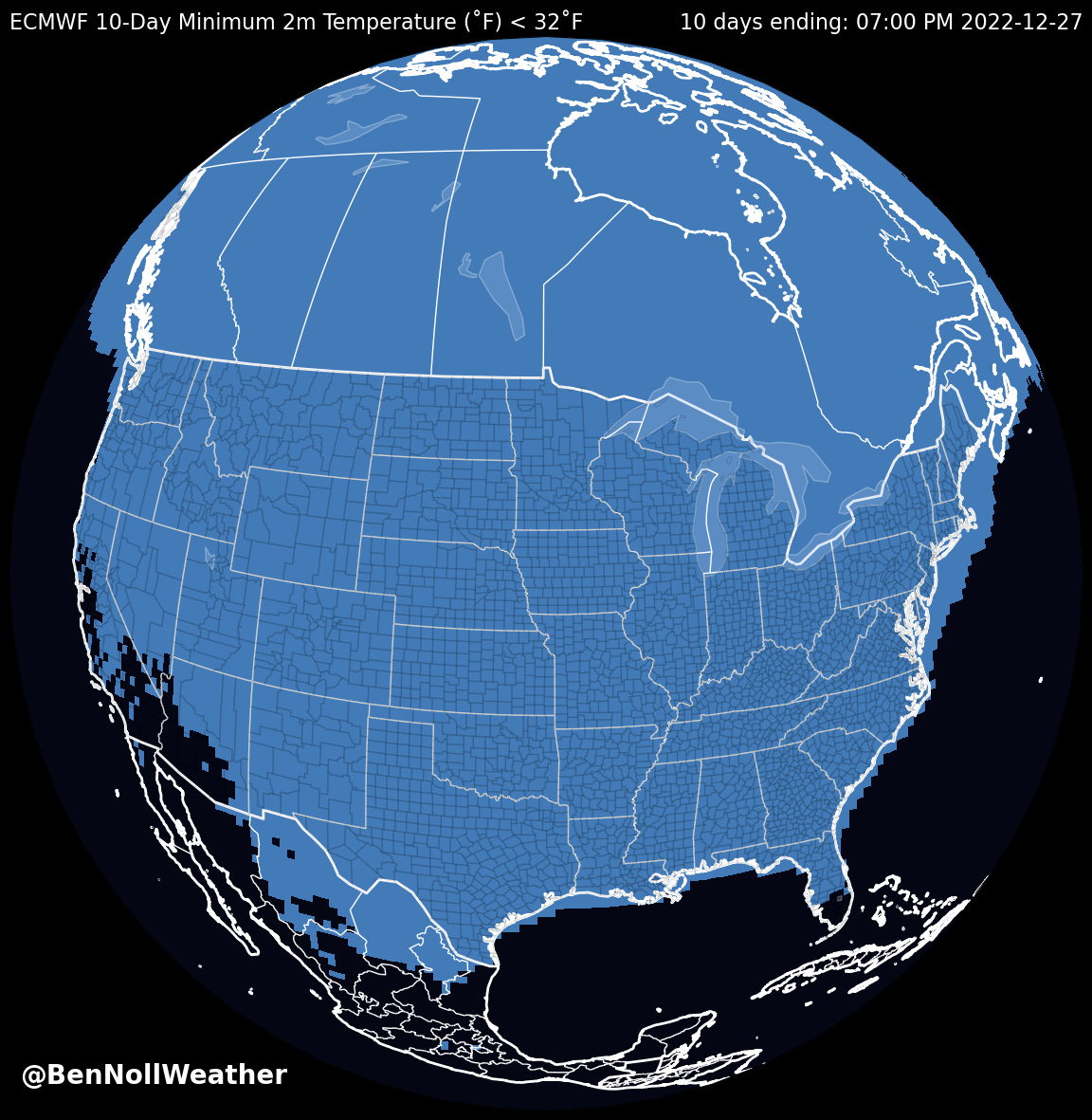
🌴 If you’re lucky enough to be traveling to South Florida, Arizona, or Southern California, you’ll escape the wrath of the polar plunge — these are the only areas not expected to be colder than 32˚F at some point in the next 10 days, as shown on the map below.
Even though the odds for a snow storm in the Hudson Valley have decreased, there remains some chance that things could trend back in the opposite direction.
I’ve got my eyes on Thursday as having some potential for a bit of wet snow or ice prior to a quick changeover to rain.
Sullivan County in particular still has a fighting chance for a Thursday snow day. Precipitation start times are favoring the mid morning to early afternoon.
⚠️ Later on Friday, an Arctic cold front will race across the region. The temperature could drop 30 degrees in about six hours — from the 50s to the 20s. Winds will be howling, with gusts of 40-50 mph possible on Friday afternoon and/or evening. These winds could be strong enough to blow down Christmas decorations, tree branches, cause sporadic power outages, and delay flights. A snow shower or squall could accompany the front’s passage. Elsewhere, blizzard-like conditions could occur over parts of the Midwest (Ohio, Indiana, Illinois, and Michigan).
On Christmas Eve, regular wind gusts in the 20-30 mph range will cause single digit wind chill values 🧊
🎄 Christmas Day looks less windy, but still very cold. It’s a far cry from Christmas 2020 which had a high of 65 (!) as well as the daily average high of 38.
The outlook for the week of the 26th favors settled conditions, although the prospect for a clipper system (fast moving snow-maker) will be monitored for around the 27th.
Trust that you’ll hear from me again if Thursday-Friday takes a turn back down a wintry road 🛣️ ❄️
If not, I’ll catch ya next Sunday, aka Christmas! 🎄
👋 2022
As the sun sets on 2022, I reflect on how engaged a community the Hudson Valley has become when it comes to the weather. Although my predictions have been going since 2004, the biggest acceleration in their popularity has occurred in the last five years. Ten years ago, I could have never predicted this!
During storm events, I receive dozens of messages, ranging from “I just learned about you, wish I had sooner” to “can you join my Teams meeting to brief us on the weather” (🤣) and “where are you located?” (yes, I know it’s fairly shocking that I do this from New Zealand!).
I’m stoked to be that “glue”, bringing our community together in a uniquely fun and informative way — especially when those snow day and delay predictions become reality 🌠
On that note, I was thrilled to be featured in this week’s edition of the Wallkill Valley Times, my hometown paper when I was growing up in Montgomery. Click this link to read the story.
I look forward to another year of predictive prowess when the sun rises on 2023 — and beyond 😁 ~ thanks for your interest and support this year and all years! 🙏
Happy holidays to you all. Enjoy the moment ✌️


All I can say is WOW! Thank you Ben and stay well!
You are always spot on. Thank you for all your time in making these predictions all the way from New Zealand!!