❄️ Finally, winter arrives! (kind of)
Update #533
It may not be the winter we envisioned.
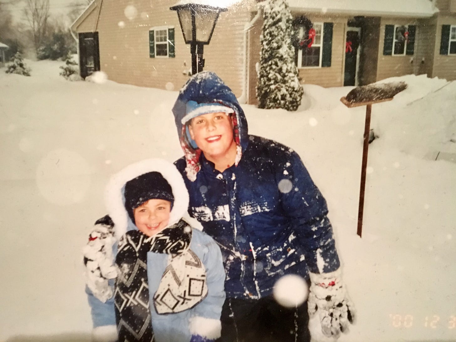
It certainly hasn’t behaved like a “winter of old”, be it the 1960s or 1970s or late 1990s or early 2000s — it’s been far from the 1995-96 or 2000-01 winters that steered me on a path to becoming a meteorologist (see below! 📸).
But it’s what we’ve got in 2023, so let’s make the most of it.
This week we have two, yes two (!), snow threats!
The first one starts in a couple of hours, from Sunday evening through Monday.
Event 1: Sunday night - Monday
What? Wet snow, changing to rain, changing back to wet snow
When? Snow starting between 4:00-7:00 pm Sunday, becoming rain overnight, then changing back to snow from 7:00-10:00 am Monday and continuing through mid-afternoon
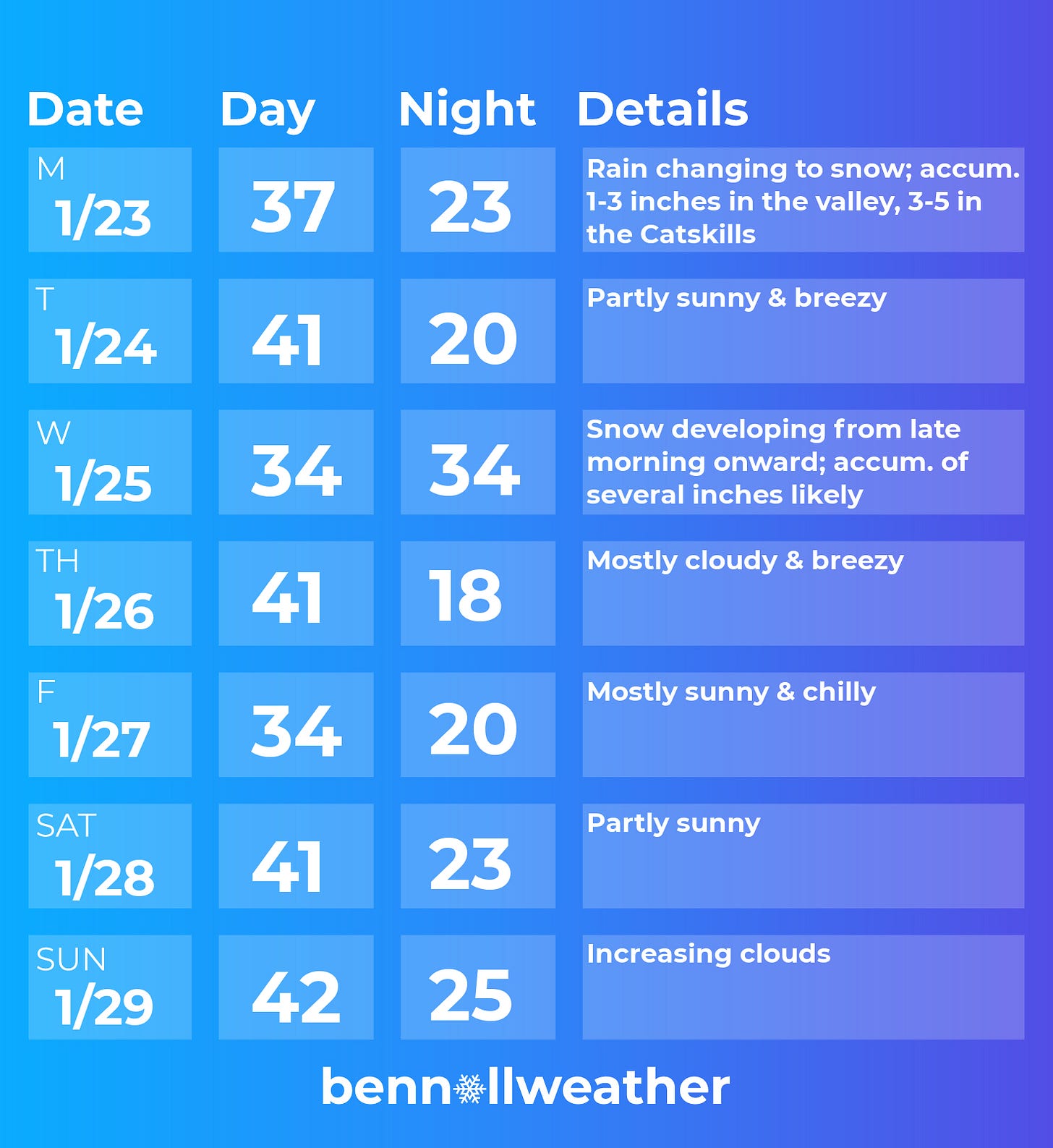
How much? 1-3 inches of very wet snow across the valley and 3-5 inches in the Catskills
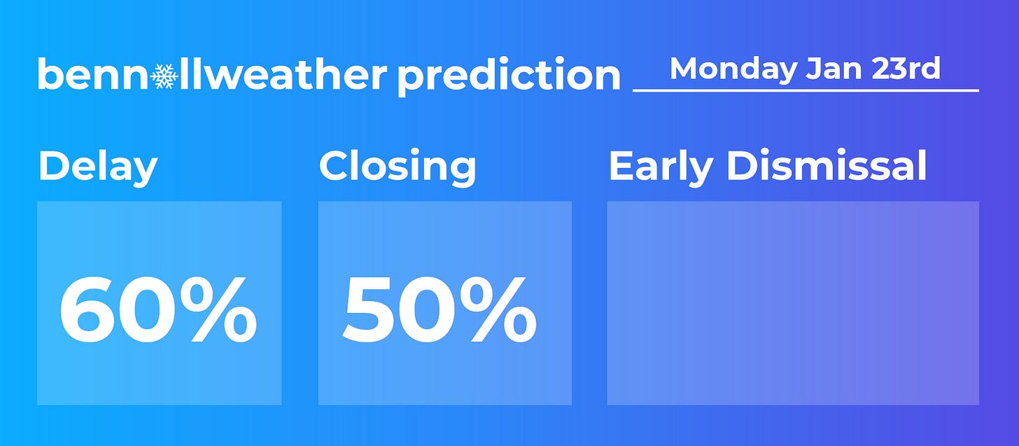
Impact? Across the Catskills, where wintry precipitation will be most persistent, school delays and closings are likely. For the rest of the region, Monday morning is the primary window of concern as rain will probably change to snow, from west to east. The snow changeover and how much accumulates remains a source of uncertainty in the forecast, but recent trends have been toward more snow. Although temperatures will be above freezing, a period of moderate-to-heavy snow could cause slushy conditions to develop and reduce visibility, leading to treacherous travel during the commute. Should an aggressive changeover to snow occur, school closings will be possible. Precipitation is expected to end on Monday afternoon.
One option is for schools to initially call a delay and then reassess the decision a few hours later to determine if a closing is needed.
Needless to say, I recommend keeping up with the latest forecast information.
I’ll have updates on Twitter and post school by school predictions around 6:00 pm Sunday. Stop by for the updated forecast and fun!
After Monday’s excitement, we’ll get a break on Tuesday.
But it won’t last long…
Event 2: Wednesday-Wednesday night
What? Snow, possibly heavy, changing to rain at night
When? Most likely starting in the late morning
How much? A plowable accumulation of several inches before the changeover to rain
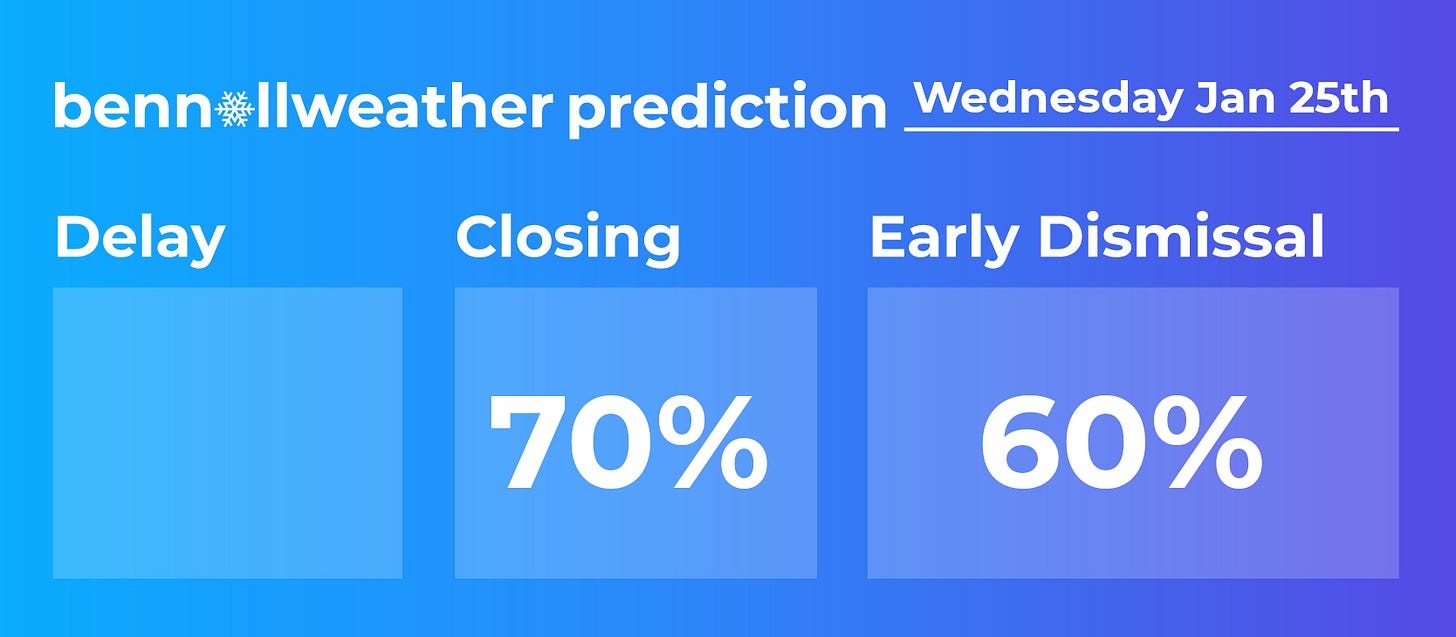
Impact? School closings and early dismissals are likely; afternoon commute road conditions look snow-covered and slippery right across the region.
I’ll send an update on Wednesday once we get past Monday.
Wednesday’s snow will melt pretty quickly. If it’s not all melted by the rain and warming temperatures on Wednesday night, it will be on Thursday when temperatures rise into the 40s.
🌬️ With a gusty breeze and sodden grounds, the risk exists for downed trees on Thursday.
After a chilly morning in the teens, Friday looks like it could have the most sunshine of any day this week ☀️
A modest warming trend is expected next weekend.
The week of January 30th could start mild but turn colder. Precipitation looks a bit less than normal. I’ll be sending my February outlook to premium subscribers next weekend — stay tuned!
⚾ Baseball… in January?!
Minor league players from the U.S. come to play winter league ball in New Zealand and Australia, in the Australian Baseball League. On Saturday night, Kate and I went to check out Auckland’s team, called the Tuatara, play the Brisbane Bandits.
Amid the warm summer sun, the culture is very loose with no more than a few hundred folks in attendance.
It’s also by far the quietest ball game I've ever attended — it's like a library! A little league game in the U.S. would be louder. Sometimes, you even hear people “shushing” those who are making noise.
Because baseball is just gaining interest in this part of the world, the games are only 7 innings long. 9 inning games are thought to be too long to keep the attention of the average person.
Smash it out of the park this week! 🤙


