Wednesday: all you need to know about the snow
Update #533b
Hello again! Hope you’re not tried of hearing from me 😅
We’ve got another storm on the way and it looks to be the first one of the season that will bring accumulating snow to the whole region at the same time. We just had to wait until the last week of January 🤦♂️
Before I get into it, here’s an interesting side story: New York City has yet to record measurable snow this season. If it doesn’t happen on Wednesday, the record for the latest measurable snowfall in the city will be broken — the record is January 29th.
As for us, well, it’s more clear cut, being farther north and having sufficiently cold air around.
First, some headlines:
A Winter Storm Watch has been issued for Sullivan and western Ulster from Wednesday morning through late Wednesday night
A Winter Weather Advisory has been issued for Orange from Wednesday morning through Wednesday evening
I expect that advisories will be expanded to include the rest of the region over the next 12 hours.
Here’s my take
What? Snow, changing to a wintry mix, then rain
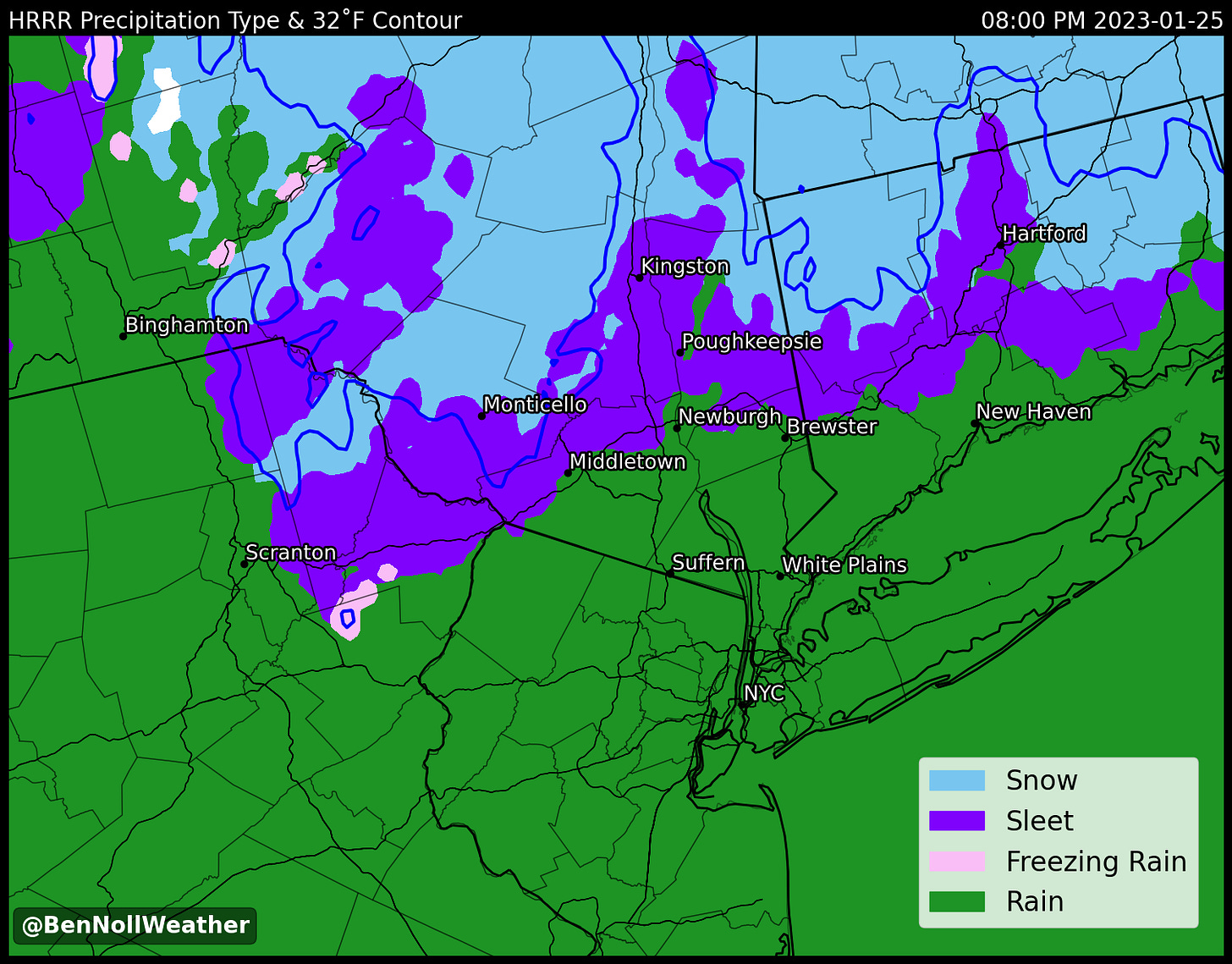
When? Starting from 9:00 am - noon from west to east. The snow will be relatively light at first before turning steadier from the afternoon through the evening. It will transition to a wintry mix during the evening before quickly changing to rain. The first radar image below shows the corridor of snow that is expected to develop in the mid-to-late morning hours. The second image shows the transition to a wintry mix between 6:00 - 8:00 pm.
How much? A range of 2-5 inches should cover most of the region. The highest amounts will be found north of I-84 and across the Catskills (5+ inches possible above 1500 feet elevation), with lower amounts toward the southern end of the valley across Rockland and Westchester. Keep scrolling to see the snow map.
Impact? Because the day will start with temperatures in the mid 20s, surfaces will be cold enough for snow to stick. Up to an inch or so is possible by noon, which favors school closings rather than early dismissals. The worst of the storm is expected from the early afternoon through the early evening, when snow rates could reach to around 1/2 inch per hour. With temperatures hovering in the low 30s, side roads and sidewalks will probably be snow-covered while main roads are slushy and sloppy.
For Sullivan and Ulster County, the weight of the snow may cause downed trees and power lines, so be prepared for power outages, particularly as winds turn a bit gusty on Wednesday evening — charge your devices just in case! 🔋
With warming temperatures on Wednesday night, road conditions should be improved by Thursday, but there will be lingering snow and ice. This could result in delays, mainly for Sullivan and Ulster County.
Water-logged grounds and gusty winds on Thursday could cause trees to topple. I don’t think it will be widespread, but something to keep in the back of your mind.

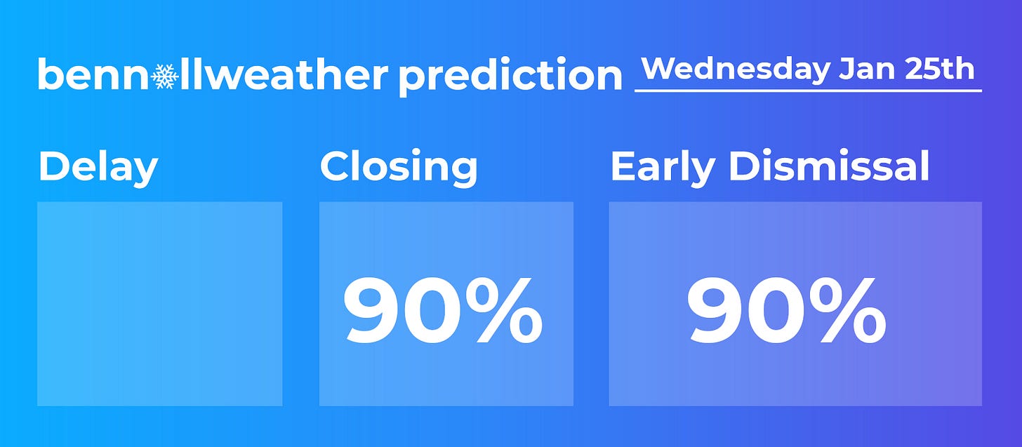
In terms of school, closings are favored regionwide. For schools that don’t close, early dismissals are all but guaranteed.

I’ll offer school-by-school predictions on Twitter around 6:00 pm — stop by for the updated forecast and fun!
If you’ve enjoyed the coverage this week, please consider upgrading your subscription to premium by clicking the button below. This supports the (hours and hours) of time spent finessing Python scripts that create custom images such as the ones in this post, fine-tuning the forecast, and keeping you as up-to-date as I possibly can from 8,500 miles away!
There’s also merch. Here’s the perfect shirt to wear…
Savor the snow, make a snowman ✌️


Just subscribed. Thanks for all you do, Ben!