
February outlook - more of the same!
Update #534

To subscribers old and new, a hearty welcome to my latest weekly newsletter!
It’s hard to believe that the first two months of meteorological winter (December and January) are nearly behind us. Are you ready for spring at this point or do you still want at least one big storm?
Clearly, it hasn’t been the most wintry of winters, with mild temperatures and underperforming snow events. To track how this winter compares to historical winters, I’ve created a real-time snowfall anomaly map that updates once a day.
The orange and red colors that stretch across New York and specifically the Hudson Valley indicate that snowfall has been at most 50% of normal season-to-date, though the Catskills have been closer to normal.

Climatologically speaking, the region experiences its deepest snow packs during the middle part of February, being peak “nor’easter” season. February 19th is the average date for the maximum snow depth in the Hudson Valley.

This year, the weather patterns haven’t been favorable to coastal snow storms and that looks unlikely to change next month.
Here’s how the next week is looking:

What stands out to you? Let me guess: the 4th. A lobe of the polar vortex is forecast to drop southward and swipe New England, probably bringing the coldest air of winter.
Otherwise, it’s looking like it will probably be an uneventful week.
A cold front on Monday night could bring a rain or wet snow shower. Behind the front, Tuesday looks colder but dry.
➡️ On Tuesday night, a disturbance will be passing well to the south while another tracks across the Great Lakes. These two features look unlikely to merge, but if they do, snow will be possible in the Northeast early on Wednesday. In the off chance of a merger, I’ll get back in touch!
Ahead of the Arctic blast, a milder southwesterly wind will develop on Thursday with temperatures rising to around 40.
🥶 During the wee hours of Friday morning, a strong cold front will swing though the region, marked by gusty winds and very dry, Canadian air.
The temperature won’t rise much during the day on Friday as the polar plunge continues. Friday night might be the coldest night of winter, with a most likely low temperature range of -5 to 5˚F. Wind chills will be even colder.
It could struggle to get out of the teens on Saturday, similar to the cold of Christmas Eve.

As quickly as it arrives, the cold will be gone — a shift in winds on Sunday will see temperatures jump up considerably compared to Saturday.
While it will be cold enough for snow, moisture will be lacking this time. It’s always something this winter!
The week of the 6th looks milder than average. Snow days, while not impossible, look tough to come by.
A summer’s worth of rain… in a day
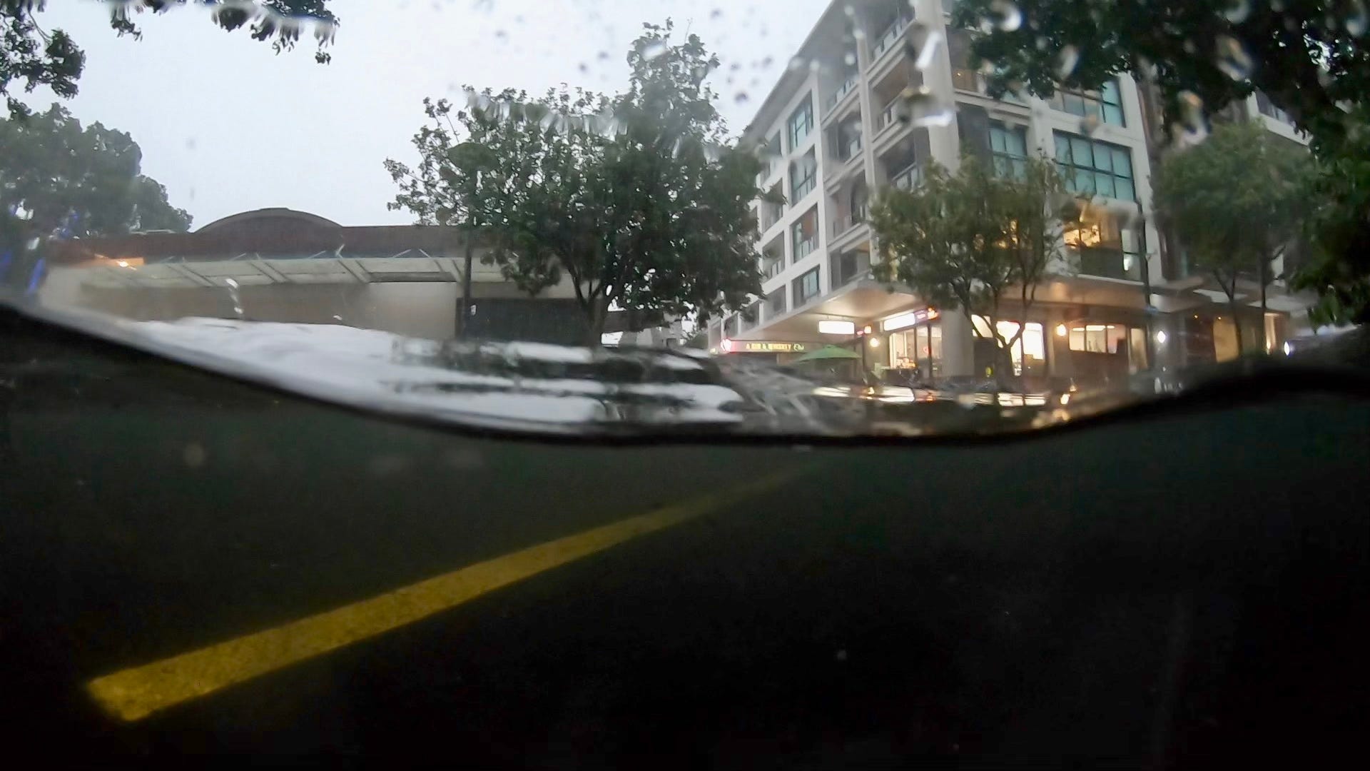
There was some extreme weather news out of the Southern Hemisphere this past week and it came from my stomping grounds of Auckland.
We had an incredible *10 inches of rain* in a single day, an entire summer’s worth, almost certainly making it the wettest day this century, last century, and perhaps the century before that.
The scenes were extraordinary.
Here’s another wild video.
With my GoPro, I often take half/half photos of crystal clear seawater and blue sky. On Friday, I took a different kind of half/half photo: murky floodwater and a stormy sky.
Whatever the weather, I hope you have a fantastic start to February ✌️
The February outlook continues below…
