
Februapril 🤷♂️
Update #535

If you’re reading this on Sunday morning, chances are it’s in the teens. We won’t be this cold again as far as the eye can see!
“Februapril” is what I’m calling it.
➡️ A period of April-like weather in February.
OK, maybe it won’t quite be as mild as an average April week, but with most days in the 40s and 50s, it’s not that much of a stretch.
There’s actually one day worth watching for snow! That normally wouldn’t be surprising (maybe even underwhelming) during what’s typically the snowiest time of the year. But this winter? All bets are off.
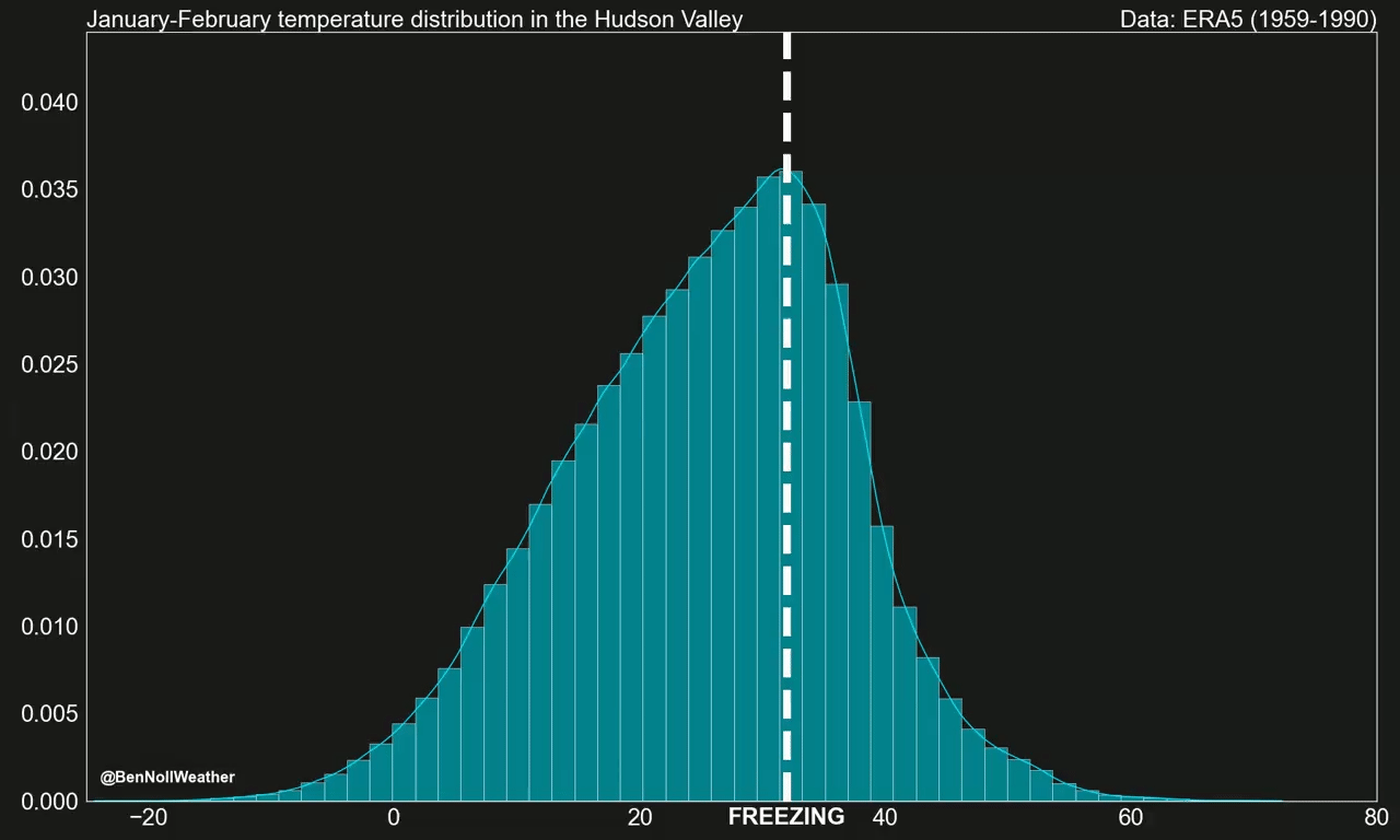
In my latest premium post, I explored the Hudson Valley’s changing winter temperature distribution. Our warming trend, as illustrated below, doesn’t mean that every winter henceforth will be a dud, but it isn’t great news for snow lovers.
Here’s how the week ahead is looking:

Update as of 2/9: the weekend now looks dry and partly sunny! A system may pass close to the region on Monday 2/13.
Believe it or not, every single temperature you see on the chart is above average! The average high (low) this time of year is 36-37˚F (16-17˚F).
Monday will have mostly cloudy conditions to start but the sky will probably turn sunnier as the day goes on. A breeze will also develop.
Tuesday morning will be chilly, but it will warm into the 40s during the day. A weak front will track through on Tuesday night, bringing some scattered showers.
Wednesday looks like a decent day with high pressure in control and a high near 50 degrees.
The next system will move in from the west on Thursday, bringing, you guessed it, more rain! ☔
Friday looks dry and rather mild, but the temperature will depend on the wind direction and amount of sunshine. A cooler, low end scenario would be the upper 40s, while a warmer, high end scenario would be the upper 50s.
A low pressure system currently near Alaska’s Aleutian Islands is forecast to cross the U.S. and pass offshore of the eastern seaboard on Saturday. It’s the only chance we’ve got for wintry weather this week, but it’s far from a guarantee. Just a “wait and see” situation at this point.
Sunday looks drier and on the cooler side.
Looking ahead to the week of the 13th, the story will be… more of the same: mild air 🌡️
At this rate, it might not be until late February or March that a more suitable snow window opens up. It’s just been that kind of winter, waiting, waiting, and waiting some more…
And that takes me to my final message for this update: don’t sleep on March! Maybe there will be a little March madness from Mother Nature this year ❄️
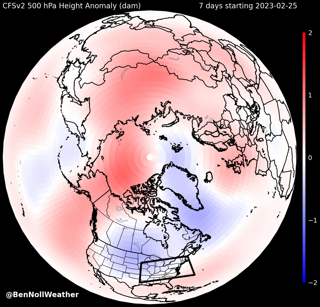
The map below shows a more favorable pattern for wintry weather during late February into early March as cold air (🔵) pools over the northern states.
Having March be more wintry than December, January, and February would be a fitting end to a weird winter.
Enjoy Februapril this week (and maybe next!) ✌️
Thank you, Ben! You’re doing the Lord’s work in the Hudson Valley. We love you!
You are my weather Bible. Thank you for helping me plan each day accordingly.