Predicting the future is a tough business. Just ask Punxsutawney Phil, who must be sweating (literally and figuratively), following his prediction of six more weeks of winter 😬
One look at the temperature chart below and you might be asking: what month is it? February or April? Maybe Februapril, as I called it last week 🤷♂️
As I have said over the last few weeks, we might just be in for some March madness this year and I’m not just talking about the basketball tournament! There’s a chance that March packs more of a wintry punch than January or February…
A somewhat funky atmospheric phenomenon, called a sudden stratospheric warming (SSW) is now occurring over the Arctic…
Say what? How can a “warming” cause a “cooling”? In a very simple sense, a warming in the stratosphere, the part of the atmosphere some 15 miles above our heads, can actually cause a cooling in the troposphere, the part of the atmosphere in which we live.
For us, the net effect could be one more shot at wintry weather in late February and March. Premium subscribers will find a bonus section at the end of this post that digs deeper into the SSW.
In the meantime, here’s the scoop on the week ahead. No, those 60s aren’t typos.
Although a coastal low will be passing offshore on Monday, we’ll find ourselves on the right side of the storm — early clouds will give way to some sunshine with mild, spring-like temperatures
A cold front will pass on Monday night, but temperatures should rebound nicely on Tuesday, again reaching to near 50˚F
On Wednesday, a warm front during the morning may bring a passing shower, followed by a very warm afternoon near 60˚F
Thursday looks mild again but with more clouds; showers are possible during the afternoon and/or evening
On Friday, a strong cold front will pass during the morning with a period of heavy rain possible; the high temperature will occur early in the day, followed by dropping temperatures
Saturday and Sunday look great at this point with Sunday likely the milder day of the two
Looking ahead to the week of the 20th, it will continue to run warmer-than-average! 🌡️
Another week, another hurricane
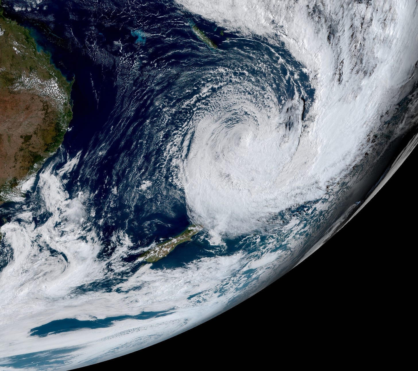
I typically end my newsletters with some beautiful photos from a summery New Zealand. Not this year, at least not yet! 2023 has been an unrelenting spree of extreme weather in northern New Zealand and as of Sunday, former Hurricane Gabrielle was nearing the country.
The storm is expected to intensify and bring severe rain, wind, and sea-related impacts on Monday and Tuesday. This has prompted “panic buying”, stripping grocery store shelves of their stock. Here’s what the bread and egg sections look like (no, eggs are not typically refrigerated in New Zealand!) 😅


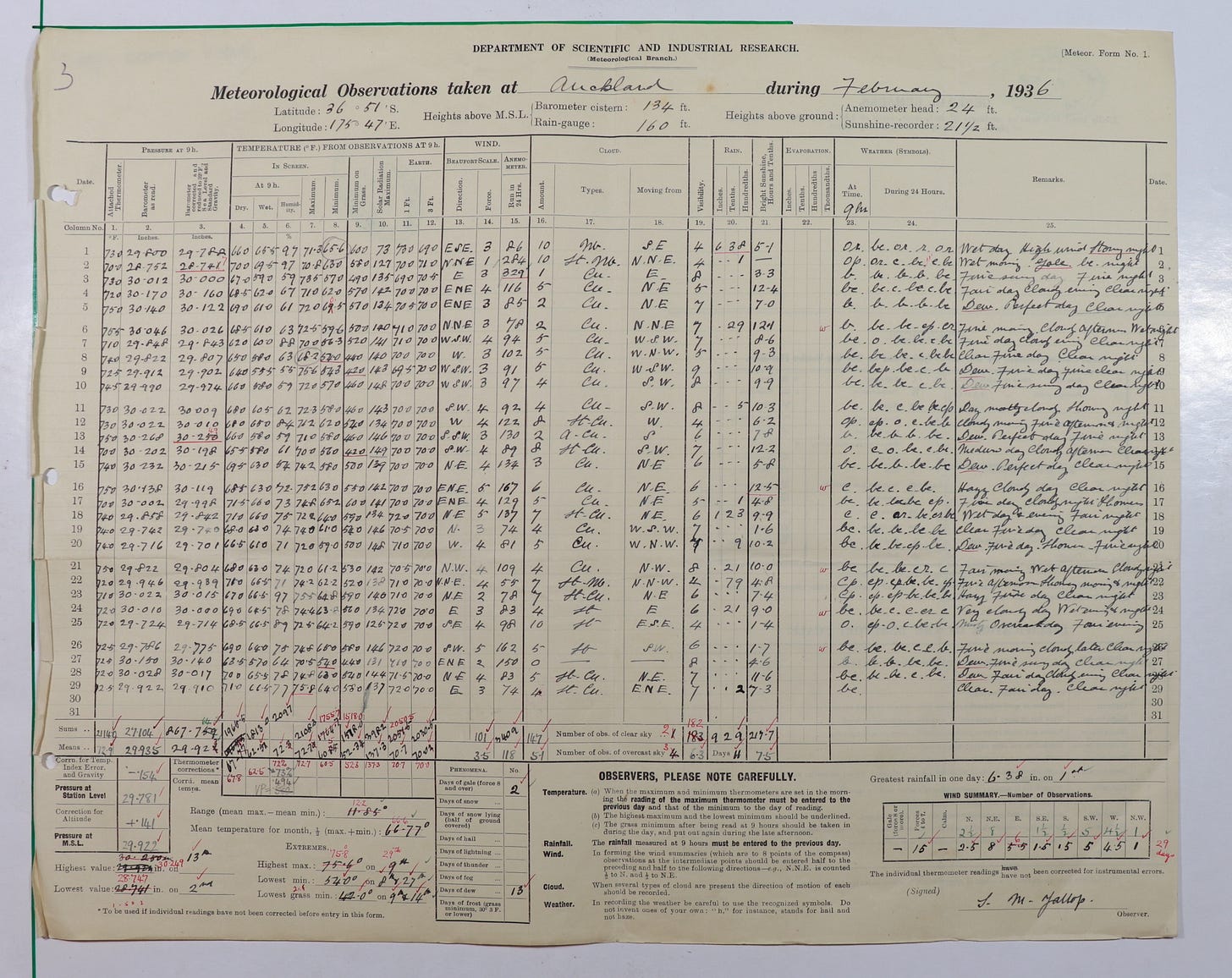
The storm may break barometric pressure records in New Zealand. Knowing that new records may be set, I spent the last week digging through archival data back to 1850. Below, I share with you a beautiful and well-preserved weather record from February 1936 — one of the strongest storms to ever affect Auckland came on February 1st and 2nd.
Hope your week is stratospherically sensational! ✌️
The bonus section on the SSW continues below…


