Nor'easter not holding back
Update #540a
Happy Monday. I feel like the weather will be a topic of discussion at work and school today 🙃
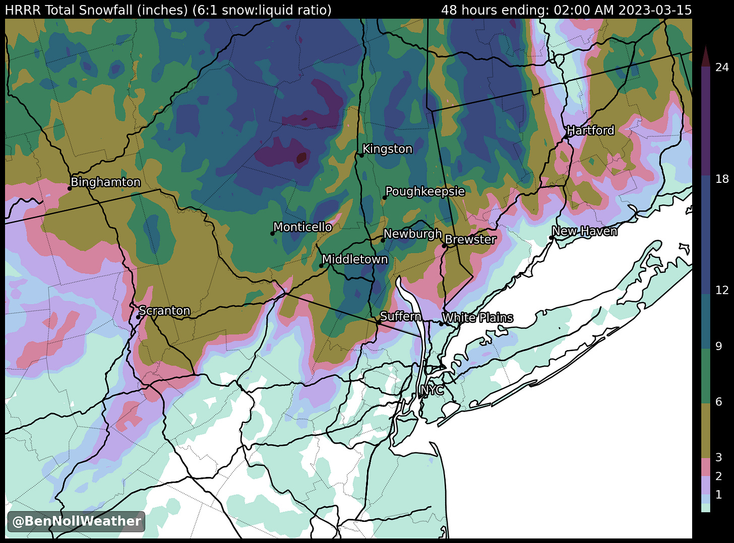
The mid-Hudson Valley is in for a heavy, wet snowfall from tonight through Tuesday, particularly north of I-84, although there is still some uncertainty in exactly how much.
The storm’s heaviest snow is forecast to fall closer to Albany, over the border in northwest Connecticut, across western and central Massachusetts, and in southern Vermont and New Hampshire.
As of Monday morning, a Winter Storm Warning was in effect for the following mid-Hudson Valley counties, starting Monday evening: Orange, Ulster, Sullivan, Dutchess, and Putnam. A Winter Weather Advisory was in effect for Rockland and Westchester.
Conditions will rapidly go downhill between 10:00 pm Monday and 2:00 am Tuesday, when rain will suddenly change to snow, intensify, and accumulate on all surfaces — travel is not recommended.
I’ve assembled a snow map showing just how complex this storm’s accumulation will be, varying greatly over mere miles and highly dependent on elevation. The highest amounts are generally expected north of I-84.
The green colors (🟢) indicate where at least 6 inches are expected.
Wondering why your weather app changes frequently? This forecast is very complicated!
Expecting a perfect forecast in this situation is unrealistic. With all of the variables at play, no one is going to be able to tell you exactly how much snow will fall at your house, but a ballpark range is possible.
Forecast details (as of Monday morning)
What? Wet snow, heavy at times. Wind gusts of 30-40 mph on Tuesday afternoon and Wednesday.
When? Starting: Monday night between 8:00 - 11:00 pm. Ending: Tuesday evening.
How much? Ulster: 6-12”. Dutchess: 6-12”. Sullivan: 6-12”. Orange: 4-8”. Putnam 4-8”. Rockland 2-4”. Westchester 2-4”. Higher amounts are likely above 500 feet elevation.
Impact?
The storm will build slowly with little or no impact during the day on Monday when there will be a mix of rain and snow showers and above freezing temperatures.
Conditions will rapidly go downhill on Monday evening, with rain suddenly changing to snow, intensifying, and accumulating all surfaces. Roads will likely become snow covered and dangerous between 10:00 pm Monday - 2:00 am Tuesday — travel is not recommended.
On Tuesday, the weight of the snow will cause downed trees, power lines, and power outages, particularly in elevated areas that receive the highest snowfall.
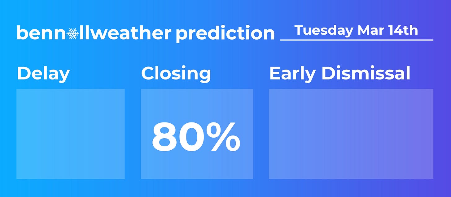
Widespread school closings are likely on Tuesday. Significant inter-regional variability in forecast snowfall means that staff traveling from afar could be dealing with different conditions.
The slow-moving nature of the storm means that snow will only gradually end on Tuesday evening.
The storm’s impact could linger on for several days. Delays or even closures could occur on Wednesday and beyond in the hardest-hit areas.
Gusty winds Tuesday afternoon and Wednesday will put further stress on heavily weighted tree branches and power lines.
Wednesday will be windy with possible flurries and Thursday will be dry and milder.
Swing by Twitter this evening for forecast updates and snow day percentages.


yay