
🙅♂️ Not smoky & not too hot
Update #553

Hello! I’m pleased to start this post off by saying that I’m not expecting any wildfire smoke days this week 😁
The smoke output from the fires has waned following some rain in Quebec and the wind flows in the Hudson Valley will be more variable during the upcoming week.
But wait, there’s more good news! A soaking rain band is forecast to track through the region on Monday evening. Additional light to moderate rainfall is likely through the rest of the week, temporarily taking the edge off the building dryness.
And it gets even better (if you don’t like the heat) — high temperatures this week will generally be in the upper 70s to around 80.

Monday: increasing clouds and humid with scattered afternoon showers and thunderstorms turning to a steady, possibly thundery rain during the evening ⛈️
Tuesday: becoming less humid with increasing amounts of sun 😎
Wednesday: back in the other direction! More humid with PM showers and thunderstorms likely ⚡
Thursday: the shower/thunderstorm chance continues, but less widespread than Wednesday
Friday: more sun than clouds, only a slight shower chance
Saturday: probably warm and dry
Sunday: warm with a chance for a shower or thunderstorm
Clearly, it’s a mixed bag! A bit tough to plan those end-of-school-year outdoor activities, but Tuesday looks pretty good and probably Friday.
The map below highlights where 90˚F is forecast to be reached or exceeded in the next 10 days. It doesn’t include the Hudson Valley, but that may change during the week of the 19th.
It appears that high heat will build as the week goes along, just in time for high school graduations during the weekend of the 24th 🧑🎓

Stars & clouds
🌌 New Zealand is home to the largest “dark sky reserve” in the world. The lack of light pollution in the interior South Island make it a world-class venue for stargazing.
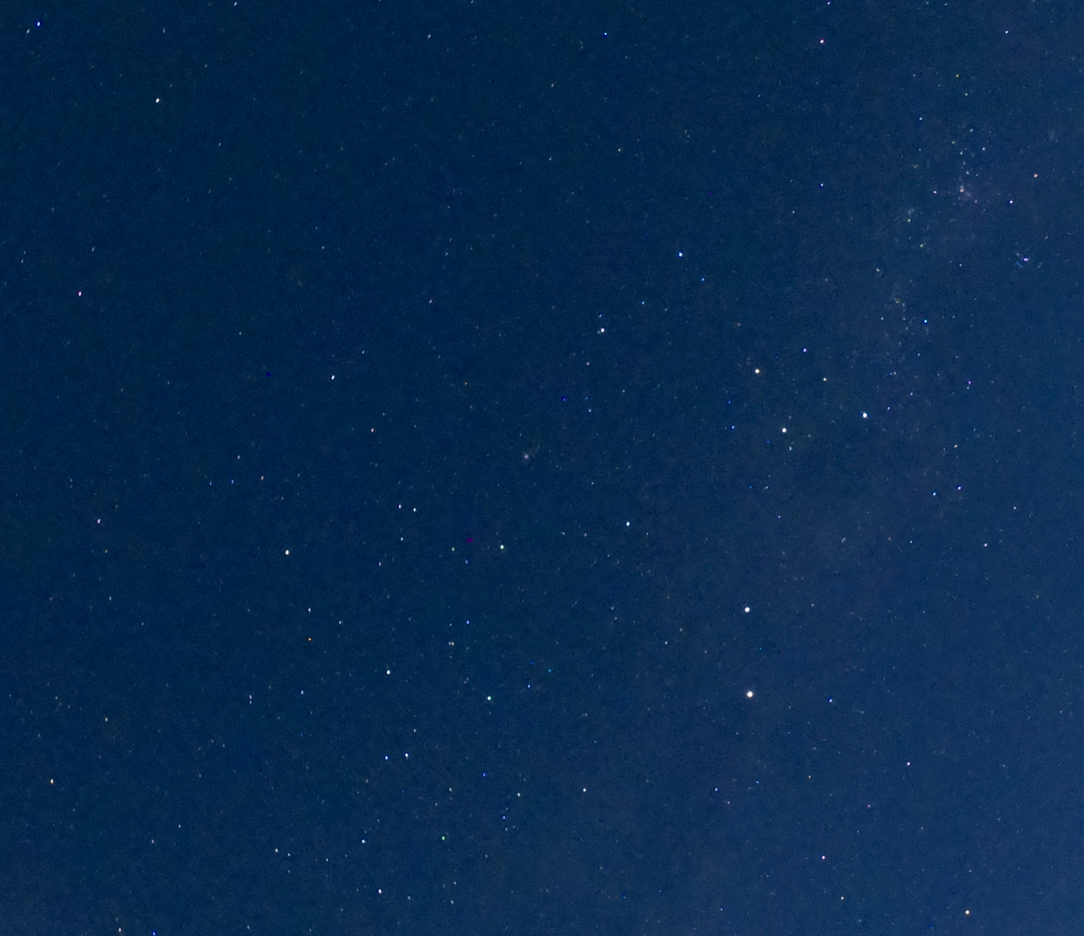
I don’t live in a dark sky reserve, but I am always a bit amazed when I step outside at night to these views.
I’m no astro-photographer, but a 30-second shutter speed on a clear night is dazzling…
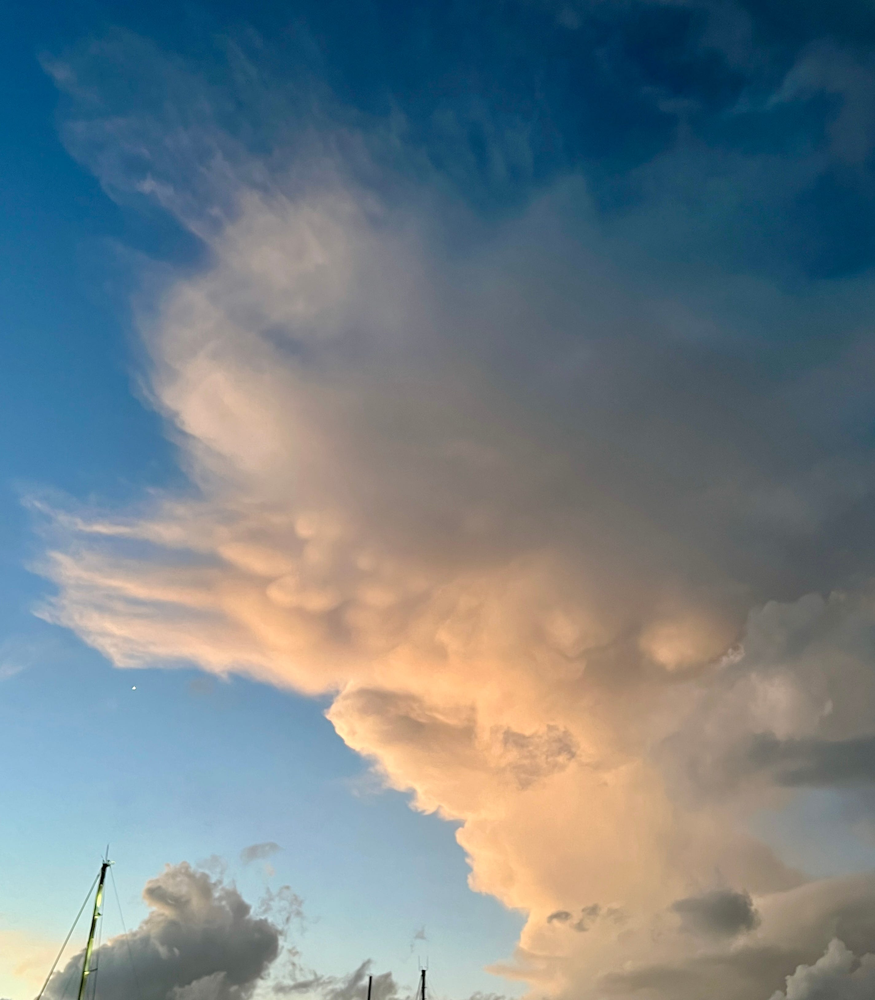
When the sky isn’t clear, Mother Nature’s theatrics still make it worth looking up.
Up until the last week, Auckland had a very unsettled weather pattern with thunderstorms and localized downpours. I spotted an unusual cloud type, mammatus, protruding outward from a towering cumulus (thunderstorm) cloud. Do you see it? ☁️
Hope your week is sparkling ✨
…premium subscribers, keep reading, I have a little extra information for you!
As you may remember from my past premium posts, the 14th of each month is a special day for meteorologists. Here’s why:
Some people look forward to Thanksgiving, Christmas, or a birthday, but for climate scientists, the 14th of every month is a holiday 🎁
Since late 2019, it has marked the day on which a coordinated “data dump” from the world’s top meteorological centers occurs.
This data provides insights on what the weather might be like — not over the next few days, but over the next six months.
As of a few months ago, the 14th changed to the 11th! That means that meteorologists get their long-range fix three days earlier.
My computer got to work parsing the data just hours ago. The data gets translated into images, which tell the weather story.
Here are the three main story lines…
