Drenching downpours return 🫣
Update #561
👋 Hello! It’s hard to believe that meteorological fall, which starts on September 1st, is just a little over 3 weeks away.
At this rate, its arrival will be welcomed with open arms, especially if it brings drier weather! So far this summer, we’ve averaged about 3 rainy days1 per week.
It looks like we’ll be living up to that notorious stat once again this week 💧
Notably, this week will feature a pattern that we’ve become all too familiar with this season: one that has tropical levels of moisture.
The Gulf of Mexico will be “open for business”, with the Hudson Valley’s air mass on Monday and Tuesday streaming in from the sultry south.
The image above illustrates the maximum level of atmospheric moisture predicted over the next five days. Any where you see purple coloring (🟣) indicates a region that could receive tropical downpours…
…that includes the Hudson Valley on Monday and Tuesday ⚠️
The pick day of the week is Wednesday. If only we could get seven Wednesdays 🤣
Monday: humid with scattered heavy rain and thunderstorms, some severe, especially after noon — flash flooding can’t be ruled out! Heavy rain and thunderstorms may continue overnight ⚠️
Tuesday: humid with scattered heavy rain and thunderstorms, mostly after noon ⚠️
Wednesday: a dry day with lower humidity 🏅
Thursday: probably dry for much of the day, but a chance for a period of late day or overnight rain
Friday: turning more humid… chance for a shower or thunderstorm, mainly later on
Saturday-Sunday: as of this writing, there’s a fair bit of uncertainty, but more heavy showers and thunderstorms appear possible as a rather hot, sticky southerly air flow may develop once again ⚡
Looking ahead to the week of the 14th, it’s wash, rinse, repeat (no pun intended!) — showers and thunderstorms again look commonplace. It also looks hotter and more humid than the upcoming week 🥵
Tropical update: tropical storm and hurricane activity looks unlikely this week, but I think we’ll need to keep an eye on things during the second half of the month 🌀
What I’m working on for premium subscribers: five maps you should see about next winter. I’ve started to get some questions as to what winter might bring to the Hudson Valley. I’m no meteorological prophet, but I can have a look through the long-range weather telescope! 🔭 — to be published next Saturday, August 12th.
Something that loves rain 🌊
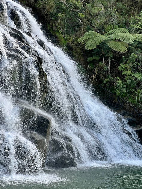
You may not be a fan of this summer’s persistently wet weather, but I know one thing that has loved and lapped it up: waterfalls!
Much like the Hudson Valley, New Zealand has endured a wet middle part of the year. Except of course, the seasons are reversed, and it is our winter — the rainiest time of the year, typically.
We were on a little road trip this past week and I just had to make a quick stop at one of my favorite “staircase” waterfalls, called Owharoa.


Hope your week flows smoothly despite the downpours ✌️
A day having measurable rainfall ≥0.01 inch


