
👋 Farewell to a funky summer, fantastic start to meteorological fall ☀️
Update #564

💭 The summer of unfulfilled promises was a season that teased and taunted with the allure of sunny days and warm breezes, only to leave us longing for the radiant weather we had envisioned.
Weeks went by, and each weekend felt like a game of Russian roulette with the weather forecast.
In the early days of June, the promise of a glorious summer was palpable — the hottest day, 95 degrees, took place way back on June 2nd.
Fast forward to the end of August, and the month will come and go without any high temperatures at or above 90 degrees in the Hudson Valley for the 9th time in the last 60 years. It happens once every 6-7 years on average.
So how will Mother Nature make up for a top-10 wettest summer? With a fantastic start to meteorological fall, of course!
Fall, according to the climatic calendar, starts on Friday, September 1st and continues through November 30th.
We’ll get a little taste of the season ahead on Thursday, as a Canadian air mass filters in to the region…

Monday: plenty of clouds and more humid with passing showers possible, particularly early in the day
Tuesday: humid with showers possible, mainly later in the day or at night, when it could be heavy 🌧️
Wednesday: rain and thunderstorms possible first thing in the morning, then clearing to sunshine with decreasing humidity 💨
Thursday: a stunning, early autumn-like day 🍂
Friday: sunshine and low humidity 🏅
Saturday-Sunday: probably dry on Saturday, chance for a passing shower or thunderstorm on Sunday
Meanwhile, the weather in Florida this week will be newsworthy, as a tropical system is expected to arrive on Wednesday. While it’s currently a tropical depression, it is forecast to strengthen into a hurricane. The next name on the list is Idalia.
The storm is currently brewing near the Yucatán Peninsula (Mexico) and will emerge into the open waters of the southern Gulf of Mexico on Tuesday, where it will siphon energy from the exceedingly warm ocean waters.
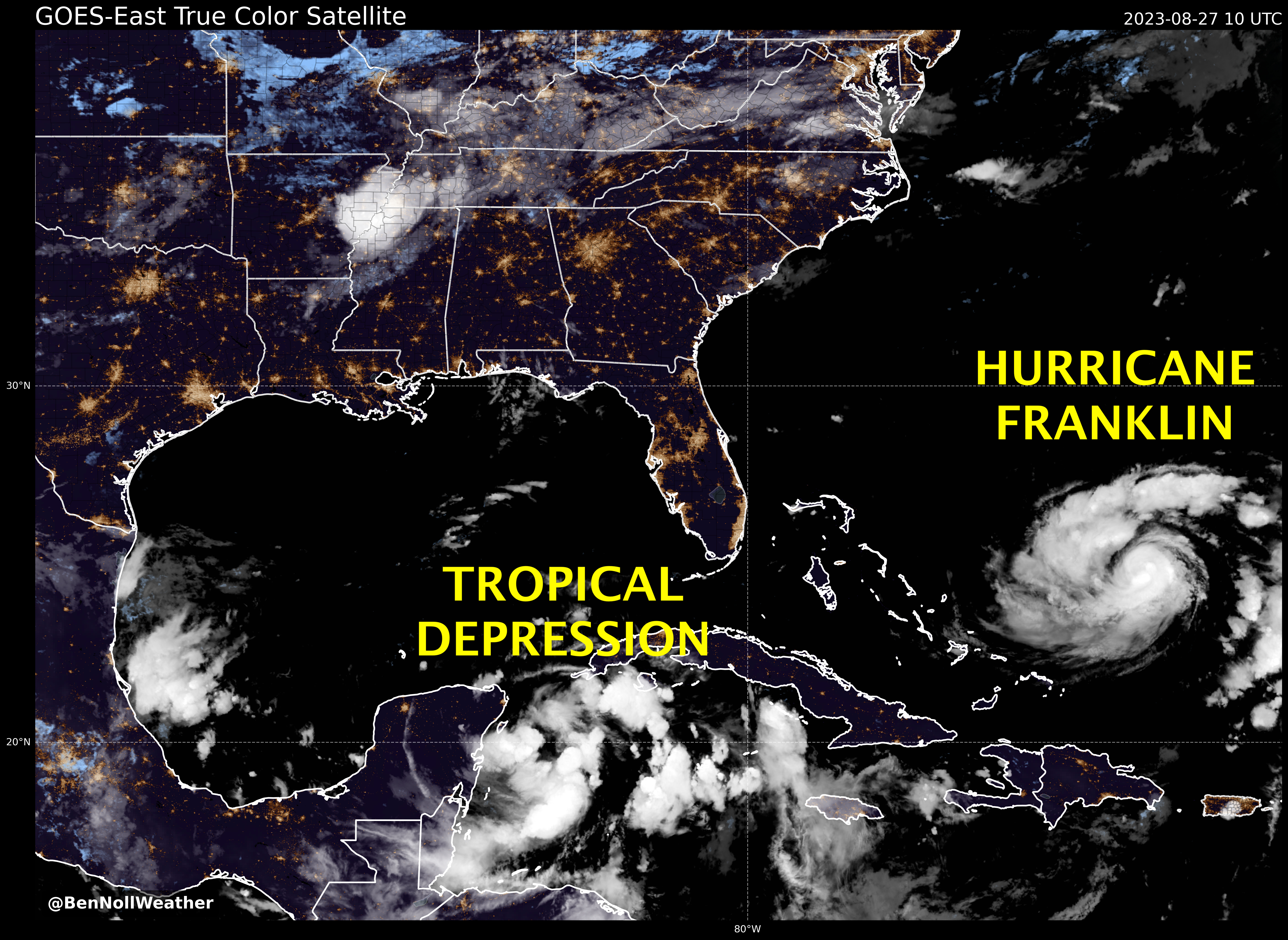
The latest forecast tracks, as of early Sunday, show a most likely landfall (black line) in the Big Bend of Florida on Wednesday.
However, there is still a range of possibilities — as far south as Tampa and as far west as Panama City.

Ocean heat content is very high in the region, which means the storm will intensify into a hurricane prior to landfall — exactly how intense is a question mark, but somewhere between a category 1 and 3 would seem most likely.
For regular track updates, you can check out my tracking bot.
🔎 What will the rest of September bring to our neck of the woods? Will it be a return to the rain or will the sun shimmer down upon us?
Premium subscribers get a preview of the month ahead…
