
Heatwave... in September 🙃
Update #565

After failing to reaching 90 degrees in August, the Hudson Valley now looks poised to eclipse the mark several times in the week ahead.
A heatwave is classified when the temperature reaches 90 degrees during at least three consecutive days.
Of course, one of the hottest weeks of the season comes just as school resumes 🤷♂️
It’s just another wrinkle in a particularly silly summer, weather-wise!
September is actually one of the fastest warming months in the region, with the average temperature increasing by about 2˚F in the last 80 years. Interestingly, the region’s hottest September on record took place back in 2015, around the beginning of the last strong El Niño — it reached 97 degrees on September 8th, 2015!

The excessive heat looks to be a one week thing, with more comfortable conditions returning next week, but not before some potentially heavy late week showers and thunderstorms…

Monday: hotter and more humid with sunshine 📈 day 1 of the heatwave
Tuesday: like Monday, but a little hotter 🌡️ day 2 of the heatwave
Wednesday: like Tuesday, but even hotter! 🥵 day 3 of the heatwave
Thursday: like Wednesday, but with a chance for a PM shower or storm 🌶️ day 4 of the heatwave
Friday: still humid, but not as hot with more clouds — chance for some heavy showers and thunderstorms ⚡
Saturday-Sunday: high humidity and showers and thunderstorms may linger on Saturday before decreasing humidity and increasing sunshine on Sunday
The week of the 11th is looking cooler and drier than normal, generally much more pleasant than this coming week.
In the tropics, there are no immediate threats, but a storm emerging off of Africa is forecast to trek across the Atlantic Ocean over the next 10 days. The environmental conditions are very favorable toward the system strengthening into a hurricane.
Any impact to the U.S. is uncertain and likely wouldn’t be until around or after the 15th. Just something to watch for now!

Opposite of a heatwave in New Zealand!
This past week, it reached 31˚F at my house in the suburbs of Auckland, New Zealand! It was the coldest temperature that I experienced all winter (the seasons are reversed down here).
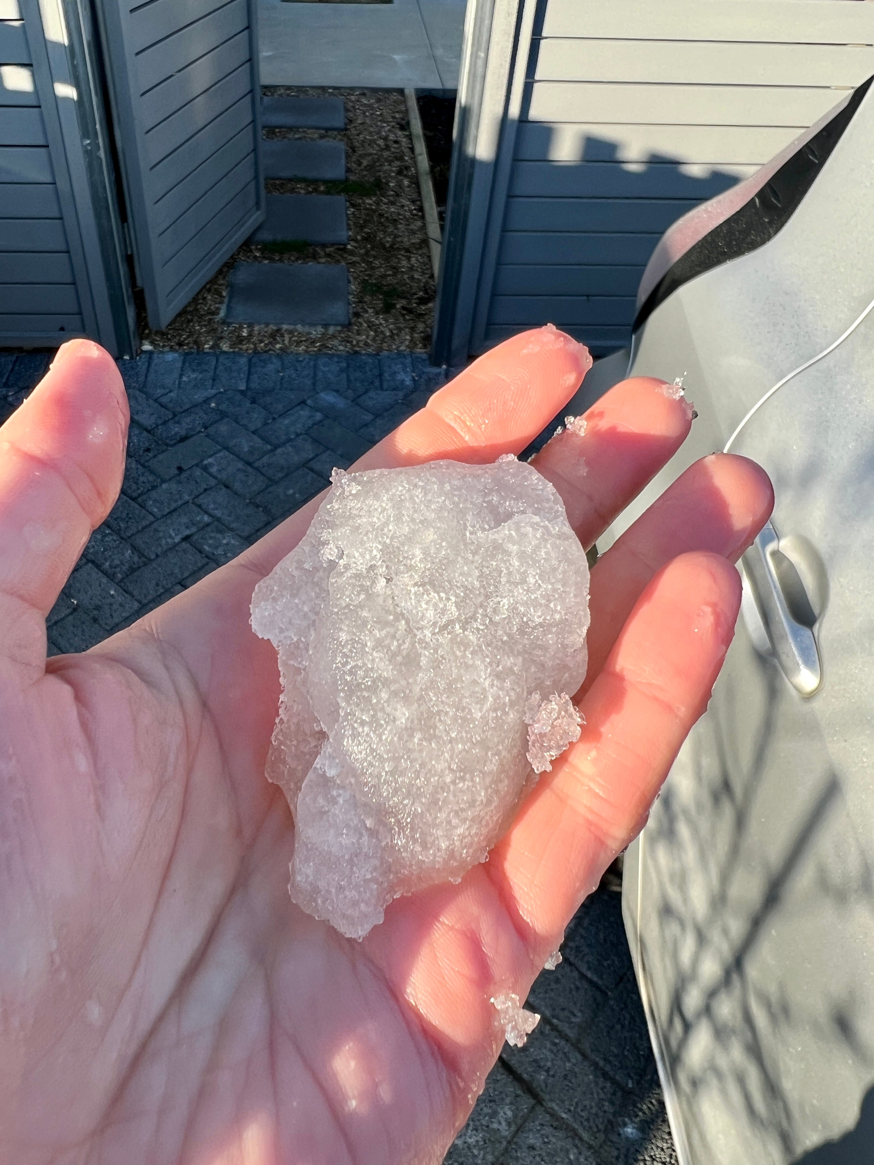
It doesn’t snow in Auckland, so this is the next best thing — an ice ball. I made it by collecting all the frost that was on my car 😁
For New Zealand, El Niño tends to bring more cold, southerly winds from Antarctica, and that was certainly the case during August.
What happens in the Southern Hemisphere winter doesn’t imply any one thing for next winter in the Hudson Valley. If you’re curious about when you might get your first snow day, you can check out my recent premium post!
Five maps you should see about next winter

Hi there! It’s August 12th and meteorological winter is a little more than 100 days away. I’ve started to get some questions as to what the winter season might bring to the Hudson Valley. School is only a few weeks away and the countdown to snow day season will officially begin! ⏳
Premium subscribers will also receive an update about the winter outlook in a few weeks, after I process new climate model data that arrives on the 10th ☃️
Stay 🆒… at school this week!
Oh Mother Nature 🤪