
🌀 From tropical storm to tranquility 🌞
Update #568

First things first: happy autumnal equinox! The astronomical fall season arrived on Saturday and the weather acted the part — cool and gloomy.
Need I remind you what season comes next⁉️
👆 Snow day season!! I’m clearly getting ready, as you’ll read more about below…
As for what’s right in front of us, we’ll be dealing with the effects of once Tropical Storm Ophelia to start the week. However, the storm will quickly get shoved to the south by a strong high pressure system, bringing calmer weather from Tuesday onward 🌤️
By Friday, a low pressure system may be passing near or just to the south of the region.
As of this (Sunday) morning, it’s uncertain as to how close this low will get to the Hudson Valley. The possibilities range from it remaining well to the south, bringing sunshine to the Hudson Valley (40% chance) or coming close enough to cause some rain on Friday and/or Saturday (60% chance).

Monday: cool with rain and drizzle from Ophelia during the morning, easing away during the afternoon with clouds gradually breaking
Tuesday: dry weather taking shape, but lingering clouds will limit sun to a degree
Wednesday: looking like the pick day of the week at this point 🥇
Thursday: probably remaining dry, but increasing clouds as a storm system gathers to the south
Friday: (❓) a storm may pass close enough to bring a chance for rain (60% chance); however, if it remains to the south, a dry day would be in store (40% chance)
Saturday-Sunday: (❓) there’s a 50-60% chance for some rain on Saturday and a 40-50% chance for sun; Sunday is looking more likely to be dry
In the tropics, there’s newly formed Tropical Storm Philippe. Philippe is expected to track westward in the open Atlantic Ocean this week and won’t influence weather patterns along the U.S. East Coast.

Looking ahead to the week of October 2nd, warmer and drier than normal conditions are favored. It’s not quite an “Indian summer” — those are typically categorized only after there has been a killing frost, which the Hudson Valley hasn’t had yet.

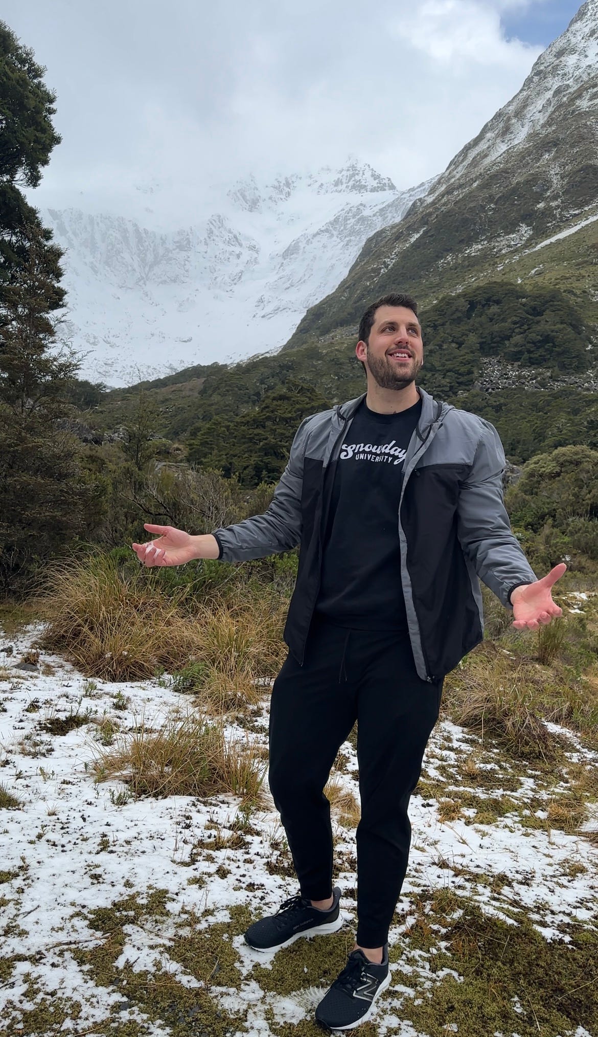
A little trip to the snow ❄️
The mountains stood tall, their peaks aglow, a breathtaking sight, covered in purest snow…
With the vernal (spring) equinox passing this week, the Southern Hemisphere officially left winter behind. At the bottom of New Zealand’s South Island, the forecast was for snow, and I knew I had to go before the spring warmth melted it away.
Plus, with my official winter outlook coming out in just a few weeks in mid-October, I needed some amazing photos from an alpine environment to get Northern Hemispherians in a wintry mood.
It wasn’t an easy journey. The flight was affected by a ferocious South Island wind storm which prevented the plane from landing, sending us all the way back to Auckland (2 hours away), our point of origin! A recovery flight later in the day managed to land safely, but we were set back several hours.
A curvy and long drive in the dark New Zealand night put us in position to go out and explore at first light the next day…
In honor of the passage of the autumnal equinox in the Northern Hemisphere, here are some snaps from a frosty Fiordland in the far southwestern South Island! 🏔️
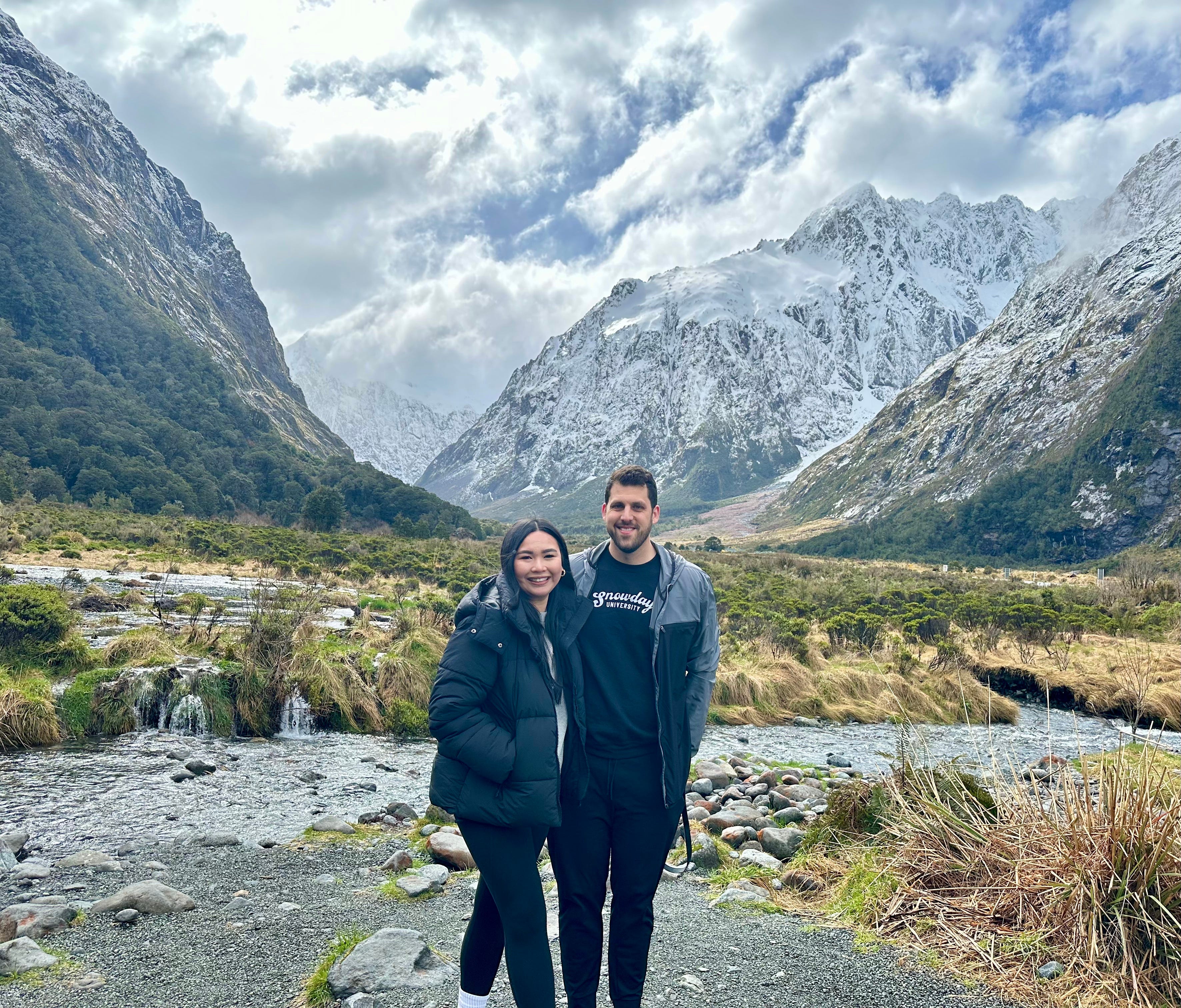
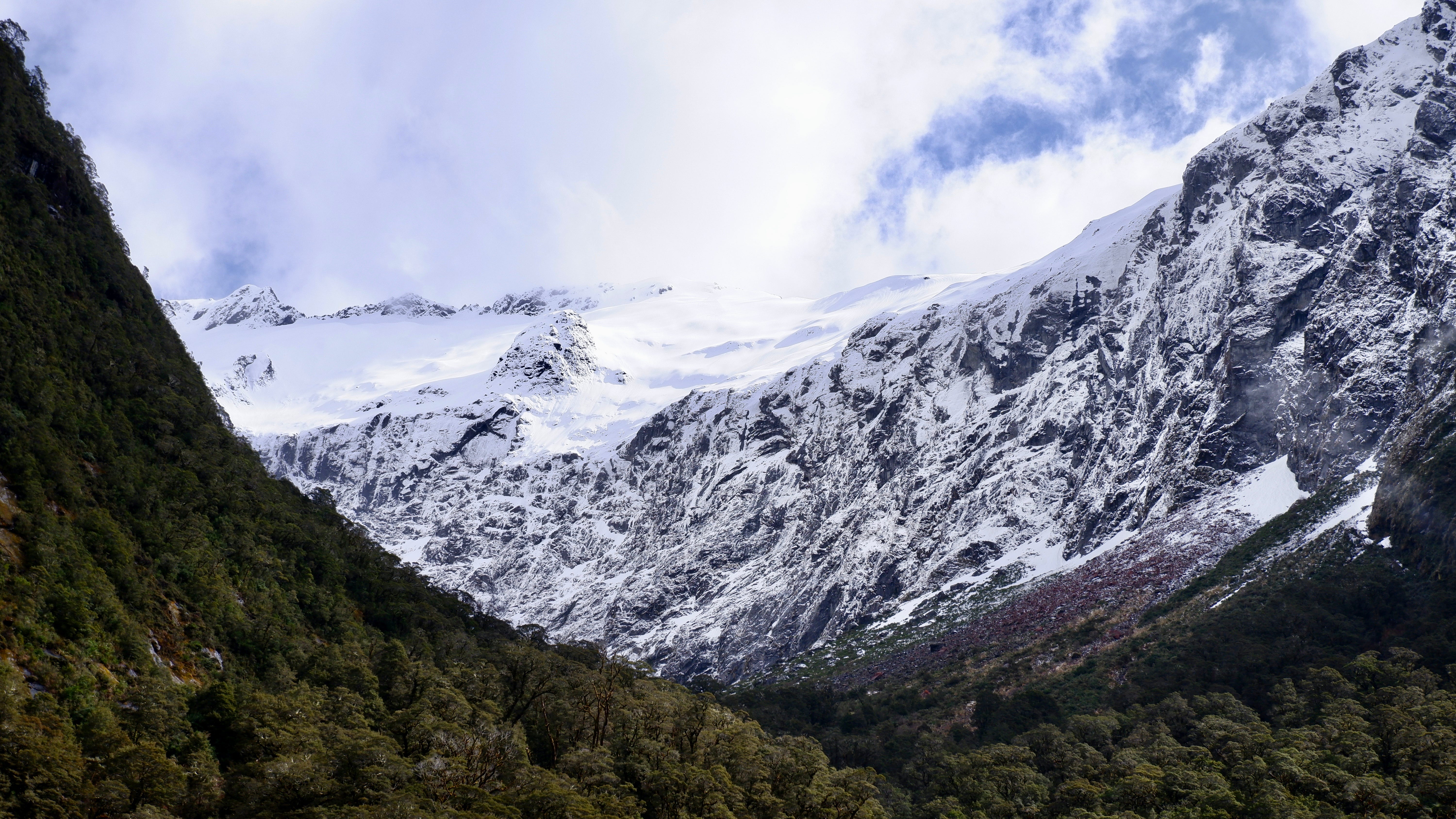


I’ll share more photos from this trip in the weeks ahead — stay tuned! 📸
Hope your week is happy and filled with high pressure ✌️
Beautiful Pictures 📸 Thank You for updates! From Walden, N.Y.12586
Great pics!! NZ is beautiful!