🌀 Tropical storm-like conditions followed by sun, but a lack of snow 🤷♂️
Update #580
With the weather that’s coming tonight (Sunday night) into tomorrow, I think it’s safe to say that even Frosty the Snowman is considering a beach getaway…
Normally, mid-December storms come with at least some snow, but not this year.
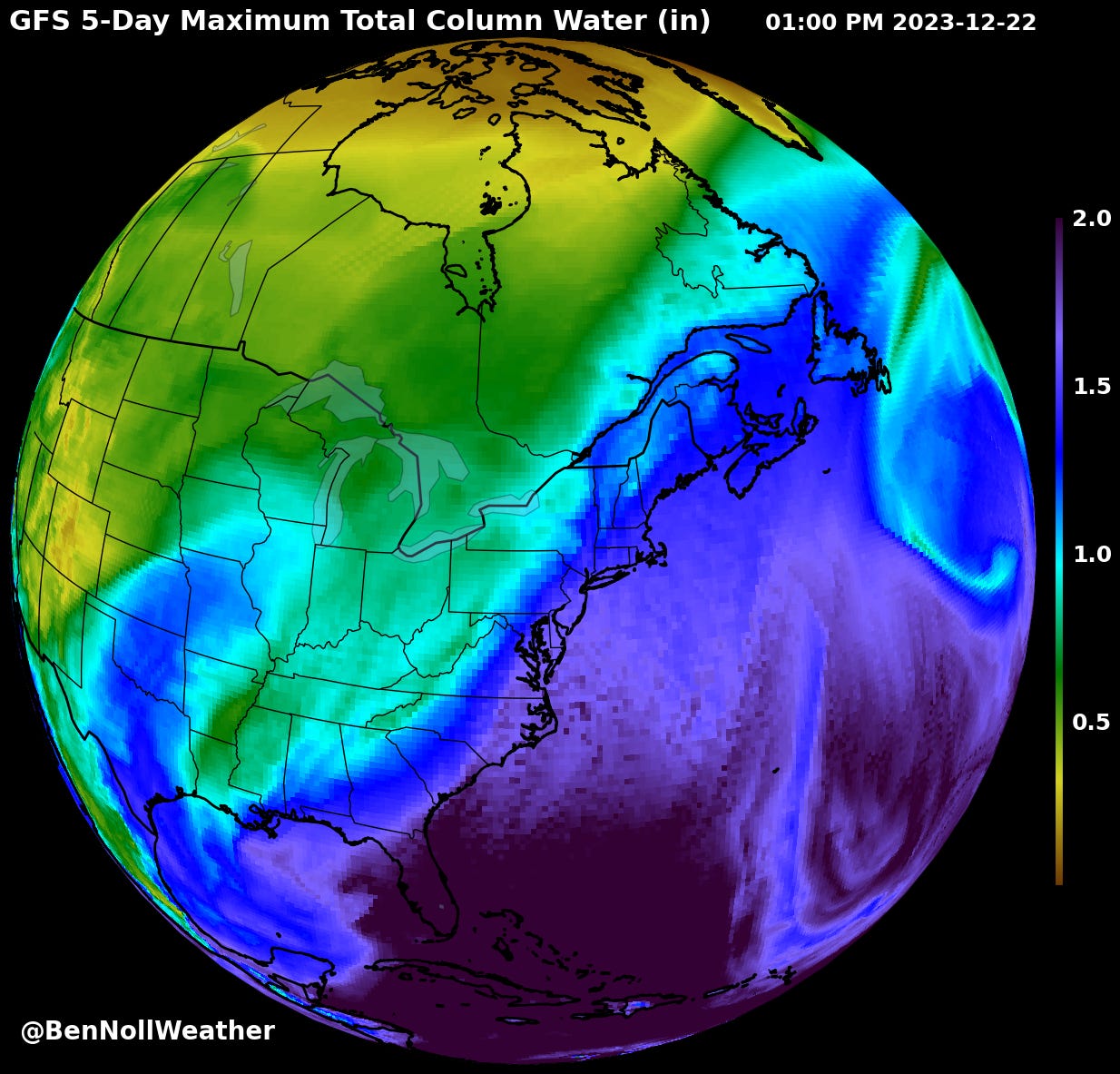
Instead, rain, wind, and warmth will steal the headlines. Despite the lack of snow, this storm is no slouch. In fact, it will be closer to a tropical storm than a snow storm!
Total rainfall may reach of 2-5 inches (up to around a month’s worth!)
Heaviest during the early hours of Monday morning, especially from 3:00 - 9:00 am, when flash flooding may occur in low-lying and poor drainage areas
Thunderstorms possible on Monday morning
Wind gusts of 35-50 mph, strongest along and east of the Hudson River and in hilly areas: secure your Christmas decorations, tree limbs may be blown down
Timing is everything: with the most intense rain coinciding with school bus runs, be prepared for difficult travel conditions and leave plenty of space between you and the vehicle in front. Don’t drive through floodwaters. Don’t let this storm catch you by surprise tomorrow morning!
A warmer atmosphere is a moister atmosphere, so even though it may “just be rain”, our region has experienced serious flooding events in recent months and years… and Mother Nature likes to repeat herself.
A Flood Watch is in effect for the entire region.

Based on all of this, I’m posting a cautionary 35% chance for delays and 15% chance for closings on Monday due to tropical storm-like conditions.
Monday: mild with heavy morning rain, possible thunderstorms, and gusty winds, clearing by evening
Tuesday: partly sunny and breezy with scattered rain and wet snow showers
Wednesday: a chilly morning, plenty of sunshine ☀️
Thursday (winter solstice!): a sunny solstice! 👌
Friday: a little cooler than Wednesday and Thursday, but remaining dry
Saturday-Sunday: probably dry with clouds and sun, but scattered showers can’t entirely be ruled out as of this writing
🎄 Sorry to say, but a green / brown Christmas is in the cards…
The week of December 25th looks rather mild thanks to a stronger-than-normal jet stream in the Pacific Ocean.
If you’re interested in giving a unique gift this year, one option is a premium subscription to BenNollWeather! By clicking the button (link) below, you can subscribe the weather nerd in your life to over 30 premium articles I’ve written in the last year, including my most recent, linked below…
Before Christmas, premium subscribers can expect a short post called “A history of white Christmases in the Hudson Valley” 😁
Map showing the lack of snow
Snow in the USA: currently on strike, demanding better conditions ⛏️ 🚫
It's so unenthusiastic about falling, even the snowflakes are contemplating early retirement. We're experiencing the least snowy days in at least the last 16 years—apparently, winter got the memo about downsizing! ☃️ 🤷♂️ #SnowProtest
…
Jokes aside, it’s been the least snowy season to-date since at least 2008. With no big snow storms on the horizon, this general theme looks unlikely to change until the new year in the Hudson Valley.
El Niño is the main driving force behind the widespread warmth and lack of snow, but the long-term tailwind that is climate change is also playing a role — December is the month that has warmed the most over the last 8 decades.
To that end, you may find my Hudson Valley climate change dashboard interesting, which speaks to the trends that the region has experienced in recent decades, including snowfall.


