Mother Nature has dialed the wild weather meter up 🎚️
Between about 9:00 pm and midnight last night, snow rates reached 2 to 3 inches per hour in the Hudson Valley, seeing many Orange, Ulster, and Dutchess County locations go from a dusting to 6-8 inches, with several managing 8-12 inches, in just a few hours!
Light to occasionally moderate snow this (Sunday) morning may accumulate a coating up to an additional inch or two, mainly on non-paved and already snow-covered surfaces. Well-traveled roads that have been plowed and treated will generally be slushy or wet.
Temperatures in the 20s tonight will cause untreated surfaces to re-freeze, leading to slick spots, but probably not enough to cause widespread school delays on Monday.
The focus will then shift to the next significant event: Tuesday afternoon into early Wednesday morning.
Precipitation on Tuesday looks to start between 1:00-4:00 pm, cold enough to start as wet snow, particularly in Sullivan County, western Ulster County, and western/northern Orange County. Early dismissals on Tuesday cannot be ruled out, especially in Sullivan and western Ulster County.
By Tuesday evening, the precipitation will have likely changed over to plain rain across the region.
An atmospheric river of moisture, like a river in the sky, will flow from the Gulf of Mexico to the Hudson Valley on Tuesday night. The combination of rapidly melting snow, temperatures rising in the 50s, torrential rainfall, and maybe even a thunderstorm means that the region needs to be on-guard for the likelihood of flooding. By Wednesday morning, between 2-4 inches of rain will have likely fallen — the entire monthly normal precipitation is around 2.5 inches! The NOAA Weather Prediction Center has issued a slight to moderate risk of excessive rainfall heavy enough to cause flash flooding. The moderate category is used sparingly, so it suggests this event has the potential to be serious.

The other factor will be the wind: gusts of 40-60 mph look likely, strongest over the hills and mountains. The strength of the wind looks fairly similar to what occurred back on December 18th, although the stronger gusts will likely be more widespread across the region 😬
All things considered, there is a chance for delays and closings on Wednesday in districts where flooding and/or power outages occur.
For additional updates on the Tuesday-Wednesday storm, follow along on X. Another email update will likely be sent on Tuesday morning.
The weather will briefly settle down after this event, but the next storm isn’t far behind: I’m watching Friday night into Saturday for a mix of snow, rain, and more wind!
Monday: partly sunny with puddles of melted snow 💧
Tuesday: 🥶 a very cold start to the day! Wet snow and rain starting in the afternoon, becoming a heavy rain in the evening and overnight, with ferocious winds 🌬️
Wednesday: a high temperature in the 50s before dawn; otherwise, windy with scattered showers and patches of sun 💨
Thursday: partly sunny, a brief break from the wild weather…
Friday: mostly cloudy with the next storm probably arriving at night (rain / snow)
Saturday-Sunday: some wet snow possible with rain and wind likely on Saturday, before colder temperatures invade on Sunday 🎢
Looking ahead to the week of January 15th… and whoa! 🥶
A lobe of the polar vortex will make its way into the western and central U.S., with Arctic air potentially reaching the Northeast around the 17th or 18th. Temperatures may range from the single digits to the 20s. It’s too early to talk about storms, but if there’s enough moisture, snow is a good bet! Buckle up!
If you’ve been enjoying these updates, consider a premium subscription by clicking the button below or grabbing some merch 🙏
Summer road trip! 🚗 🏖️
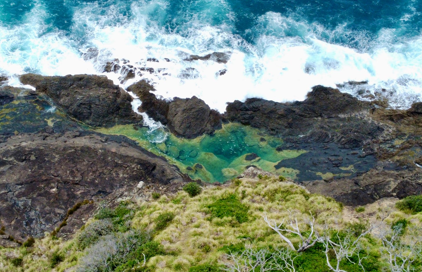
A special stretch of coastline: the mermaid pools…
New subscribers may not be aware that I do my Hudson Valley forecasts from an island in the South Pacific Ocean where I live and work: New Zealand! There’s an 18 hour time difference during this time of the year.
Since New Zealand is in the Southern Hemisphere, it's currently summer. The seasons are opposite to the Northern Hemisphere and New York!
In addition to forecasts, I occasionally post photos from my travels across this beautiful, rugged country down under.
The weather during the holidays was hit and miss in northern New Zealand where I live, but our time wouldn’t be complete without a trip to the beach.
Kate and I took to the road and headed to Northland, the northernmost region of the country, and home to some world-class beaches.
Our destination was a place called Matapouri, which features a beautiful bay with golden sands and a special feature called the mermaid pools! 🧜♀️
The mermaid pools are turquoise tidal rock pools, submerged by the sea during high tide and a gem of a swimming hole during low tide.
Due to the popularity of and high visitation to the pools, they were closed in 2019 to allow for natural restoration. We had actually visited the pools in person in December 2016, so this was our second time “visiting” them.
Since the track is closed, it’s time to unpack the drone and lift off! 🚀
The flight revealed that the pools are still as stunning as ever, as is the rest of the surrounding area ✨
Enjoy the view! That color 😍


🏝️ Do you prefer this view or the snowy scenes of the Hudson Valley? ❄️
If you enjoy photos like these, you can follow me on Instagram.
Hope your week is more relaxed than the weather!


