
Tuesday night: flooding, wind damage likely
Update #583a

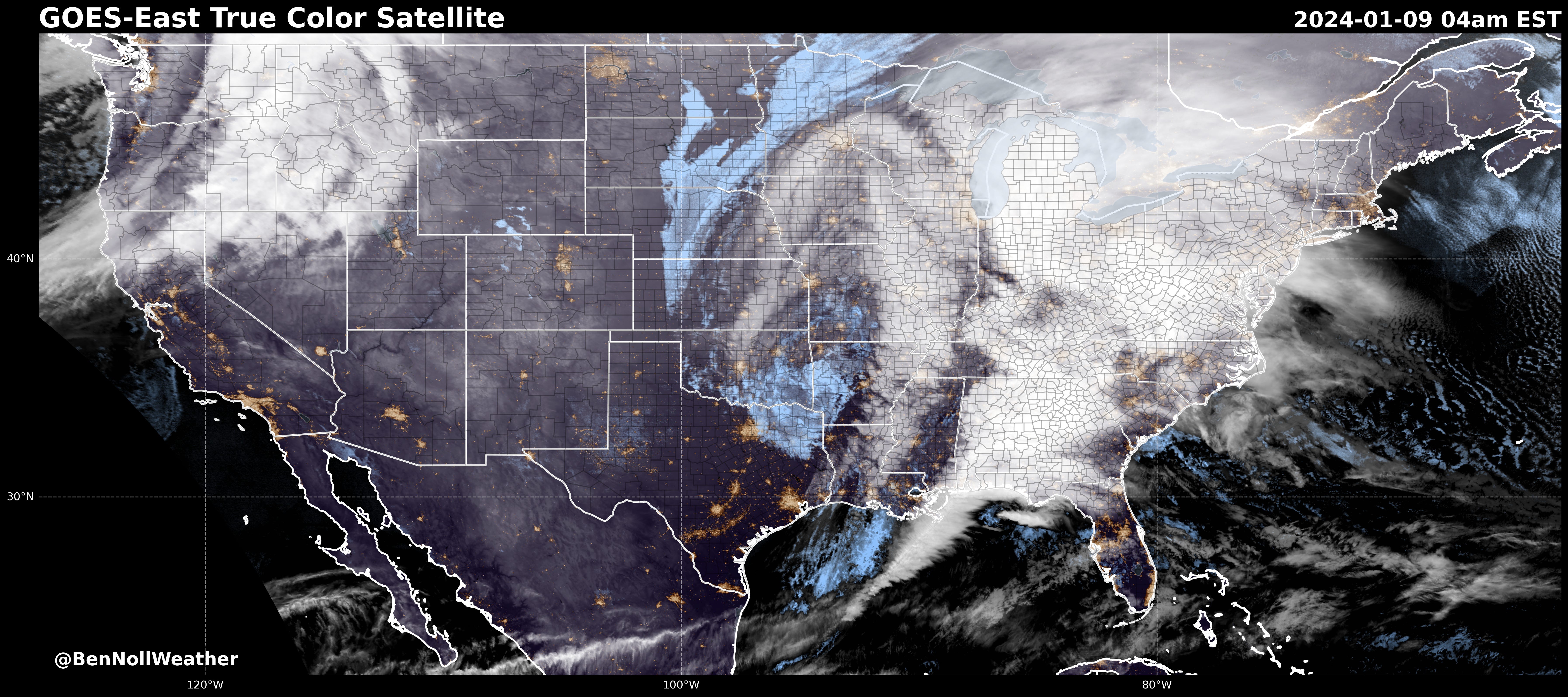
Greetings! A major storm is strengthening in the nation’s midsection today, with blizzard conditions for the Midwest, severe weather in the South, and heavy rain and wind in the Northeast.
The satellite picture tells the story — a massive shield of cloud covers dozens of states early Tuesday morning.
The National Weather Service has issued the following for the Hudson Valley:
Flood Watch, valid Tuesday evening through Wednesday afternoon
Wind Advisory, valid Tuesday evening into early Wednesday morning
Before the rain, 1-3 inches of wet snow in Sullivan and western Ulster County between noon - 4:00 pm may cause early dismissals or lead to the cancellation of after-school activities.
Elsewhere across the mid-Hudson Valley, any wet snow that falls this afternoon is unlikely to stick to paved surfaces. After 4:00 pm, the main precipitation type will be rain, and it’s expected to become heavy in the evening.
The forecast for Tuesday night and early Wednesday morning is a tumultuous one:
Periods of heavy rain and maybe even a thunderstorm between 6:00 pm - 3:00 am, with rainfall amounts ranging from 2-4 inches (a month’s worth or more)
Rapid snow melt, especially when the temperature reaches the low-to-mid 50s after midnight
Strong-to-damaging wind gusts of 40-60 mph between 6:00 pm - 3:00 am
Possible impacts include:
Ponding of water and flooding on streets, particularly in urban and low-lying areas
Flooding of rivers, creeks, and streams, some of which may rise out of their banks
Scattered-to-widespread power outages and downed tree branches; the combination of sodden grounds and strong winds may cause some trees to topple
If you live in a flood prone location, expect flooding tonight — take extra steps to protect your property.
Some school delays and/or closings will likely occur on Wednesday because of this storm, although it isn’t possible to pinpoint exactly which towns will experience the worst impacts. The December 18th storm is comparable to this storm, although the flooding and wind damage chance looks higher this time around.

Although the worst of the weather will be over by daybreak Wednesday, strong wind gusts of 30-40 mph are expected on Wednesday afternoon, affecting cleanup efforts.
Another significant rain and wind storm is likely on Friday night.
Premium subscribers will get a quick heads up about next week’s storm activity below.
Stay safe!
