
🌧️ April (snow?) showers bring May flowers 🌸
Update #595

I could start this off by teasing you about a phantom snow storm for the upcoming week, because tomorrow is April 1st, of course 🃏
But in this case… the storm isn’t phantom! It’s real! And it will probably produce piles of snow across the mountainous areas of New England and northern New York later this week.
For the Hudson Valley, this slow-moving weather system will bring rain on Monday, Tuesday, Wednesday, Thursday, and Fri-, actually it should be (mostly) done by Friday 🤦♂️
➡️ From Wednesday evening into Thursday morning, cold air will wrap into the strengthening system, potentially changing the rain to wet snow. This time of the year, everything has to go just “right” for snow to accumulate, but having a strong storm like this is an important ingredient. Necessary ingredients also include a favorable storm track (illustrated below), unseasonably cold air, heavy precipitation rates, and for it to mostly occur at night. I wouldn’t bet on an April snow day at this point, but I can’t rule out some wet snow on Wednesday night. Stay tuned!

It’s better to get it out of the way this week so that we can have decent weather for the eclipse on Monday, April 8th, right?
Speaking of which, premium subscribers will receive an early forecast at the end of this post! My official eclipse-cast will come out later this week.
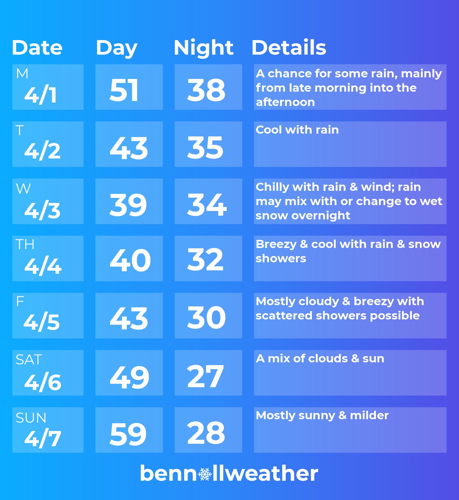
Monday: overcast with some rain possible, particularly from late morning into the afternoon
Tuesday: a soaking rain developing 💧
Wednesday: windy with periods of rain; wet snow possible at night 💧 | ❄️
Thursday: mostly cloudy and breezy with scattered rain and snow showers
Friday: breezy and cool with plenty of clouds; scattered showers possible
Saturday-Sunday: dry with chilly mornings, warming up by Sunday afternoon 📈
Looking ahead to the week of April 8th, the weather looks to do a 180! High pressure will likely result in a good deal of sunshine, much warmer temperatures, and much less rain than the upcoming week.
Cool clouds! ☁️
On Tuesday, March 26th, I was alerted to some cool clouds over the Hudson Valley.
Turns out, the region was being treated to some amazing asperitas clouds!

Asperitas is a newly classified cloud formation, officially recognized by the World Meteorological Organization in 2017.
They are relatively rare wave-like clouds, typically forming in an unstable atmosphere with heavy showers and/or thunderstorms, and characterized by their undulating, turbulent appearance, often resembling the surface of a rough sea.
Someone also mentioned how the photo above gives the appearance of tall, snowy mountains! This Facebook post chronicles the region’s experience with these clouds on the day.
Eclipse-cast 🕶️
Premium subscribers can see the latest outlook for Monday, April 8th below.
For more information about what to expect and how to prepare for next Monday’s solar eclipse, click on the post below.

Several schools have already announced early dismissals and I expect more will come.
