The dog days of summer
Update #610
Good day! 👋
🐶 The dog days of summer are upon us and the Hudson Valley’s 90+ degree high temperature count (at Poughkeepsie) stands on 13 days. That total will grow through Wednesday, likely reaching 17 days. The average number of 90 degree days in a year is 16. The record is 34 days, set in 2022.
There have been two distinct heatwaves (at least three consecutive days with highs above 90): June 18th-23rd and July 6th-10th. The current heatwave, the third of the season, is expected to run from July 13th-17th.
It’s been a hot one.
Dog days of summer - did you know that the phrase is of astronomical significance?
The astronomical meaning of the dog days of summer refers to the period when the star Sirius, also known as the "Dog Star," rises and sets in conjunction with the Sun. This typically occurs during late July and early August and was historically associated with hot and sultry weather as Sirius is the brightest star in the Canis Major constellation and was believed to add its heat to that of the Sun ☀️
Why so humid?
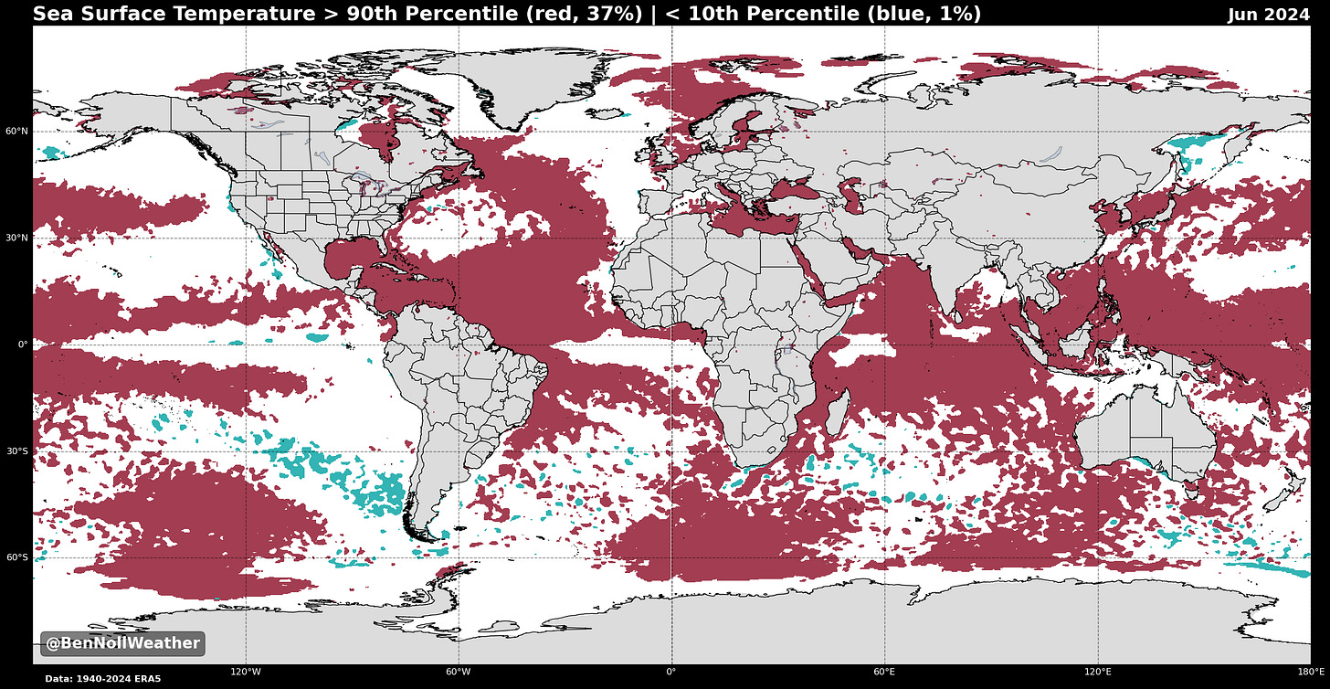
Another factor that you probably have noticed is the humidity. Humidity levels have been above normal, contributed to in part by near-record warm ocean water along the eastern seaboard. This has been coupled with more southerly wind flows than normal, seeing air masses commonly track in from the tropics. Beryl, whose remnants ended up missing the Hudson Valley and instead caused several tornadoes in upstate NY and destructive flooding in Vermont, caused the Hudson Valley’s humid day of the year so far last Wednesday.

2023 was the 3rd most humid year on record in the Hudson Valley and 2024 seems to be keeping pace.
The Hudson Valley is on the northern edge of the U.S. “humidity belt”, experiencing around 60 days with very humid conditions per summer:
This coming week, a Canadian cold front later on Thursday will briefly sweep away the swamp-like humidity from the Hudson Valley.
Monday: partly sunny, very hot, and humid with scattered PM showers and storms
Tuesday: like Monday, but even hotter and more humid — a real scorcher 🌡️
Wednesday: *very humid* with PM showers and storms likely, some heavy
Thursday: showers and humid conditions may linger early, followed by clearing and decreasing humidity; not as hot
Friday: sunny with lower humidity 🌟
Saturday-Sunday: decent weather looks likely to continue on Saturday, though some moisture may return on Sunday (50 / 50 chance as of this writing)
Looking ahead to the week of July 22nd, the hottest week of the year on average, temperatures and humidity look to be relatively close to normal for the time of year. It’s also looking drier than normal.
❄️ In my next premium post, to be released next Saturday, July 20th, I’ll share some very early information about winter 2024-25. Don’t miss it! ❄️
Find a pool and stay cool this week ✌️


